Transcript
Automated transcript · Written by software from the replay's audio. It can mishear names and figures; the replay is the record.
0:04 Welcome everyone and thank you for joining us today for this live event with Cascade Copper. We're pleased to have Jeff Ackert, President and CEO, with us to share his insights on the company's latest news releases. Since we are live, this is your opportunity to engage directly, so please submit your questions in the chat and we'll do our best to get to them. As a reminder, today's session is being recorded.
0:25 Jeff, thank you for taking the time. It's been an eventful week for Cascade Copper with 2 significant press releases hitting the wire. We'd love for you to walk everyone through them and give us a sense of what's on the horizon for the company, and then we can get into some questions. Kyle, thank you very much. It'll be a pleasure for me to be able to explain our press releases and kind of give some insight and what's next kind of thing for us and for our investors and shareholders. So maybe what I'll do to start off Kyle is just remind people where the project is in Northwestern Ontario. And the visual that we've got up here is kind of just a general area between Dryden and Sioux Lookout. You'll see Dryden in the bottom left-hand corner and Sioux Lookout in the top right.
1:12 And we're in the Wabagoon Greenstone belt, which is a very prolific belt for many things, VMS systems, but also gold systems like what you see at NexGold's Goliath Miller Complex, which is a pretty big stake or a shareholder or sorry, property owner in the area. Other significant groups that are in the area, Dryden Gold, Bella Vista Gold, which is up to the north there, near Sioux Lookout, and Heritage Mining, which is, you see a little bit of that on the Eastern side of the map. And then of course, Ashley Gold, which is more or less a sister company of ours, who has just finished a recent drilling program on their TAC project. And those assays are coming up. But the visuals from their press releases look pretty good. So the bottom line is that we're in a great spot here for gold, for copper, for silver, lots of metals. So what I'll do now is I'll just flick this off and we'll get to the bones of the press release.
2:20 And we'll just bring this up so we can all see it a little bit better. And there we go. So if people have seen this press release, it came out on Monday. And I'm starting with this one because it really is, sets the stage for the drilling program that we've got set up. So what I'll do here is just kind of go through some of the visuals, some of the graphics that we have, because they are a little bit technical, but I think with a little bit of explanation here, people can kind of understand why we're quite excited about what we're seeing here and why we want to drill. So what we'll do with this first one here, and I think I can zoom in on it. Yes, there we go. So what this is, not just a bunch of, you know, flat rectangles on a page here, but what these panels or these plates represent are conductors, electromagnetic conductors that we've identified over several years historically and with the work that we've done in the last year and a half.
3:32 But what they represent are a couple of things. One is, and you'll see that these ones here are kind of more regular and a regular sort of pattern, and there's 2 trends of them. And these are what we call regional formational conductors. And the system that produces those is an ancient island arc system with volcanic activity. There's material that's coming out from the seafloor and then it ends up being layered and of course where we are in this part of the the Wabagoon Belt everything has been sort of turned vertically so that those things that were eventually or originally flat-lying are now turned up on their side. So these 2 trends that we see, the regional informational conductors, are telling us that we're in a package of rock that in this case has some extremely good potential for VMS targets.
4:32 And why we like this MGZ area and the newly discovered SWZ, which is a Southwest zone, MGZ is the main Gossan zone. Why we like this is because these regional conductors are augmented or distorted or reintroduced with something else. And the something else is much more conductive than what we're seeing in the regional trends. So it's something different. It's an anomaly. It's something that when we see this, we get quite excited about it because it's sitting right below beneath the surface, because this is a view that's sort of isometric. It's looking from the surface down at an angle. But what it's telling us is that there's something very conductive and very different from those regional formations right underneath where we've intersected with historic holes at the MGZ, some extremely good copper, gold and silver, where our surface exposure at the main Gaussian zone is giving us extremely good copper, gold and silver as well.
5:37 So it's sort of all kind of lining up that surface shallow drilling from the historic work. And this, this interpretation of the conductors at depth was extremely high conductance. So it's all kind of coming together, telling us that we've got something special here. And we have to realize, too, that we've only got surface exposure in this area just around the MGZ. The rest of the area going to the northeast, which is up this way, and to the southwest is covered with glacial till. There's a lot of, well, a fairly thick, maybe up to 3 meters of material, basically hiding all of the bedrock exposure. So there's a hint of it here. So now we've got to kind of look at this in the future, but what we're gonna do now, and maybe I'll just quickly step ahead, but I'll come back to it in a bit, is that we need to get in here and drill at the MGZ, just because of all these things are winding up.
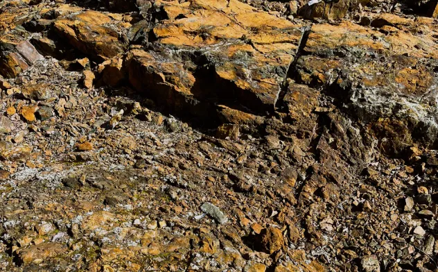
6:40 So I'll go through to the next image here, if you don't mind. Well, maybe what I'll do first is just to remind people, as I mentioned, we've got the surface exposure of the MGZ. We've got this rusty, gossamous, distorted, altered rock that we see on surface. So we've sampled this over the last couple of years on different campaigns, and I just want to draw people's attention to some of the numbers we're getting here in not just copper but gold and silver values. And so the copper numbers you see here in this column are copper percent. And if you see these numbers, and these are extraordinarily high numbers considering what people are mining today in most mine situations.
7:29 Even in the Congo and Zambia, they're looking at less than 1%. Some places in the Central American, South America, they're looking at, you know, in mostly copper porphyry systems, anywhere from 0.5 to 1%. In British Columbia, in the porphyry systems, they're mining out in BC, you know, like Copper Mountain or Tex Highland Valley, they're mining 0.28% copper. So when you see these numbers, these are quite significant. And this is typically the numbers that you would see in a VMS or Volcanogenic Massive Sulfide Deposit. Porphyry systems obviously are extremely large, so they can afford a lesser copper tenor. So in the VMS systems, they're typically a little bit less wide and less tonnage.
8:20 So you do need to have these higher grades to make them a possible mining situation. So we're happy to see that these plus 2% copper are worsening. But again, what's significant in this system is the gold numbers. You can see that we're getting up sometimes over 2, 2 grams per ton in gold numbers. And then again, with the silver, silver numbers aren't extremely high, but it tells you that it's a pretty good strong system to have all of these together with some quite anomalous numbers up to 29 grams per tonne silver. So I just this is just sort of what the context is that we're dealing with these VMS systems have some pretty decent copper, gold, and silver numbers. So the next view we're gonna look at, again, it's technically, it's a little bit complicated, but I hope to be able to explain it fairly easily here so that people can understand it very quickly. So what this view is, is basically a cross-section view. So we've sliced the ground down, given it a window of maybe 75 meters.
9:28 And we're looking northeast up the trend. Those formational conductors that we saw that are trending to the northeast, we're looking straight up that trend. So those green plates that you see here and here and over here are those formational conductors that we could see on that previous map. Now, these semi-circles or ellipses here, represent a magnetic response that we see on... Along that trend as well, but what we're seeing here is the coincidence of the high magnetic trends and these conductive plates that we saw on that previous map. And because we're just looking at a thin slice here, we're only seeing one of those plates. Well, actually 2 of them. We see this green one here, but more importantly, we see this flat pinkish colored EM plate that's telling us that at the top of this magnetic system, we've got an extremely high conductive zone.
10:42 And when we see those together, This is a typical signature of a pyrrhotite-rich volcanogenic massive sulphide deposit.
10:53 So it's typical across North America, probably across most Archean or older, you know, 1.5 to 2 billion year old rock so it's a very significant signature. Now one of the things that we like even more so is the fact that these conductive plates are very very high and when you get these high conductance and the magnetic signature, you've got an excellent target for a VMS system. Now, maybe some explanation here is why did these historic holes, why were these historic holes put over here? Well, our interpretation of this is that this is sitting right beneath where our MgZ or main Gaussian zone exposure is on surface. So they just basically they didn't have the Ability to do the interpretations that we have now I mean, this is all modern technology that, you know, we're taking advantage of and we're happy to see. So the early holes were drilled basically just underneath what they saw on surface, so they didn't have a lot of information to go from. But what it's telling us is that it's part of the system.
12:03 And the system is what we've interpreted is a feeder zone. In other words, a zone that is a lot of fluids are coming up through the ancient sea floor bed and coming up to an ancient surface and accumulating on the surface and that's what we see this zone it represents is this accumulated
12:28 horizon in this ancient sea floor that could have some extremely wide and long and extensive continuity. So that's why we kind of like this. And if you look closely, you can see these darker blue lines here. And again, we're talking about our drilling program now. It's sort of integrating both of those press releases together. The potential or proposed holes are now drilling not only up through here, which if you see here, there's also another conductive plate, that's quite anomalous and flat lying, so we're going to drill here, and we're going to drill through here, down into this Magnetic system, which again, we we propose that it is a highly Magnetic, Pyrrhotite rich VMS conductor, that may or may not come to surface here but we see it with a strong conductance very close to surface so a couple of holes in this area to test that theory But one of the things is that we've done enough work and enough interpretation that, you know, we've de-risked the system and we've got, you know, examples of this in other parts of Canada, especially in the Wabagoon where we're seeing similar types of conductance, magnetics, surface exposure and so on.
13:51 So you can see why we're quite keen to get in and do something with this. Now I think I've got one more map here to show you. And basically what it's telling us is that not only do we have some extremely good targets at our MGZ, our main Gossan zone, but with this interpretation and evaluation of the VTAM survey that was done in the past, this area has been, you know, has given us some hope that, you know, it's not just a 1 trick pony here. We've actually got a couple of different areas that we can follow up with. Now we won't drill this one on this phase, not right away unless we get some extremely good numbers here, which you never know it might happen. But we haven't done much ground truthing on this area, again, because of that cover of till and glacial till and surface material. So this will be sort of our next phase to look at this on the surface first and then de-risk it a little bit and then get it in and do some
14:58 drilling on this one. And I think This is just a quick, I'll just, 2 seconds on this one. The Southwest Zone, we were looking, that previous map, looking at a plan view. Now we've done another one of these slices through the system. We're seeing these Magnetic ISO shells, we call them, so that shows the highly magnetic area. We've got these flat-lying, highly conductive EM conductors together. The only missing part on this one is the surface exposure. So maybe get some trenching done or maybe some surface sampling, geochemistry to confirm that this has got the Copper, Gold and Silver, then it's a no-brainer. That will get in and do some work on that. So I think basically that's it. So I'll just maybe 2 seconds here on what our plans are for the drilling.
15:48 And as I showed you on that previous map, we've got 3 proposed drill holes. We've got a bit of room to pop 1 or 2 more in if we see some excellent results on this. But ideally, we've gonna do a minimum of 600 metres. We'll do NQ core. We'll more than likely sample just about every metre of every hole. The reason for that is not only to look at the copper, gold and silver numbers, but also look at what we call pathfinder minerals and alterations. So we can track that using a multi-element assay technique that'll give us ideas on, you know, what other minerals are there, if there's a halo, sometimes we can use those to vector in on other areas. And one of the things that we'd like to do too, we haven't mentioned this yet, but if we get the sulfides and the alteration that we
16:45 expect to see here, one of the techniques that we'll do next, part of our next phase, will be to do some downhole or borehole EM surveys. And what that does is it says, okay, put a probe down inside the drill hole at depth and then read the conductivity that it's seeing in the region area. It'll probably go out maybe a couple of hundred meters or more and we'll see whether there's more systems that perhaps we're just catching the edge of on this or maybe they're a bit deeper so it'll give us a bit more information so that that'll be part of our next phase of exploration at Centerfire. So Kyle I think that's that's it if you or any of the viewers have any questions I'll be happy to answer them. No that's great I think it's very helpful going thoroughly through these diagrams. Thank you for that.
17:38 There have been a few questions, so let's get into it. The V10 plate modelling returned a conductivity thickness value of 495 on the 1980 flat target. For investors who may not be familiar with geophysics, can you put that number in context and explain why it gets your team excited?
17:57 Yeah, that's a good question. I mean, these numbers, what do they mean, right? So, to put them into context, I think that CT, which is conductivity thickness value, is a really good filter on what potential VMS metal content could be there. And anything up to 100 is still, is certainly anomalous. It may or may not be a VMS target. Anything over 300 though, becomes a high priority target. And anything in over 500, which we're very close to, becomes an extremely good target. So a real high priority target. So, you know, this is when you, when people look at other deposits, you know, whether it's the Horn or the Kid Creek or locally the Metabi area, which includes the Sturgeon Lake mine, all of those had, you know, 4 to 500 up to 1000 numbers in CT when they identified, you know, the actual VMS metal containing horizon.
19:13 So you can see why with a near 500 that is extremely anomalous, extremely good and points very closely at a really productive VMS target. Nice, exciting. You mentioned that the mineralized system appears to be folded and overturned. How does that structural interpretation influence the orientation and positioning of your planned drill collars?
19:37 Yeah, again, it's a bit of a technical thing. And maybe I can flip back to one of these diagrams here. And this one's probably the best. Let me just pull that up a little bit here. So when we say that it's overturned, if you recall, I mentioned that these originally, these are formational conductors, which are these green plates here that you see on this map. It was originally a horizontal system back, you know, over 1 billion years ago, so a long time ago. Over time, these things have tilted up. And typically when they tilt up, they're still, you know, the top of the system is closer to surface. And the top of the system means that original stratigraphic unit and sequence is with the tops are up.
20:27 But what we're seeing, and in this case, we're very lucky to see it, is that part of that sea floor back in the Archean contained volcanic pillowed flows. And the pillows are typical, and if you've seen pictures of, you know, in Hawaii or some of these places where the lava is going into the water, there's this typical system where the lava becomes like a pillow. So the material comes up from below, and it creates a sort of a shell in the water and has this typical profile with a pointy bottom and a roundy top. So we're seeing that on surface, but the problem is that it's tilted the other way. So in this case, it looks like the tops are facing down deeper.
21:18 So the pillows are telling us that we've not only got a tilted vertical system but a tilted vertical and then slightly you know turned over the other way. So what does that mean? Well what it means is that the potential VMS horizons that are more richer and more laterally extensive are probably at depth here. And what we're seeing closer to surface is the deeper, original deeper system. And these systems are what we call feeder zones. The feeder zones come from a depth and then they hit that horizon and then they spread out into these VMS systems. So I think what we're seeing and what's been interpreted by us and Shannon Baird, our VP Exploration, and some of our other people that have looked at the system, is that what we're seeing at the MGZ is where this fluid is coming from a deeper system, and it's coming down and going actually deeper at this point and then turning into a VMS layer down below. So what we're trying to do with our drill program here is actually drill down the feeder system where it's telling us it's vectoring us towards this horizon that depth so we're gonna tie into where they've hit some decent results before where we see on the mgz on surface we've got some decent results so we're gonna try to thread the needle down through the
22:51 feeder zone and then hit this VMS lateral extensive zone at depth. You mentioned the historic holes from 1968, I believe, intersected mineralization but stopped short. How confident are you that the new holes will reach the deeper target and what depths are you designing them to? Yeah, well, This is a good graphic to look at to explain that kind of thing. So as I mentioned, I think in the, you know, just when I was explaining this slide at one point was the Phelps-Dodge in 68 didn't have the ability to, first of all, do the EM surveys. I think they were just doing, you know, surface sampling, maybe some VLF, which is a handheld, sort of an ancient kind of geophysical technique. So it didn't have the depth of information that we have now. So that's number 1. Number 2 is that they were hitting some numbers at surface.
23:56 So they thought, well, maybe that's all that we've got here. They didn't have the ability to look at where the system was and they didn't have the interpretation to say, okay, maybe it's an overturned system, that kind of thing. So I think they were kind of in the dark on this. They were lucky, I think, that, you know, they drilled underneath some surface exposure, But they didn't have all the information. So that's why we're more, you know, quite excited. We're extremely confident that we've got something at depth here, just all the signs are there. The interpretation is there. And as I said, there's other deposits that are very similar to this, including Matabi. Matabi is a little different in the geology, slightly more felsic system.
24:44 And that more Felsic system has a little bit more Lead and Zinc in it, but nonetheless, I think we've got more Gold and Silver in our system, so I'll take that any day. Phase 1 is targeting the main Gossan zone and you mentioned the southwest zone, but the centerfire system sits along an 8 kilometer trend, right? So if the phase 1 model is confirmed, what does a follow-up exploration program look like across the broader trend? Yeah, yeah, so this is quite significant because if this, if we confirm that this is a VMS system, these VMS systems are, they do have sort of centers and they come in clusters, depending on how permeable the system is and how strong the system is.
25:36 But in our basically 8 kilometer strike length as defined not only by our claim boundaries, but also by these formational conductors, We see very similar trends along strike. So where we're seeing disruptions in the EM systems, where we're seeing disruptions in the magnetic systems, those could be centers for more VMS activity. And as I mentioned, we've got a lot of sand and till cover across the area. So walking along the ground, looking for rusty rock, sometimes it just doesn't work. You've got to use hints that you get from the geophysics. We're proposing some soil geochemistry in some of these hot spots too to confirm that there is metal, precious metal and copper in those trends.
26:30 And then if we can come up with similar centers like this, that we know are mineralized, you know, it expands the whole area. So, it then becomes a camp rather than a deposit, you know, because of the extent of the, of the mineralization across this. But, you know, we still have to prove this, But if this is proven, then it blows the thing wide open. I'm very keen to get more work done on the ground along that 8km trend. When you say prove the main Gosselin zone, like what do you define as success? Because the Southwest zone is a phase 2 priority, it sounds like not phase 1. So what would need to happen for it to get bumped up to a phase 1?
27:19 Yeah, it's, I think I did mention it just briefly, but to explain it a little bit more is, you know, on the, on the MGZ, we've got, you know, all the ingredients, basically surface work. We've got geochemistry, we've got continuity from trenching, we've got historic drill holes that have hit Copper, Gold and Silver numbers. We've got the geophysics now that says this is sitting right below all of those components on the surface, it's kind of like I said, it's a no-brainer that this is going to be a decent target to follow up with drilling. You've got to remember that drilling is pretty expensive. Our in-house budget is somewhere between US$250 to US$300 a metre And that takes not only including the contract costs, but the mobilisation, the assays, the geochemistry, the geologist on field, all the G&A that goes with it.
28:19 It's a big-ticket item. I've seen in the past people have lots of flow-through or lots of money and they say, let's just go wildcat it, and then they miss it. Or maybe they should have drilled the other way, you know, so we don't want to do that. We want to make sure that we've got all the components that we've de-risked the target, that we're confident that we're going to hit something, and then we use our shareholders money wisely to put the drill hole in the right spot. So it's going to take a little bit more time on the Southwest zone to de-risk it a bit more, get a little bit more surface information that tells us that yes, there is Copper, Gold and Silver in this area, then we can get the drill out.
29:07 And I think if we're successful in this one, drilling the second phase could happen very quickly. Great. Awesome. Jeff, I have one last question. I think it'd be a great way to conclude. So please take it as the opportunity for your closing remarks. But you've been involved with significant discoveries in the past. What is it about CenterFlyer specifically that tells you this one deserves to be drilled right now? Yeah, that's a good one. Yeah, like you said, I've had some good success and that success is basically based on a lot of science, a lot of groundwork, fieldwork, interpretation. I've always thought that the geology and mine finding is kind of like, you know, case studies in a lawyer's pocket, you know. You can refer to something in the past that has happened. So we'd use that quite a bit. We take the information that we have, we compare it to what's been found in the past, either outside of our realm or within our realm.
30:12 And one of the, like I mentioned here, is that we're in the same belt as world-class, or sorry, tier 1 or tier 2 project at Metavi, Sturgeon Lake, where they had high-grade Copper, Gold, a bit of Gold, Lead and Zinc in a VMS system. So we've got a VMS system in the belt, so we know that it's not unique in that respect. VMS systems are again, high-grade Copper, which is fantastic to see these days. There's a couple of deposits that are just being discovered now. One of them is Arrington's project up near Sudbury, another VMS system that's laterally extensive with some nice high-grade pyrite and copper systems there. McElvenny Bay out in Saskatchewan.
31:03 So these VMS systems are starting to come back onto people's radar because of the high grade numbers you can get. So that's why I'm excited about this one. That's why I think It's the right time to drill this. There's a lot of interest in VMS, obviously a lot of interest in copper systems. You know, I think even today, copper future prices were over $6.50. So you got to pay attention to copper. And the big companies are running out of copper. They need to find the next deposit that they can come in and start mining. We won't mine this ourselves. Our strategy is to define these things with high-grade Copper, continuity over a lateral distance, build some pounds of Copper, some tonnage and then bring in a senior partner to basically take it to the next level.
31:58 They're hungry. If we have some significant results here, We'll have people knocking on the door. So, look forward to that. So, in the final comment here is that, you know, we've got the targets, we've got the commodities, It's the right time to drill it. I'm confident we're going to hit something here, but we'll get the drill on the ground in the next month and stay tuned. And this is just 1 asset in your portfolio. So as I close things off here, just a reminder, if you came in late, the recording will be available shortly after we conclude. When we conclude, there will be a request meeting button pop up on your screen. So if you'd like to meet with Jeff, Just stay off until I close things off here and then you just hit request meeting and you can sit down and talk More about centerfire and all the other projects, but thank you so much Jeff for your time. Really appreciate it and great update Looking forward to the next one. All right.
32:59 Thank you very much Kyle. I'll talk to you next time.