Transcript
Automated transcript · Written by software from the replay's audio. It can mishear names and figures; the replay is the record.
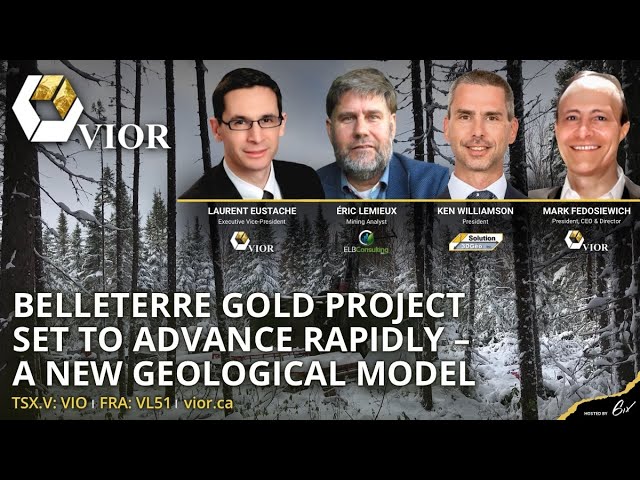
0:08 Welcome, everyone, to today's exclusive summit, where mining analyst Eric Lemieux will moderate an interview with Vior's CEO, Marc Ferozouic, and the Executive Vice President Laurent Eustache, as well as Ken Williamson, Vior's consultant from 3D GeoSolution. Together, the guys will take you through the new geological model at Vior's flagship Belter Gold Project in Quebec and the work plan going forward. Please note, due to availability, the interview was pre-recorded and edited to focus on the key topics. After the presentation, Marc, Dédon and Ken will be accepting questions. As a reminder, you can submit your questions to the Q&A panel found on the right-hand side of your screen at any time during the presentation. Lastly, there will be forward-looking statements made today, So please be aware of the risks associated with these statements. And so without further ado, let me start the presentation. Hello, ladies and gentlemen, welcome to the technical summit.
1:03 It's a pleasure for me to present the Belter Gold Project, set to advance rapidly a new geological model. My name is Eric Lemieux. I'm an independent mining analyst based in the province of Quebec. And I have the pleasure of moderating this technical session on VIO, ticker V-I-O on the Venture Exchange. Just shortly to discuss about who I am, I'm a professional geologist trained in the province of Quebec at Laval University in Quebec City. I've been involved in the mineral exploration industry for the last 30 years, a little bit of gray if you want. I am a graduate from the Colorado School of Mines in Mineral Economics, which has second master's degree. And my career has evolved from being an exploration geologist working for companies such as Calavial, Miranda, and SOCAM into becoming a consultant for the regulators, the Quebec Securities Commission, and being behind a little bit all through the National Instrument 43-101.
2:06 And then I became a sales side mining analyst with Laurentian Bank Securities. Long story short is an analyst and I cover approximately 15 companies, mostly focused on the northern hemisphere. It's my honor right now to introduce the executive team of Vior. We have Mark Vladovich, who's the CEO. Mark is in a veteran industry in the sense that he's been a first vice president with Wood Gundy CIBC, has about 3 years experience more on the financing side, and his right arm if you want is Laurent Eustache, who is the executive VP. Laurent I know very well, he's a trained geologist both in Quebec and in France, worked for the industry such as companies as Minorizon in the Casabararity area and the Abitibi with Agnico Eagle.
2:58 And like I say, he's a graduate with both a master's degree and also an MBA and worked for CDEX, which is the Quebec, if you want, one of the Quebec Inc. Financial institutions as a portfolio manager. And so the team of Yaw on the executive level, I can say are very experienced. I also have the pleasure of introducing Ken Wilmingson, who is a consultant geologist. He has over 15 years of experience in the mining industry, specializing both in structural geology and 3D litho structural modeling and also mineral resource estimation. He has an MSc also from Laval University in Quebec City in structural geology, as I had also, and he has experience in the Red Lake camp, both with Gold Corp and with Premier Gold.
3:55 Gold Corp is now with, if you want, now is known as Newmont,
4:00 And Premier Gold is now known as I-80 and focused in Nevada. But long story short, he has experience in the Greenstone belts, both in the Red Lake area and in the Abitibi. He was involved with the O'Bien project in the Abitibi with the resource estimate. And so he's uniquely positioned to give us a great insight on the geological modeling following what I would call some modern comprehensive data compilation on the Belterra project. Before I delve deeper on the Beltair project and start getting some technical questions, I just want to tell the audience that, as I said, I am a mining analyst. I have been covering VIAW for the last 3 years, And I do write my assessments on LinkedIn.
4:48 So if people are interested to see my writings, they can follow my stuff on LinkedIn. And I just want to say that I did do an interesting site visit back in July on the Bell Tower project. So I do have a little bit of insight. And in that regards, I'd like to perhaps bring the discussion to the reasons of why you all acquired the Beltair project and what was the process behind all of this. So I would like to have Mark maybe give us some insight on how you guys got, if I could use the expression, got your fingers into the Beltair area. Mark. Thank you, Eric. And good afternoon, everyone.
5:22 So a little background on on Belterre. Laura and I back in the summer of 2020 last year, set forward a project generation criteria for a flagship project. And our objective was to acquire or consolidate a top tier district scale goal project that would meet our rigid internal project generation criteria. And that hopefully would be able to attract the attention of a producer down the road. The project generation criteria was effectively, it had to be situated in a mining-friendly jurisdiction. In our case, it's Quebec. It had a unique location. And in our case with Belterre, it was a past-producing high-grade mining camp, which certainly met the criteria of being close to an existing or a former producer.
6:21 It was also situated 95 kilometers south of Raynoranda, had excellent infrastructure nearby, year-round accessibility, So unlike in James Bay, we can drill year round. And it also had to have the potential to advance rapidly to a more advanced exploration stage and hopefully build an economic resource. So Belter met all of that criteria. We had the potential for the first time in over 50 years to consolidate this mining camp that had never been consolidated. It was previously a very fragmented camp.
7:03 Now we're able to adopt a very systematic approach to exploration. We were able to assemble this consolidation at a very reasonable cost. And we've assembled a true mining camp with excellent high-grade potential and I'll let the technical team delve into the technical potential and the opportunity for a discovery. Excellent Mark. Effectively, I'm just curious how did you guys execute that opportunity to get the Belterra project?
7:40 Yes, Eric, I'm also pleased to be there to share with you today. When we look at that opportunity, we thought about the strategy to execute on that opportunity. And the first aspect was to acquire and consolidate properly the camp. And our first priority was the heart of the Belter old mining camp, which is what we call now the historic mining trend, composed mainly with the concessions and the jack property. And we also recognized the high fragmented ownership of the camp that you usually see in these old mining camps and quickly realized, as well as I would say our partners that we were negotiating with, that the value of the conciliated project as a whole was greater than the sum of its parts.
8:36 So that led us to negotiating sign up about 10 acquisition and option agreements, which today aggregates district scale goal project of almost 300 square kilometers. 30,000 hectares. 30,000 hectares, which is a good land position. OK, yeah, yeah, perfect. So the other aspects
9:06 of that strategy was to assemble the appropriate team to execute that with the right set of skills and executing the state of the art advanced exploration drilling and communication with local communities. And in that regard, our 2 managers, Christian and Mathieu, both highly experienced, are a cornerstone on the operation front at Bjorg. I did meet Mr. Gay last summer during a site visit and effectively that was one of my observations is that you had a very good team on the field and I think that's a good prerequisite. Yeah it's fundamental to acquire good data and to manage them as well properly.
9:53 So and the other aspect is to fast track a functional exploration strategy. Considering the advanced type of exploration, I mean with a huge amount of data, we decided to rapidly surround ourselves with one of the best in class structural 3D modeling consultants, Ken Williamson, with us today, and who will elaborate more on the technical aspect of that strategy in a few minutes. Excellent. So maybe just give us an assessment of what you guys have done since the acquisition in terms of, as you said, you acquired the land position, consolidated this fragmented land package. But I don't know if you just want to go in terms of what you guys did in terms of fieldwork and just to prepare this ongoing drill program that just started about a week ago, right? Yeah. Yeah.
10:44 I'd say, Eric, we've been really busy and the team has worked really hard these last months on a short timeframe and executing a systematic and rigorous strategy in order to prepare that drilling campaign. So basically We've completed 2 full months of prospection, validating historical work and locating the exact position of these past work,
11:10 leading us to confirm the high-grade component of the property. And we've also completed a high-resolution MAC survey on the whole property, which has never been done on that particular area. We've also consolidating under 1 database, all the past information that we've been able to get. And most of this information are from hard copies and old technical reports. So there was lots of work done to put that in the 21st century with the new standard of
11:51 managing data. So that led us to the 3D modeling that we will share with you today. And basically the idea behind that was to take advantage of the data with the use of modern tools, 3D modeling tools. In my view, it's a way to save money, time, and the effort on the process to unlock the full potential of the Belter mining camp. Excellent. I can concur that the Belter area hadn't been worked for probably 20 years, and the fact that you've considered the land package and have a big picture outlook has tremendous value, in my humble opinion. Let's maybe just delve a little bit deeper on the 3 model now. And so I'll, I'll have the pleasure of having Ken, maybe just show us all your, your work you've done behind us. And I just want to highlight to the crowd that effectively, This has never been done and we're in 2021 and it's safe to say that it hadn't been done for 20 years. And if you recall 20 years ago, we didn't have or 30 years ago, we didn't have this power in terms of artificial intelligence, data compilation, the computing power and all the geological models have sort of evolved also. And I just give the example of Canadian Malartic with the oldest Cisco, how that sort of was a game changer. So to me, Deltaire in that regards is an excitement. So Ken, if you just want to delve deeper on the 3D modeling, I appreciate it. Well, first of all, thank you for the invite here. It's a real pleasure to share with you
13:22 the team effort that the VR technical team and us here at 3DGS are trying to do. It's well underway. The philosophy behind all of this is that when Vior approached me, the idea was
13:43 that the geology there has been studied for decades. It is wonderful geological information that has been compiled and gathered for many, many years. The problem with the data set is not the quality, but it is the way and the capability or capacity at compiling all of that data into one common platform and then be able to look at the interaction of all of those sources of information to interpret in a different way perhaps the same geology that has been looked over for years and years. When the VR team approached me with that idea, I fell in love instantaneously with the project because it so reminded me the work that was done in Red Lake Mining Camp at the time I was there.
14:40 And the philosophy I proposed to the VR team then was, okay guys, what we need to do, and they already knew that that was the way to go, but what we needed to do is to go from the known, using the Tremantis dataset that is available there, interpret that, and from there, in a somewhat iterative process, we'll learn something by interpreting that specific data set which we can, new knowledge can then be applied to somewhere else and vis-a-versa.
15:18 So we initiated the entire thing by compiling into LeapFrog the entire data set that we had. So It's covering the entire property that we have displayed here on screen. This is a sizable land package. I think it's 37 kilometers strike on a northwest, I should say southwest, northeast sort of strike. And Just to re-highlight the fact that it's 30,000 hectares, which covers most of the Greenstone belt, the Valetero Greenstone belt. In that regard, it's a good land package. That's very good. Oh, absolutely.
16:00 That next image actually shows us the property boundary with the distribution of the known greenstone belt, which is displayed here in green, along with the collar location of all of the historical drill holes that VR team has been able to compile to support the creation of that 3d model. Ken, I'm just curious, we're talking about a pretty good data set that you guys compiled and some of that information was not even electronic right? I mean you had to put this all into an electronic format and I'm just curious to see what how much data sets did you guys have to compile?
16:45 Quite a bit actually. Laurent would know better. I guess the compilation work, we decided that Vior was to spend time on that while me and my co-worker would be spending time more at the 3D modeling. But it's quite a bit of information that has been digitized, scanned, geo-referenced, all of those old maps.
17:15 And done correctly done, right? I mean, it's just not just to do it just to say we did it. You guys really did it with a long term view of creating a good database that is solid and that will be used for the future. I should say for future use, right? Absolutely. To answer your question, Eric, you're right. We've been really busy doing that at the Vure team. And I mean, it's a process. And we're still compiling. We're going by priorities. But I think we start to see the footprint of what has been done in the past. We've been able also to nail on the field most of the work done in the past as well to make sure that the location is correct. So all these validations are in process and we're still adding new information on that front. That's very exciting.
18:10 We are really excited with all that data and to be able to take advantage of it and to see Ken using that wisely on 1 data set. But yes, it's a huge work to do that. Well done. Yep. So, ultimately, the work that we've initiated ended up with the creation of a regional model that covers the entire property as we can see here.
18:45 And we've focused on the regional side of things. We've focused at defining the major structural domains that we have to play with. And as I was mentioning earlier, the interpretation here is a consolidated interpretation across the way I see things and the way the VR team see things too. So we're making sure that it's not the consultant doing his own thing. We are having very regular meetings to discuss about those things, etc. Now from that regional interpretation, many, many things can be talked about or discussed about.
19:34 Principally, we could separate the topic in 2. First, what do we learn from the detailed modeling work that we've done in each of them deposit area, so to speak, Belter Mine, Obel, Paquet, Conway, and those areas here. What do we learn from their local geometries and local geological settings when we insert those local models into the regional models. The one conclusion that one could end up with is that There is a structural domain here which is very prolific.
20:24 It is that band in medium green that we have in here which is hosting the Belterre mine, it's hosting Obel, and hosting other deposits that are known. We can see the extent of the data that is available in here. You can see how less or very very little data exists in the extensions of that. That's a really important assessment here. It means that the work that we're doing at trying to understand the local geology of those different deposits may lead us to better understand how the mineralization has been deposited, or how deposits were created in that band of prolific rocks.
21:26 Depending where it is, it may have a different geometry. By learning and understanding this a lot better, it's money saved in the sense that future drilling or future exploration would be guided by the knowledge that we're gaining from that modeling work that we currently do. So there's a 5,000 meter drill program that's ongoing right now,
21:56 based on your assessments and your compilation work and your 3D modeling. So what I really could summarize is that you guys did your homework, and you're now testing things. Maybe you could tell us a bit more about the drilling program and what are the various targets in more specific detail, knowledgeable that time is of the essence, nevertheless. Yeah, I'll begin the introduction in that regard with respect to the drilling program. Eric and everyone we've recently announced that we commenced our initial 5,000 meter drill program. Laura will go into the specifics on where we're targeting and why shortly. But we wanted to ensure that we were in a favorable position for this program and going forward. So we recently closed a $1.49 million Quebec flow-through.
22:51 This will give us enough funds and financing to complete the first phase and also to quickly begin a second phase in the new year if we like what we see. All indications are very positive thus far. I'll let Laurent go into the specifics of targeting and rationale behind the initial drill targets. First of all, I really think that the potential to discover new economic neutralization is exciting in various areas of the property. And to be realistic on the amount of drilling required, that could become really quickly overwhelming if we were to explore properly all these areas at the same time.
23:44 So for that reason, we decided for our first initial drilling campaign to focus our effort only on the historic mine trend where we have the best control of the geology at the moment on the property. So the targets that we've designed, they will follow along the mine trend, along the mineralization known at depths and along strike, but with large step outs. Between, let's say, 200 meters to almost a kilometer from known mineralization in the extension of strife and depth. And these are huge step outs and not usually done by by others, explorers.
24:34 And I mean, it's a huge step up for the type of mineralization that we we understand at that time. But our goal is, I'm sorry, I don't want to do a tongue in cheek, but it's not a la Conway, if I could use that expression, and the insiders will understand what I'm trying to say here is that it's not drilling just to make some good press releases. I've seen some of the drilling done there where they followed a vein that was maybe like 15 centimeters wide and they just did these huge PQ holes on it. Maybe some people say it was bulk sampling, but it was more to, as we say in French, épater la galerie. So kudos to you guys to do this in a smart and intelligent way. Yeah, the reason, the goal there is potentially immediate success with eventually new discoveries along stride.
25:22 But I mean, we have to be realistic as well. And the other fact of that strategy is to really better understand the structural plumbing of the orientation of the mineralization, the various lithology and how does it work at depth on that particular corridor. And this information, they will become really critical to refine on 3D model and come up with higher level of targeting in the next drilling phase. As we've compiled lots of data, we're still adding some new data on these 3D model. We need to do some drilling to better, let's say, locate the frame plumbing of the mineralization.
26:08 And as we will get this information, we will higher the level of comprehension and higher the level of targeting for the next green campaign. So both strategies there, potential immediate success. And in the meantime, being really strategic in the way to better understand the location of the potential of that particular trend. So in other words, we think that all the ingredients are there for value creation. And even if it doesn't hurt, our strategy doesn't rely on luck. We strongly believe that mineral exploration is and value creation is a process that needs to be executed with rigorous science and strategy. And that's what we try to do with that first initial drilling campaign.
27:06 I don't know, maybe we could show some of the targets that we have, just to explain some details on a couple of holes that we planned. Yeah, absolutely. The image that we see on screen is again the regional model displayed with the historical drill hole information as those little black traces that we see
27:42 with the current planning that you guys have put together. So allow me to zoom in here on the model and perhaps we will just pinpoint the location of the 2 holes that are drilled or in the process of being drilled as we speak and the next targets that are coming up online. Laurent, you were explaining to me that VR's strategy has been to, from the known geology that we've unraveled by doing that detailed modeling work at the different deposit areas, your strategy has been to, as you were mentioning, to step out quite considerably.
28:38 So what we see on screen is, yeah, extreme west, extreme east, and the central portion realistically. And to me, that is the best strategy right now to be using. Ken, maybe if you could go into some of the details of the 3D modeling and tie in with your targets, your drill targets that you've defined, Give us a sense of what you've defined and I just wanna highlight again the scale of the property and what the distance between these holes are. Yes, Absolutely. But prior to getting into the detail of those proposed holes, perhaps it is very pertinent to understand a little better where the drill targets are from and the reasoning or the rationale between or beyond selecting those specific drill holes.
29:39 So
29:41 before we dig in into the detail of that process, that targeting process, just to relocate ourselves again. A regional model with that prolific band or structural domain here which is hosting the Belterre mine and most of the known deposits in there. Let's turn off that regional model and assess a little bit better the type of detailed work that we've done so far at the Belterre mine. Obviously similar type work has been done also on the other deposits but probably in a less extensive way because of the smaller size of the data set that we can play with at those other deposit areas.
30:37 In here, what that image shows is the combination of the modeling that was done on the Beltaire mine vein itself. The Beltaire mine vein in here in yellow.
30:53 What we've done afterward is, from the geological maps and the drill information, we went ahead and modeled several dikes that were seen on those maps. We are now recognizing a couple of families of them, or 3 types of dikes. The first one that we've put on is that big orange one in here, which is a porphyry dike. It seems to be later than the mineralization as it's cutting across very clearly the main vein. We can see that the dike itself is being deformed as well and presents at local scale various kinks and change of orientations and things like that, giving us an indication on the timing on the structural deformation events versus the creation of that dike and the mineralizing event.
32:09 We've modeled that big dike and then there were many, many other smaller dikes, probably a meter wide, something in that range. Those dikes are of particular interest as they are lamprophier dikes. Those are the ones that we see in green in here. So we've recognized a few families of them based on their orientation. So you can see that some are more or less East-West, some are very, very oblique to the trend of the vein itself in a more northeast orientation. The importance of them dykes is as it's been documented in many many deposits, especially at the Red Lake Mine where I've worked for many, many years, Lemper Fire dikes are supposed or interpreted as utilizing the same or interpreted as being utilizing the same deep-seated structures that potentially would have brought up, closer to surface, those mineralized fluids that are creating gold systems.
33:35 Presence of lamprofired dikes at the Belter mine is very intriguing and very promising in the sense that it confirms that this is not a weak system. It is a deep-seated system. Presence of lamprophyric dikes kind of confirmed that. So that's really good for the interpretation and I guess what we're doing with that information after is to try to interpret what kind of geological phenomenon
34:16 may have been responsible of the final geology and final geometries that we see on screen. So maybe we could start to the west of the historic minefield, where we have a couple of holes planned. A couple of holes planned. And just to show to the audience, maybe in section, that we have this whole plan to kill and test various targets with 1 hole. And as you can see, we're really
34:54 well positioned to test these continuities of past known mineralization at depth. So just to give an idea to the audience, the grey level there is about 300 meters depth. So as you can see, we're really testing the depth of the system to really understand the continuities of these zones, which will help us to eventually end up with immediate success, but also to better understand the continuity of alteration, lithologies and eventually mineralization. Mineralization. So maybe Ken, the Obel deposit is right with these bubbles in orange and pink And maybe we could show a close up on that particular hole, which is trying to follow the plunge of that mineralization.
35:59 But as the audience can see, we are about more than 350 meters below what is known yet. That's hole 5 or hole 3? That's hole 4 in the planification. But we will start drilling these holes and going forward to the east, next to the mine. So maybe, Ken, we could move on the east part between Obel and the old mine. So here are 2 other targets following the extension of the old mine and Obel to better understand what's going on between both.
36:46 We have some structural control there. As you can see we already also have modellized some dikes and structures which we will follow up and validate their location to better understand intersection between the dikes, the mineralization, and the structures. So these are designed the same as we saw on the first targets to follow continuities of non-mineralization at depths and also precise their exact location for next drilling campaign. Interesting.
37:34 And maybe the final one that we could show, Ken, is the extreme east of the property on the continuity of the old mine. So here, as you can see, we have some structural panels modalized on the main structure of controlling the mineralization of the mine. And what we would like to validate is, as it has not been retested to the east of the mine to see if we have continuities of the main chute of the mine, the past producing mine. There's no exploration done below kilometer, below the mine. So these are also really good targets, but it's these type of drilling should be done, but not for a first exploration phase. What we wanna do is to assess if we really understand properly that fast, that fast, that fast mind trend.
38:41 And but for sure, these are good targets that we will eventually evaluate for next drilling campaign. So I think that's what we have to share on what's going on at the moment. We're really pleased to have Ken with us, helping on the modeling and providing really good tools for the team to execute on their drilling campaign that is going on at the moment at Vior at Belterre. I would like to thank Eric and Ken for their support there. And maybe I will leave the mic to Eric to wrap up that interview.
39:26 Well, thank you, Laurent. We just had a great technical session that permits viewers to see the business proposition. I just want to say that I think VR has seized the opportunity in executing on a strategy and it's set itself to develop results, positive results I believe. These tangible results of the Bell Tower project are interesting to follow. And I just want to also highlight the fact that VR has other projects in its portfolio. It has that hybrid strategy that it's executing on. So in my humble opinion, VR is very well set to deliver results. And so I think I want to just thank the audience for their attention and thank Mark and Laurent for giving us a good insight and Ken especially for giving us this technical eye-opening sort of elements on what's going on on the Belt and Road project. So I just want to thank everybody. Merci.
40:20 Thank you, Eric. We're back live to take your questions now. As a reminder, I'd like to let you know, as the audience, that you can submit any questions that you have using the Q&A panel found on the right-hand side of your screen at any time. But with that, I'd like to start with a question that came in via email earlier. It reads like this. Congratulations for this impressive work of compilation and geological modeling. Could you tell us more about the potential for discovery of new Gold deposits along the historic mine trend? And what's your take on the relationship between mineralization and structural deformation on the trend? And this question is primarily addressed to Tim. Well, thank you. That is probably and really one of the key questions here, isn't it?
41:06 You know, that's probably one of the main reasons we do what we do. So thanks for asking that really good question. To answer it properly, Let's first relocate ourselves here. Just on screen, what we see is the location of the Greenstone Belt, along with the property boundary and the concession that is displayed in yellow. So what we'll do is we'll focus on this area of the mine concession to answer that question. But let me just first introduce how it all started. I guess when I first arrived in a project like this, and it's a really strange comment that I will say, but I have a tendency to not even look at mineralization at first, just to unravel what is actually the geology in which those deposits were developed without any bias. And then we can apply that knowledge to somewhere else and trying to discover new deposits. So that's exactly what we've done here.
42:12 So what I'll do without waiting much, I'm just gonna zoom in on the concession area. I'll just clean up the screen here by removing that greenstone. And we'll replace this by what I usually start with, which is magnetic data or magmaps. What we look at now is the first vertical derivative. So from that image, what we could see off the bat is there's a really clear separation of domains in here that are lighted by those iMAG bands that we see. And just as a recap, I guess, from the regional model, what we've identified are those domains, and the central one here, which I've left empty, is that mine trend that we're looking at right now. So let's turn this off. What we usually do as a starter will define those major domains. So If you don't mind, what I'll do is I'll just, as we usually do in casual meeting, I'll just draw on my screen here live.
43:24 So those domains, as we were able to see, were defined by those bands of higher magnetic response that we could see on the maps. And then looking at that in section, it became very obvious that in this part of the area or the property, all of them, contacts appears to be trust faults like this. So first thing first, we could then anticipate if it is truss faulting like the way we think, then we can anticipate having much more deformation than a simple faulting happening in here. And one of the features that may happen in such a situation is to develop drag folding along those major trusses.
44:15 So the hypothesis has been tested and supported, I guess, by the MAG data using the shadows and different techniques that I'm not gonna get into today. But I'll just reload quickly here the different domains that we have and just simply cut a cross section against it just to show you guys the general setting in which we are. So definitely trust faulting with trust faults dipping south supported by those shadows as we can see here and things like that. So that was pretty much scanned. So the next step for us was then to evaluate within that mind trend, what do we see in more detail?
45:02 So with experience looking at data sets like this, and it may for the ones who did not do that in the past may look a little strange or People may say, well, that is questionable. And obviously it is. But what we've done is to interpret the patterns that we were looking at in the band itself or in the MindTrend domain itself to realize that in places what we could look at are little domes or donut shapes Like this so there are at different scales Mind you so so we kind of started to draw Those things the best we could and trying to identify those patterns.
45:51 So now at the regional scale, those patterns are repeating themselves, those donut shapes, and it gave me the idea that maybe what we're looking at is not only drag folding, but it's more drag folding in multiple phases, and in which case we may have developed a second phase of folding, whether it's after that main trusting event or during that trusting event. And in either cases, what we did develop there is some sort of a dome and basin geometry, we think. So if we look at the geometry of the Belter, the main vein that we've modeled so far, we will then almost instantaneously recognize that donut shape in here.
46:47 So if you allow me just to highlight it, so following the trace of the vein up on surface, what we'll see is it seems to be dragging. Obviously we're missing portions of that donut here. Maybe it's not exposed on surface or simply hasn't been drilled yet. That is FIOR work at that point to properly drill this. But we did recognize some domes and basins, I guess, geometry in here. So what's really, really interesting with that, and we're getting close to better understanding that structural regime in which those deposits were developed, is, And what's really, really cool is if we look at this in a long view, and then we'll just simply look north here on the thing, what we have displayed now on screen is the long view looking north-northwest at the main Belterre vein.
47:49 And what we'll recognize on that long view, supported by the historical long view that we have also displayed in the background, is again, if I can draw another drawing here, What we'll see is that in such a view the vein is plunging in 2 directions. So it's plunging fairly shallowly in here towards the the west and more steeply in that direction towards the east. So that can give us an indication that overall, what's happening in here, and I'll just, in a little box here up top, we'll just pretend that this is the Belterre mine area in that sector here, and perhaps this would be AuBel area, a little bit further to the West.
48:41 So now what we think is happening here is something like this, perhaps. We're at the Belterre mine. What we have is a vein that is shallowly plunging towards AuBel, and then on the other side, in a steeper way, plunging towards the East. And if our hypothesis is correct, it may be actually a case like this, where from Beltaire to Obel and potentially other places along that trend, we're very simply repeating the same process that happened at the Beltaire mine. So the first part of the answer to the question is, is there any other potential other than the Belter mine? Yes, there is a lot all along that trend that is on Vior property.
49:36 So on that, if we were to go back and look at that more precisely, I'll just turn off my drawing here and complete maybe the question or the answer by showing to you guys the point sets that are coming from the compilation work that Vior team did from the underground drilling that was done at Belterre. And we can clearly see from the distribution of grade those 2 plunges, those 2 main plunges, that's not surprising. But what's really, really interesting too is it seems that the hypotheses that we have to explain the regional vision seem also to be applicable at the mine scale itself. So if I can allow myself to simply draw some lines like this, well, we have the shallow plunge to the west, but then in here, internal to the vein itself, it seems that there are other plunges, high-grade plunges that follow either one of the 2 limbs that we have identified at the regional scale.
50:48 So obviously for the mine scale, having such a knowledge in mind and better understanding that structural regime very, very precisely and locally will definitely help us out to unravel the potential at that scale. And then if from what we learn at that scale, we will very simply reapply this at the regional scale. And Just as a blue sky comment here, if a vein has been developed in such a structural regime, I don't really know why it would not be possible, and I'll use simply a different color here to highlight the fact that maybe what has not been discovered yet on the property is a second vein, which could be somewhat subparallel to the first one, either deeper or higher up on surface, such that at the Belter area, all of this would have been now eroded.
51:50 It's gone. But as it's plunging in directions that we can anticipate now, it means that we can better locate good potential targeting areas based on that kind of first step interpretation that we have of the structural regime. So not easy, very complicated, but explainable. And that to me is the good news to get out of that, the project here, it's complicated, but all the ingredients are there to develop major, major scale deposits in the area. Wonderful, Well, thank you for that, Ken. Thank you for the great in-depth answer.
52:36 Just being cognizant of time, we do have some more questions. We have a question from Peter just regarding, it looks like a big bend in the geological structure here. Is that a nice local setting for metal endowment? Curious to see how it fits into a broader scale of regional geology as well. Maybe, Ken, could you highlight the historic mine trend between the mine and the and the Aubert deposits and maybe show that continuity on the model. Is that something possible if you zoom out? Absolutely. What, sorry, what would you like to see? To show the historic mine trend between the mine and the obel and show the trend and maybe the interpretation that you just did the demonstration.
53:25 OK, so I'll just reload this and that. I think that's the sense of Peter's question. OK. Yeah, absolutely. Just being cognizant of time, maybe a very quick review, as we do have other questions. I mean, also, we are available. And you have our telephone numbers, our address, and we will be pleased to answer the question if we don't have time to cover all the questions. So is that image okay with you, Laurent? Yeah, like in a long view and highlight in the drills that we we have planned and the plunge of What you what you just demonstrated?
54:12 Okay Well, we're live in your kind of coding getting me off guard there, but Maybe maybe we will get back. Maybe it's no, that's fine. I think we're there. We're almost good to go. Hold on. Wrong file here. This should be the one. Hey, sorry about that. Where are you guys? Yes, all right. So that should be what you are asking for. Yeah, and maybe you could show your interpretation on the mind trend as you just did on the mind. Like redrawing it live? Yeah.
55:00 Let's do that quick. So I'll just use that same color. So we're talking about limb here, eroded somehow, and then shallowly plunging. And then perhaps it may do something like this, as we are interpreting it. Yeah. So we could have this repetition as well at depth. And so we could have some various repetition. So all these things will be evaluated as we advance in the drilling. And that's the reason we need to do some deeper holes to really understand the frame of that fast producing trend, mine trend.
55:49 So maybe we could go with another question. Yeah, absolutely. This question is for Mark specifically, but what can we expect over the next year out of Belterra? Okay, Cam, I guess this is just to summarize for the audience the investment opportunity. Look, we've consolidated and assembled a top tier district scale gold project here at Belterre. As you've just seen in the technical webinar we've got about 12 kilometers of favorable ground field strike within an overall 37 kilometer of a favorable strike in the greenfield in one of the top mining jurisdictions in the world. You know, as the web at our title suggests, Belter should develop rapidly.
56:38 We've commenced our first phase 5,000 meter drill program that should be quickly followed up in the new year with another 5,000 metre second phase, given all the targets that our technical team has identified thus far. So there should be a significant amount of news flow throughout the coming year. I'd just like to summarise, it's statistically improbable that there's not at least another Belter Gold mine in this mining camp that we've assembled. We believe that with our systematic approach, the technology that we have at hand, as you've seen today, and with an excellent outstanding technical team that we have a significant competitive advantage to make a new discovery year.
57:29 Absolutely. Thank you for that. Looking at the clock, unfortunately, we are getting close on time. We've received a number of questions that unfortunately due to these time constraints, we aren't gonna be able to answer here live. However, make no mistake, all of your questions, if they have gone unanswered, will be asked of the group here and we can always follow up. Likewise, you can see on the slides here, Mark's and Laurent's contact information if you'd like to continue the conversation further. Before I hand things over to Mark for some final words before we part ways today, I'd like to let everyone know that Mark and Laurent will be back alongside Chad Peters, the CEO of Ridgeline Minerals, on Tuesday, December 7th, that's this coming Tuesday, to discuss their respective exploration strategies and what's working for them. And with that, Mark, I'm going to hand things over to you before we wrap things up today.
58:14 Thank you, Cam. And listen, I'd just like to give a hearty thanks to everyone who's attended this technical webinar. Obviously, we haven't been able to answer everyone's questions, but we encourage you to contact Laurent or myself for a follow-up, and we'd be happy to give you the answers that you deservedly are owed. So thank you very much once again to the whole technical team and thank you to 6 for hosting this for us.