Hayden Locke
Chief Executive Officer and Director at MARIMACA COPPER CORP.
Replay available
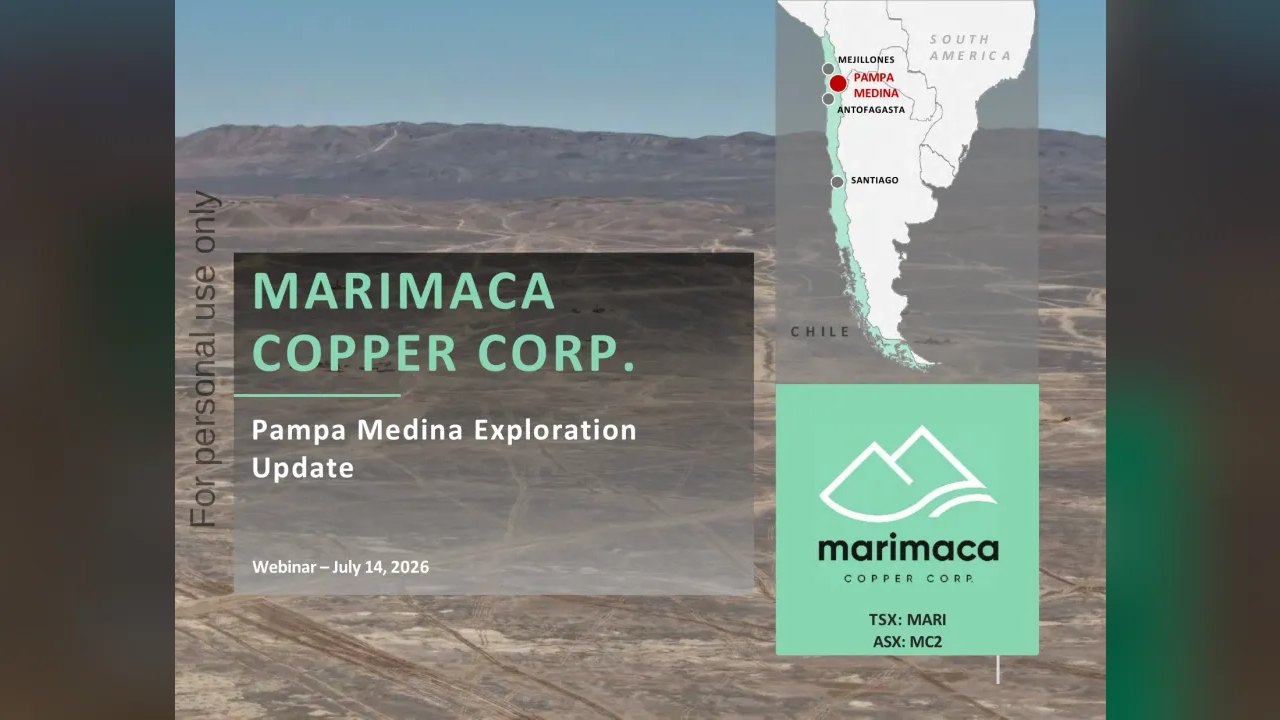
Pampa Medina Exploration Update hosted by Marimaca Copper (TSX:MARI) on Investor Meet Company, held 2026-07-14.
On 6ix: 6ix.com/event/marimaca-copper-corp-mari-pampa-medina-exploration-update
Automated transcript · Written by software from the replay's audio. It can mishear names and figures; the replay is the record.
0:01 Good afternoon, and welcome to the MARIMACA COPPER INVESTOR PRESENTATION. Throughout this recorded presentation, investors will be in listen only mode. Questions are encouraged and could be submitted at any time via the Q and A tab situated on the right hand corner of your screen. Simply type in your questions and press send. The company may not be in a position to answer every question it receives during the meeting itself. However, the company can review all questions submitted today and publish responses where it's appropriate to do so. Before we begin, I'd like that... I'd now like to hand you to Nico Cookson, president. Good afternoon, sir.
0:30 Thank you, operator, and thank you, everyone, for joining us today and for your continued interest in MARIMACA and the exciting exploration top opportunity we have here at Pampa Medina. Before I get started, just a few forward looking statements to refer to, please. And before I hand over to Sergio for the technical discussion, I wanna briefly just frame why we are so excited about this discovery. Geologically, at Pampa Medina, we see a stratabound hosted mantle type deposit within a very extensive sedimentary basin that our land claims cover. This allows us to draw on important geological parallels and learnings from both proven Chilean mantle deposits such as Mantos Blancos and the exciting new discovery at Cocharo and some of the world's largest sediment hosted copper systems like the African copper Belt, Comoa Kukula and the Cooper Sheafer.
1:20 While every deposit is unique, these analogues demonstrate the potential for this style of mineralization to develop significant continuity, scale, and in the right geological setting, exceptional grades like what we see at Pampa Medina.
1:32 At Pampa, we have already defined mineralization across more than four square kilometers within a much broader identified sedimentary basin of approximately 46 square kilometers. In our view, the combination of a large, high grade mineralized footprint and a much broader underexplored geological system creates a compelling opportunity for substantial organic growth within MARIMACA. With that context, I'll hand over to Sergio to take us through the geology and our latest results in more detail. Sergio, over to you. Okay. Thank you, Nico. Hi, and greetings to all those attending today's webinar. I will be presenting and answering your question regarding the progress of the exploration that MARIMACA COPPER is carrying out at Pampa Marina. I'm going to give you first some location context and a key piece of information regarding stratigraphy and structure that I consider relevant to understanding the controls of the mineralization.
2:28 And then I will show you the results of poles from the phase we call delineation or footprint definition. There's our drill space at 300 meters with continuity test down to 150 meter based on East West and North South sections. I will comment about the drilling results as they reveal
2:53 the continuity of the mineralization that can be observed in the mineralization of the intersection. The nature of mineralization shows an important feature related to the silver values related to copper. And I'm going to show you how this copper silver correlation occurs and is disputed through the deposit. Finally, we will conclude the discussion with the reference this this exploration potential through a review of the current resistivity, geophysical advances, and how the interpretation of these results is defining the potential for continued mineralization to the north, south, and west. Next, please. This map shows the location of Sierra Madina property block, which is located approximately 20 kilometers east from MARIMACA COP project.
3:46 And Pampa Medina is in the southern part of the block and actually observing the map. It is situated in the area with an active mine operation led by Mantos Blancos and notable for the recent discoveries of Cachorro by Entropagastomerias and our Pampa Medina exploration project. In the next slide, I will show you the... And comment you about the key thing from the geology geology point of view for for our understanding of the realization and make controls of the realization. As I mentioned, the key to understanding the controls of realization and therefore, the potential resource possibility eyes in the understanding of the strategic infrastructure.
4:33 The area correspond to a Pampa, a typical landscape of this part of the Atacama vessel, and the entire area where we explore except for part of Cerro Norte has no rocks pushers. The map on the right shows a summary of the Skarnajemin regional map indicating the main regional structures that you can see all are oriented Northeast basically and the location of exploration projects. On the left, the stratigraphic column, which comprises a sequence of Jurassic and Triassic rocks lying on a basement of Triassic volcanics and parasites sediments. This sequence is more than 1,000 meters thick as measured by three holes. The copper silver mineralization occurring in Mantos and is distributed through distributed through all the entire column.
5:25 At this scale, there are examples of different type of earth occurrences such as the typical volcanic cost of deposit of the coastal range at the Elenita And Muralo Mines. At depth, more than 300 meters thick sequence of tougher sediments, we call the Rancor deformation, host the mineralization we have discovered at Pampa Merida. The style of mineralization is unique to Pampa Medina. And while the muralization and alteration are comparable with the descriptions of Marcos Blancos and Cachorro, that that means talking about muralization of chalcopyrite, boronite, chalcocide, solid with a starch pyrite and alteration of albip chloride, the thickness of 100 meters of duffel sediment causing this mialization has not been observed in the area, not even in the country.
6:22 In the following sections, you will find simplified interpretations of the stratigraphy in relation to the mineralization. In the next map, I will show you the situation of the exploration area, a summary of of of our definition of the of the exploration project. The Pampa Medina shows and and the and the gel... Excuse me. The blue dots are shows the the location of holes drilling, some historical drilling as well as our our actual drilling. To the west, the Madueguelo area is a... Is an is an old mine and also have some some drillings, and you can note the cluster of those that define the area of the old mine.
7:13 To the north of Maduehador is Tierra Norte and then is Pampa Norte areas. In Tierra Norte, historical exploration inform... Is informed of trenches that expose volcanic rocks with copper oxides and some shallow holes that did not reach the underlying sediments. At Pampa Norte, it's completely covered and has not been explored before, and our interest is based in the extension of A and T's statistical study, the results of which I will present at the end of this talk. Now I would show you real map showing the locations of of holes we drilled today projected to surface. And along the traces of the new holes, drill it at 300 meters and some at a 150 meters fences.
8:06 You can see the histogram that's showing the distribution of cover grades along the holes. And for reference, note that the the area marked by the green line in the Southeast in the Southeast part, which correspond to the oxide deposit previously evaluated by Minidera Riron. The dashed red line frame shows the limit, but for now, we have arbitrarily designed to the area we evaluated in this campaign. However, as shown by the arrows, mineralization is still open to the Southeast, Northeast and to the Northwest as well. The area behind for the CORP. Project covers 2.5 kilometers east west by 1.5 kilometers north south.
8:56 So far, we have setting up the core area. And in the next part of this presentation, we will review the updated drilling results in three main aspects. The delineation of the extent of the mineralization footprint and its main control, the lateral and the continuity of the mineralization as it can be interpreted in North South and Inquest sections, and also the relationships between the copper and single mineralization. The next slide shows the results from the 300 meter step and partially 150 meter step out drilling and shows how we can delineate the main distribution of rates of the deposit... Corporate rate deposits up to now.
9:51 This is a simple interpretation showing the area distribution of the mineralization in terms of significant field holes intercept with copper weight ranges from 0.5%, 0.3% and above 0.2. In 2% borders are yellow and 0.3 shows the area in orange and the central part in kind of red color. They're above 0.5 mialization distribution in terms of intercepts, same intercepts that are being released in various previous press releases. Note that the 0.5 above point five and above point 4% copper curves define a northeast oriented central zone with the access within the perimeter of the project under evaluation extends for about two kilometers and is approximately one kilometer wide and refer just to the...
10:55 What would be the central high grade zone with... From the arrows, it's still open to the North, open to the South and open to the West of market size to the West Northwest. In the next slide, shows the same base map of the footprint as defined by cover rate sectors. But you can see here that the... That all another feature was important. We have recognized from real core mapping and structural information from both all to the viewer measurements, a control accepted by West Northwest oriented photon dykes showing in this slide in blue.
11:43 And... But in general, if you see the distribution of the high grade zone in northeast oriented direction, the effect of the west northwest oriented structure stone are not observed at the scale of this footprint. And just can be noted in some East West section because the structures are... Seems to be parallel to to the... Some of the east west or west or west structures parallel to the sections. But from the most recent 150 meters step out results, revealing that the effect of the western western structure is confined to certain discrete corridors with limited patient in terms of thickness.
12:34 In the next, please. I want to show you the location of some key sections, East West sections and a North South section, section that in which we will see the distribution of the mineralizations in terms of corporate rates mainly. And
12:56 starting with the the main forty forty eight hundred secondtions in the Central Park, It's an East West section with our... We use this as a general reference. And then I will show you a 100... A section which is a 100 meter north, which is the section forty nine fifty, and then a 150 meters south of the reference section, which is the 404006650 North section. And the and the north south section is the is the four four zero six two hundred section. Let let the start first with the section 48. Holes are located 300 meters apart. This sector is only for reference regarding the repulse of the elevation of the kind of meters.
13:52 Not first, the dimensions of the section that exceed two kilometers in this west direction and reached 900 meters in-depth. The left at the bottom shows the rock units in terms of a column at the corporate rate range, and you can note that the that the ranges goes even reach levels of above 3% in in the in the purple color. And it shows also also another feature that is interesting for us in terms the location of what can be... What we call the ultra high grade zones or sections with mineralization above 10% copper. And another definition, which we call the high grade two, which is high grade above 2% copper.
14:39 And we show the where this specific high very high grade intercepts are located in holes to give you give you the idea of what is the distribution and extent. But remember that the holes are 300 meters apart.
15:00 In in this section, we chose the stratigraphy as summarized in the upper part in green color in the volcanic rocks, the intermediate unit of sediments in light blue, and the basement in gray color. In the 300 meters hole 300 meters apart hole, we have not yet discovered extension of mineralization into basement, which we have observed in the new 150 meters about deeper drill holes. Note here the extent and continuity of the 300 meters of the mineralized level that we have defined as ultra high zones, generally above 10% copper. The mineralization appears to be limited to the east due to falls that uplift the basement and to the west is also limited by falls that produce the same effect, uplifting the basement in the western block.
15:57 The east west extent of the mineralization, the cross sections of high grade two and ultra high grade, is approximately 900 meters between Holes 13 And 1. And the next section is the section forty nine fifty. It's it's located a 150 meters north of the previous one and shows the the drill the drill holes are 300 meters apart. And the results confirms the lateral extension of more than a 500 meters, but note that high grades begins to appear near the contact or in the basement units in this case, especially the ultra high grade in in...
16:42 And the and the high grade two as well. The ultra high grade from holes five is remarkable, but so do the high two... High grade two grids from the southern and surrounding holes. The Western grid holes had scouts from the first campaign and, without a doubt, show too shallow to intercept the sediment and basement mineralization column at that. The next slide is the Slide fifty six forty, 60,
17:19 Site 650. And similarly, a section is 150 meters south of the previous key section shows the results of 1,400 meters apart three holes that confirms the extent of mineralization also in terms of ultra high grade and high grade two. We are progressing from actually in the field with two diamond drill rigs and one RC rig in drilling a series of a 150 meters drill holes apart with... Through all the central area of the higher grade that we previously defined in the in the map that shows the footprint. So with all these whole... The new holes, we are trying to prove the continuity in... Of the mineralization in more detail.
18:15 This... Now we can can take a look of the of the North South section, the Section 406200, which is located in the West Central part of the Mialized Zone. And the continuity of the mineralization is more evident here with a slightly graded level of detail in the stratigraphic sequence just to showing and allowing us to appreciate how
18:41 the mineralization extend throughout the entire sequence. In this case, mineralization is is in the... We... What we call the r r one unit, the super... The upper part of the Renkoye formation, and then a unit of tough that we... What we call the queue... Key unit that we follow for... With the structure and define the stratigraphy column. But also in the r two unit of of of Rankine formation, the mineralization also extend. And we have the high grade two and ultra high grade in this case, basically related... More related to the base of r one and the and the TAF unit.
19:26 But also, there is some high grade in the bottom of the R2 unit and close the basement as well.
19:36 The extent of mineralization with the greatest evidence of continuity can be seen for more than a thousand meters in this case with several ultra high grade and high grade two zones defined by drill holes. The next map is also helps to shows the continuity of mineralization. In this case, we use the undiluted potential thickness above 0.5%. And this is basically an illustrative diagram that is playing the Pampa Medina drilling to date with the undiluted composite thickness of each three holes, which cover rate exceeding above 0.5%. And the thickness is interpreted in terms of plus 70 meters, 50 meters, 30 meters, 10 meters of occurrence of high grade mineralization terms in terms of cumulative thickness above 0.5%.
20:40 It was produced just for illustrative purposes only for comparison. The Northeast, for example, the Northeast trend of the that controlling the highest thickness compared with the previous footprint interpretative map. Next, please. With reference to the mineralization, I mentioned that the mineralization at Pampa Medina consist basically of primary association that shows sonatio ranging from central areas with boronite chalcocite to borders of higher
21:24 calcuate and pirate gallows. In some areas and depending on the structures, this mineralization has been oxidized to atacamite and secondary chalcocide. A common feature of manto deposit is the copper silver relationship that we can found in many of the mantle type deposit of the Costa Corriere and elsewhere. Same we can observe at Pampa Medina as shown in the correlation graph of the figure. Not how for different mineralization associations defined by meteorology and drill holes, the correlation between high copper values and high silver content is maintained.
22:05 Next, please. Finally, to conclude this review, I will show you why we are considering extending Pampa Medina type realization into the rest of our concessions, especially to the north, south and west. We based these ideas on the A and T resistivity survey results. The map in the figure shows the areas covered by the A and T grid at 200 meters and 400 meters apart measured to date. For reference, the area covered by the AMT is about nine kilometers north south by five to eight kilometers east west. We use AMT because it appears to be the best method to help in defining stratigraphy structure and mineralization.
22:55 The validity of this proxy is more evident if you consider the view of the of the right, which correspond to AMT section of about eight kilometers between Pampa Medina and Sierra Norte. The AMT anomalies are coincident with the project three holes from Pampa Medina. From this, you can make inference from Sierra Norte, where below the volcanic rocks represented by sections of higher resistivities. The lowest anomaly... The low anomalies compared with mineralized subjects and sediments units can be interpreted. It is essential that you retain the image of the section with the anomaly and the drill hole distribution to evaluate the three d model animation in the following slide.
23:46 So in this case, and we can put the animation, this is a a close representation of the variation of the resistivity model along the area. And you can show, especially in this section, for example, the relationship of the of the anomalies in AMT as related to the previous three... Related area and how this anomaly... AMT anomaly extend to the rest of the area, especially to the Sierra Sierra
24:22 to the West and also to Pampa Pampa Norte when we advance to the North in terms of distribution of the AMT anomaly.
24:35 So this indicated basically the consistence of anomalies of resistivity units, which will be lead to indicated that the potential exists of sedimentary levels that could contain malaiseation in the northern part. So finally, the ongoing exploration program in addition to the drilling of Pampa Medina, 150 meters step out, included target identification exploration toward Maduevalor, Sierra Norte and Pampa Norte detailing AMT and adding Bedrock Geokinistry and Skull Drilling. We expect to have results from these programs by early twenty twenty seven. Thanks very much from my side. That's great. Thank you very much for your presentation. Ladies and gentlemen, please do continue to submit your questions just by using the q and a tab situated on the right hand corner of your screen. Just while the company take a few moments to review those questions submitted today, I'd like to remind you the recording of this presentation along with a copy of the slides and the published q and a can be accessed via investor dashboard.
25:41 As you can see, we have received a number of questions throughout today's presentation. And, Nico, could I please ask you to read out the questions and give responses where appropriate to do so, and we'll pick up from you at the end. Perfect. Thanks, Sergio, and thanks, operator. We'll move through some of these questions now. For anything we don't get to today, we will publish, as the operator said, responses to the questions in in due course.
26:05 First question, how large is the perspective area in your mines? Is it underpinned by any drilling? Any other evidence of sediment hosted copper and any geophysics? And what does the AMT anomaly to the north mean? Yeah. Look. I think from the discoveries at at Cacharo that we've seen and now Pampa Medina, it's, an existing operation at Mantas Blancas. We know this is a a very prolific metallogenic district. I think what gets us most excited is is probably the AMT resistivity surveys that Sergio ran through to the north. We... We've now completed the grid of of approximately 10 kilometers by eight kilometers, on that AMT grid you can see here moving north into the west from Pampa Medina. And for the most part, there... There's no historical drilling in this area, and the bedrock is is predominantly covered by by quaternary gravels in Caliche.
26:56 So what we see at Pampa is is a is a very nice correlation between these resistivity lows and and sediment hosted mineralization. So it it is a useful tool we find for defying the contact between the upper volcanics and the target underlying sediments, which is, predominantly the the host lithology the high grade mineralization that we see in those rancorite sediments. And what you would have seen in that animation as we move north is that there is clear continuity of that resistivity low, indicating that there is potential for fairly significant extensions of those host host lithologies, those target sediments. It's... You know, geophysics is never diagnostic or a clear cut, but but, you know, we're encouraged by what we're seeing, and we'll move to, the broader step out campaign after we wrap up this initial delineation program at at Tampa, Maine.
27:46 The second question we're getting is the maiden MRE, timing, methodology, and scope. Where does the maiden, Tampa resource stand? How much drilling remains, and what's the release timeline? Yeah. Look. Our our 150 meter delineation campaign will continue through into November, across the initial, defined AOI of of approximately, one and a half kilometer by two kilometers, two and a half kilometers as you can see here. At that point, we'll we'll we'll cut off the data for the first MRE, and we'll start working on that. So we expect to have that released in the first half of twenty twenty seven. Just keep in mind that that will very much be a snapshot in time. Concurrent with that MRE, we'll, as I said, we'll commence our step out program focusing on those anomalies to the North and those extensions to the West.
28:38 But, again, target MRE on that initial AOI will be first half of of twenty twenty seven. Next question, which I'll hand over to Hayden on, is is the deposit architecture and mining method. The 2026 hole shows certain high grade zones, one to 2%, alongside long low grade runs. Is it a working assumption to sequence the high grade zones first or develop as a lower cutoff bulk deposit from day one? And what cutoff grades are you currently considering? How are you thinking about the stacked mantos over the deep sulfides open pit mining, underground at depth? Or can you explain more? Thanks, Nico. It's a great question. Our thinking is fairly high level at this stage, but what I would say is we've been analyzing the potential for this deposit using the analogs that Nico outlined in the first slide. So to give us a rough sense of direction of travel in terms of operating costs and therefore economic cut off grades and how we might think about the mining of this, what I would say is once we've got our shapes, our initial shapes for this resource, and once we've done our geological interpretation, we will be working one... With one of our partners who are very good at, reviewing and analyzing how you might go about, developing a project like this. And that will include underground mining methods, what's available to us, what's going to be logically the best solution for this project.
30:03 But if I use Kamoa Kukula as an example, in terms of, operating costs from their DFS, you know, it's a... The... I would note Kamoa Kukula on average is about five meters true thickness. So, you know, the the Pamper Medina deposit area is in general, a multiple in terms of thickness of that. So, logically, it will have a lower unit cost for mining. But if you use Kamoa Kukula assumptions, $40 a ton mining, $8 a ton processing cost, $5 a ton underground development, and $12 a ton sustaining CapEx with a sort of rough eighty eighty five to 88% recoveries. And assuming a 10 gram a ton silver byproduct, we expect our economic cutoff grade depending on copper price to be somewhere between point six and point seven.
30:52 Now if we can materially reduce that mining cost, there is a world where you can start to think of this as a much more bulk tonnage underground mining operation, and that's what we're aiming to get our head around towards the end of the year is what is the best way to develop this to, be able to capture as much of that lower grade halo around the high grade mantos. I think in the in the other question was, you know, will we focus on those high grade mantos? Well, yes, it makes perfect sense, to focus on a higher grade portion, during that all important payback period. Once you pay back your capital, you can then adjust your your cutoff grades lower, maybe sacrifice a little bit of margin, but materially extend, the mine life. So that's all of the thinking that we're doing, over the course of the next six to twelve months. We'll be trying to come up with some solutions for how we move forward on this very exciting project.
31:43 Thanks, Hayden. The next question we got was just revisiting the AMT was the last graphic where you tracked the AMT anomaly from south to north, did that end all the way through the Pampa Norte block?
31:54 Yes. You can see here on this map the grid that we were running that AMT survey on extending extending north through Pampa Norte and to the West through Sierra Norte. Next question on exploration upside, the basement sediments, the Cotaro analogy, and going deeper. SPRD o eight hit the basement meta sediments for the first time. Drawing the control... Cotaro comparison, what geophysical or geological evidence suggests that Horizon exists laterally across the AOI rather than being local to that hole. Look. Almost certainly, the basement meta sediments is a new target for us. Previously, the Rendcaret sediments, the upper sediments was our was our focus, but, obviously, the the intersection from SPR SPR d o eight, you know, changes slightly what could potentially be the host of of mineralization here, and we do see that at Cocharo in terms of extensions into the basement.
32:47 I doubt it'll make it into the first resource that we publish given most of the holes to date have been finalized before going extensively into those basement met... Metasettlements, but the opportunity always remains to go back to those collars and extend those holes if we continue to see, evidence of continuity at at depth. The next question on metallurgy. On metallurgy, how many samples have been tested, and do they cover all major areas? Are these early rougher tests, or have walk cycle tests been run? What's the single biggest met risk today, impurities, recovery, pyrite? Have any samples thrown a red flag? Look. GEOMET one is underway. We have not published any met at this stage, which is not why we're not reporting copper equivalents in our drilling, But the geomet phase one is underway. This program consists of, testing on the three mineral subdomains that we see at at Pampa, being the sulfides, the mixed domain, and the oxides.
33:43 Sulfide testing at this stage is is a bulk flotation, rougher cleaner. Oxides, we are completing bottle roll tests and 30 centimeter mini columns. And the mixed material, we're completing both leaching and flotation tests on those. So it's very a diagnose... Very much a diagnostic program to identify any potential red flags, but I think fair to say at at at this stage that we aren't seeing, anything that that we're particularly concerned about or or fatal flaws, from the test work. Now I'd note on the oxides, particularly, we have, we we have the benefit of of a wealth of information from the MARIMACA test work that we've completed. The mineralogy in the oxides is is very similar between a taco mite, cricicola, and and chalcocite. So while the the host rock is different, we obviously have have learnings from the extensive MARIMACA campaigns that we can apply to the oxides here at Tampa.
34:35 The next and and final question is on, corporate strategy. Has the pace of inbound strategic interest shifted, with recent results? Has it changed your thinking on developing both assets in one company? Which milestones over the next twelve to twenty four months have the most potential to close the apparent discount to Pamper Medina, and what would the company do to force value recognition without unnecessary dilution? I'll start on this, and I'll hand over to Hayden to to close out this this webinar. Look. I think it's it's early days to let Pamper Medina, but, you know, with any new disc... Any new discovery, particularly in this part of the world, you can expect, you know, interest in people following what... What's going on. I'd say at at this stage, you know, the company is very inward focused on on our two value maximization pathways being, one, you know, the successful and and near term development of the mod, which is progressing rapidly, and then two, just continued growth of... At Pampa Medina and continuing to to improve our understanding of what we actually have our hands on here. Now that said, I think what what is clear about Pampa is that the potential scale of this opportunity is or could be significantly larger than the mod, which has implications for, you know, both both capital and execution.
35:48 So that will factor into our decision making in the future once we better understand, the scale of the opportunity. But I think given the location of these two deposits and the fact that there is an oxide opportunity at Panther Medina or an apparent oxide opportunity, there will almost certainly be, assuming both, deposits get developed successfully, some sort of industrial synergy between the two given the location that that they share. And, Hayden, I'll I'll hand over to you for any closing remarks. Thanks, Nico, and thank you everyone for attending. Hopefully, everyone has found it useful, and you can understand why we're so excited about the Panpamedena opportunity where we see the potential for us to make a tier one discovery, something that is really game changing for us as a as a company, but also game changing in in terms of new discoveries made in Chile.
36:39 And with that, we will sign off. That's great. Thank you for updating investors today. Please ask investors not to close this session as you'll now be automatically redirected to provide your feedback in order that the management team can better understand your views and expectations. This may take a few moments to complete, and I'm sure it'll be greatly valued by the company. On behalf of the management team, we'd like to thank you for attending today's presentation, and good afternoon to you all.
Follow Marimaca Copper Corp. into a list and get an email when it puts out news.
Chief Executive Officer and Director at MARIMACA COPPER CORP.
President at MARIMACA COPPER CORP.
VP of Exploration at MARIMACA COPPER CORP.