Transcript
Automated transcript · Written by software from the replay's audio. It can mishear names and figures; the replay is the record.
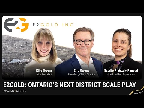
0:07 Hello everyone and welcome to E2 Gold's live summit today hosted by 6. Today I'm joined by Eric Owens, the company's President and CEO, Ellie Owens, the company's vice president, and Natalie Piet-Chuck Renaud, their vice president of exploration. The company is gonna walk us through their presentation today that they have, and they'll be accepting questions that you can submit to the Q&A tab found on the right-hand side of your screen at any time today. As always, the summit is being recorded and will be available to watch afterwards on SIX.com. Without further ado, Eric, I'm going to hand things over to you and you can get
0:38 us started. Thank you, Cam. Thank you, everybody who are out there listening to our story today. We're very pleased to be here to try to introduce those of you who are not familiar with us with E2Gold to our activities, to our story, and to our people. And for those of you who are familiar, bear with us as we make these introductions. I'm Eric Owens, the president and CEO and co-founder of E2Gold. I'm here today with 2 other team members here of E2Gold. That's Ellie Owens, our Vice President and also a co-founder, and Natalie Pirchuk-Renaud, our VP Exploration. A little bit about myself before we have Ellie and Natalie tell you a little bit about theirselves.
1:29 I'm a geologist by background, exploration history and education. I've set up E2Gold along with Ellie to start a new venture, which we did about a year and a half ago. We took the company public in December 2020 on the backs of our current flagship project, the Hawkins Gold Project.
1:54 But in summary, I've spent about 30 years in the industry and have been involved in the discovery or definition of gold deposits totaling some 7 million ounces of gold and resources throughout the Western Hemisphere, Central America, Mexico, United States, and Canada.
2:13 Ellie, would you like to say a few words about yourself. Sure. So my background is as a geologist and a lawyer. I was a geologist first, worked for a couple of years in the mining industry at various mining sites, exploration sites. And then I went back to school, became a lawyer and came out of that doing securities litigation on Bay Street. And so now really my role at E2Gold is a pretty good combination of those 2 backgrounds. And having started this company with Eric, it's been a really, really fun transition from those 2 backgrounds.
2:47 Very good. Thank you, Ellie. And Natalie, could you provide us a few words about yourself? Sure. Yes, my name is Natalie, and I am a geologist by education and by practice. I'm a professional geologist. I've worked in the industry for close to 20 years. I've started as a junior mapper with the government and then I've worked with junior exploration companies ever since. I've worked my way from being a mapper into more management roles, managing different aspects of the projects. And I've worked on many different deposit types and on many different projects all over the world. Thank you, Natalie. Okay, now we can begin the slideshow here. Our property package is located right here in the central part of the map.
3:33 It's a large property package. As I indicated, there's a number of salient features that are of interest to us and to our shareholders. One is it's an 80 kilometer long property package. It's like traveling from Val d'Or, Quebec to Noranda, Quebec. And so it's pretty much a district sized property. It is anchored in the red star there at the centre of that property package by a surface near surface resource, the McKinnon resource, the McKinnon zone, which is 6.2Mt of 1.65g per tonne for 328,000oz of Gold. So it's a good starter. It's all shallow level in the upper couple of 100m, 150m or so depth, wide open all around.
4:20 Another positive point from our point of view is that it's located in an emerging Gold-producing district. You can see The orange dashed image there, the orange dashed circle around that area here, we have a whole bunch of new developments which have been involved in recent discoveries or recent redefinition of Gold deposits and developing into Gold mines. So some 26Moz of Gold have actually come to, are coming on stream or have come on stream from a production point of view, And that includes Cote Lake, Borden, Maginot and Island Gold Mines, and the Sugar Zone.
5:08 Finally, these things are separated, as I mentioned earlier, separated on either side or separate. This area separates 2 well-known gold mining districts, the Timmins Camp on the east and the Hemlo District over on the west. Prolific camps for a long time. So these are all new discoveries, which are really great for us to be, great and interesting for us, but also for our investors. Before we move on into the details of our more details of our activities, we'll tell you a little bit about our share structure. We have about 95 million shares outstanding with warrants and options. That brings the number up to 164 million.
5:55 Most of the warrants, the table at the bottom or the notes at the bottom, I do not think we've updated them, but most of the warrants are coming due over the next year at this point in time. Our market cap sits at about $10 million right now at current prices. And then over on the right, we show a little bit about the share structure itself. We're fairly tightly held. We have 15% held by insiders, 27% held by 9 funds. We're pretty proud of that number because We're fairly such an early stage company at this point in time that having that number of funds
6:39 occupying that much volume of our shares is quite strong, says a lot for us, about us. And then 23% of high net worth individuals. So we're pretty well situated for going forward and running to the future on our activities.
7:01 A little bit more about our property package here. This is, you can see the outline of our property. Regionally here, it's an 80, as I've said before, 80 kilometers long. Our focus of this property package is the central 15 kilometers of what we call the Hawkins Township portion or the Hawkins Corridor. On that, in that portion of the property package, we're currently focused in and around the McKinnon Zone, which is right there, is the small portion. The McKinnon zone is a 3.5 kilometer long resource. As I said, it's about 150 meters deep, slightly deeper in some spots, but on average about 150 meters deep from surface. And it's about 20 meters wide.
7:49 We own most of the Greenstone Belt. This property is superimposed on the geology. We won't go much into the geology right now, but we can address that more in the question and answer. But the McKinnon zone itself, we have some indications that it's similar to Hemlo in the sense that the deposit comprises some disseminated type mineralization as well as some of higher grade gold mineralization as well. And now I'll turn this over to Ellie as she gets into our current activities. Okay, yeah, so thanks Eric. So now we're gonna zoom in on that 3.5 kilometers, remember this is just a small portion of the rest of our property and look at the McKinnon zone and what we did this past year and we're going to talk about what we're going to do in 2022. So what we're looking at right now is a side view, a slice in the earth, a side view of the McKinnon zone. That's this
8:45 purple zone here and you can see that surface up here and to about roughly 150 meters deep. And what we've done is we've superimposed it on top of the outline of the Hemlo mine to give you an idea of depth of size, size perspective. Hemlo goes down to about 2 kilometers, So you really can see how shallow MacKinnon is. And if we want to, if this is gonna be something that's independently a big deposit, we do need a bit more of an at-depth component. And so this kind of gives you an idea about why we drilled the way we drilled this past year. So last winter, we did a conformational drilling program, and that was to confirm the
9:21 Falcon Bridge drilling in these upper 150 meters. Then we did, and we are still finishing up this 10,000 meter phase 2 program, and that was really targeting 2 step outs. 1 were these shallow step outs in these ovals here that's chasing down high grade structures. And the second was the deep drilling program in this oval down here. And so that was more of a statistical style of drilling, spacing, sort of doing 11, we've done 11, are going to be doing 12 holes equally spaced apart targeting that 500 meter depth. And so that represents a pretty deep step out from the current known resource. And the idea there is to find at least extend the footprint of the zone before doing any real building of a resource because, you know, we don't really want to put a lot of money and time into building a resource if there's not even going to be that up to the component. So what did we find in this drilling program? So what we're looking at here again is a side view of that McKinnon zone in purple. What you can see in the black here, these are the Falcon Bridge holes from the 1980s.
10:23 And the green are our shallow step-out holes. The red are our deeper step-out holes. And the black is what we're still drilling. And so in every hole we did hit the resource itself, we hit the zone, and we found this was a very successful program and we extended our knowledge of the footprint of the zone down to this dashed line that you can see here. These squares here are 250 meters each. And so you can see quite like how far down this extension is. So on average, it's about say 250 to 300 meters below the resource, but even at some points, you can see it goes down about 500 meters below the resource. And now these are exploratory holes. You can see that the distance between these holes can be anywhere from 300 even up to 500 meters apart.
11:10 And so we're very pleased that having hit the zone and even 1 or 2 of the holes would have been great, but we've hit it in all the holes. In terms of results of gold assays, we've released results from 5 of these holes, those are the labeled ones on this diagram. And so those 5 represent, have shown pretty wide zones up to 35, 40 meters down core of anomalous Gold, but also grades up to 14.7g
11:35 per tonne over a metre. So we're pleased to have some targets to follow up on in future drilling. So Ellie, can I just add a little bit to that? And that is, just remember that those, the McKinnon zone itself is defined by 40 year old Falcon Bridge drilling, the black Pierce points as Ellie showed you there. These holes that we're drilling that are shown by the green and red dots there are the first holes to test the step out or the potential for growth along the McKinnon zone since the Falcon Bridge drilling. So it's very important and critical from the point of knowledge and as well from the point of view of trying to help us go forward with this in terms of trying to set up the next round of drilling here is the assay results and trying to interpret all that stuff, all that information for the next phase of drilling.
12:34 Yeah, so the next phase of drilling is going to start this summer. We want to do a 15,000-meter follow-up program on the McKinnon Resource. But how are we going to go about targeting that? Well, aside from gold assay results, We've also been collecting a lot of other information from this drill program. We've been collecting geophysical, geochemical, basic geological information, and we're putting that all together into a more robust geologic model. So You can see here, this is the model that we started with. This is just based off of gold assays, provided us a nice planar projection of where we should be drilling. But now we're moving into a much more robust geologic model. And you can see here the
13:13 first draft of that geologic model. And that will help us define better where we're gonna be drilling at depth. And so that will be helping us follow up on those higher grades and drill at depth based on this past program. And aside from drilling at depth, we're gonna be drilling out a long strike of the McKinnon resource. Now we're stepping back, we're looking at a bird's eye view, we're looking down at the surface of the earth right now. This base map is a geophysical, it's an airborne magnetics map that we compiled both this past fall and the year before.
13:45 And just to give you some orientation, we've got the McKinnon zone right here in red. This is the central 15 kilometers of the property. That's that Hawkins corridor Eric mentioned. And the McKinnon zone was not only open at depth, but also along strike. It was open all around. And the McKinnon zone, you can see, is associated with these orange circles, which are high-grade prospects. And only these 2 orange circles have ever been drill tested. And so these other high-grade historic prospects that are along strike there are going to be drill tested in the future.
14:16 You can see that these all trend nicely along this geophysical signature. So we'll be coming over here and testing these high grade prospects. And then we'll be coming westward and testing these ones. And to help us drill target we've already completed an IP survey in this red box here. That will help us start to- target better there. And then we'll be doing an IP survey in this red box here. And so that's going to be those are going to be the 2 main targets of this next drilling program along with a couple of other geophysical signatures that are off of the resource
14:47 itself. And so that's the general plan for this 2022 drilling program that we're going to be embarking on. And Eric, can you give a bit more of an update on what else we're working on? Yeah, so We're wrapping up the presentation here. This slide summarizes where our current thoughts are on our activities going forward for the coming 12 months. As Ellie noted, our real focus is going to be in the central Hawkins Township portion of the property package. We'll have follow-up drilling, no doubt.
15:23 We aim to start the next round of drilling. We're still finishing up the current round of drilling, of course, but we aim to finish up the next round or start the next round of drilling June-ish, early summer, late May, June, sometime during that period. We plan a 15,000m
15:41 programme in the back of our minds. Most of it will be once we finally get full assay results in and from our current round of drilling and interpreted, I'm sure we'll be following up on some of those as well as the long trend testing that we intend to do that Ellie was talking about. So there will be a combination of deeper and shallower drilling plan for the summertime. And then we'll follow up in the future with further drilling in the area as well. In addition, we have plans and the previous slide showed a few yellow ovals on the Western or KAB claims.
16:27 We have targets there, but this year our program will involve prospecting and mapping and some of those targets based on the magnetic survey we just completed. And we will also be undertaking certain selected IP surveys in order to develop future drill targets in the new year, that is for 2023. Likewise, over on the Eastern claims, there's been very little work over the years done on the big body of claims we have on the East, but we do know that there are similar rocks to the McKinnon zone at this project or in that particular area that haven't had a serious look at yet. So we will be seeing new activities there from
17:18 prospecting, mapping and some selected geophysics as well in order to further advance potential drill targeting into the future. So that's really our story. We have a lot of activities that we're wrapping up now in our current program and we will be starting up more activities in the summertime as well for the foreseeable future as time and interpretation allow.
17:45 We're happy to answer any questions that you may have at this point in time. And Ellie, if you have any thoughts or comments before we do that, let we can do that now. Nope, I think this is good. Wonderful. Well, thank you for the presentation. I'd like to remind everyone in the audience that you can of course ask any question you like using the Q&A tab found on the right-hand side of your screen. But to begin with, we've had some questions come in already.
18:11 I think just to reiterate, you've gone over it in your slides already, but Eric Lemieux is looking at how many hectares is in the Hawkins project. And Ellie, I know you responded in text, but for everyone, maybe that's calling in, you could answer. Yeah, so 50, 54,000, which is 540 square kilometers. Great. Thank you so much for that as well. Eric is also wondering if there are any underlying royalties with the project. Yeah, effectively. So let me try and undo this. I'm going to have to color on this.
18:43 This part of the property in gray here is optioned. The remainder is 100% owned by E2 Gold, but that optioned area plus a radius of influence of about a kilometer has a fundamentally 2% NSR on it. It is more complicated than that in the central part here with McKinnon's, but effectively it can be bought down to 2%. Okay, great, thank you. Another question we've received is what exploration activities are happening with KB claims?
19:15 Well, actually, maybe Natalie, you want to answer that one. Sure. So at this time, the plan for 2022 is to do targeted mapping and prospecting on those targets that we've outlined based on the airborne geophysics. And then with that, we are looking into the soil sampling, but we need to do some of our reconnaissance mapping in that area to understand what the terrain looks like and what survey will be suitable for that.
19:42 Yeah, we've reprocessed some of the mag data there on this mag data that you see and have some preliminary targets as you can see by the yellow ovals in this diagram. So these are we're looking forward to this because this has sort of a similar geological environment as to the sugar zone line which is on the sort of southwest side of the pluton that this occurs on the northeast side of. So it's an interesting target so we've got a couple of fault major shear zones that run through here which complicate the geology and that would be this
20:20 body here as well. And so yeah, we're kind of excited to get started because it's essentially virgin territory. Great. Well, thank you so much for that. Maybe speaking to that point, but Jason is wondering, you know, if you have any plans for expanded exploration, you know, for example, you know, bulk sampling in the near future. Yes, definitely we have plans for that, not only over in the KB claims, but in and around McKinnon as well, especially to the north of the zone where we haven't been able to collect the data on the mapping. So the soil sampling is one of the key ones that we're looking at as a potential bulk sampling survey. Wonderful, thank you for that. Wes in the audience wants to know what the geological significance is of pluton.
21:08 The strickland pluton?
21:10 I believe so. OK. I would say that that is something that we have to investigate. But what we can see so far based on some of our mapping is that the Pluton has caused some kind of interference folding so as it's intruded over to the east into the KB claims we can see multiple generations of deformation and some interference folding. So we believe we know that structurally that the pluton has impacted the the KB belt. When it comes to the actual kind of intrusions or if there's any kind of metamorphism, that's something that we have to look at. Some of that has contacts are under the lake, so we have to infer it, but that's definitely going to be part of what we're looking at in our mapping this summer is try to understand a little bit more about that relationship.
22:02 Fair enough, Thank you so much, Natalie. Roy in the audience wants to know if QH's thesis is correct. He says results to date have been disappointing for a deep hole and the new program in the summer seems to have a different approach. So again, is the thesis correct? I would say that the challenge that we have faced this winter is the delay in assay results. It's been 2 to 3 months at least of getting the results back, and we want to take our time to interpret those results and put them into our geological model to better understand what those results mean in context. We are still waiting on a number of results. So I think our summer program at this time that we know about is we are looking at drill targets that don't rely on those assay results. So those are going to be drill holes that are along the East West extension. But as we get that data in and understand what we're looking at within the McKinnon zone, we will probably add a few holes to specific areas that we want to test based on those phase 2 results.
23:02 Yeah, I would add that
23:05 in our minds, the current drill program has absolutely been a success. We are looking pretty much at virgin territory here in all aspects, whether we're down at depth here or along trend. This is exploratory drilling. We have hit the target zone. We know the target zone has been intersected in all the drill holes that we've completed so far. That was our goal. In part, that was our goal. Does the McKinnon zone have a footprint that is bigger than the existing inferred resource?
23:44 And we're showing that it does have that footprint. Now comes the further work of trying to identify where the higher grade zones, because we're going to have to hit higher grade material, wider, higher grade material down at depth if we're going to see any growth in the economic determination of this mineralization. And I'll just add some context to the Hemlo discovery plan. There were a lot of holes prior to their discovery hole that were sort of smoke, lower grade, but certainly at least anomalous, kind of here and there. And their discovery hole was something like 11 grams per ton over 3 meters. That's a 30 gram per ton, or that's a 30 gram meter. And you're looking Here at 14.7 grams per ton over a meter, that's almost 15 gram meters, just half of that.
24:36 Really to put it into context and to expand on what Eric's saying, what we're seeing is the resource at depth. These are still looking at this map here. You can see that this is each square is 250 meters apart. These are still fairly far apart, these holes, and you can get higher grade zones that are just a couple of meters wide. So if those higher grade zones are say 6, 10 meters wide, and there's a distance of 500 meters between these holes, we still have a lot of work to do. And then finally, in terms of the concept, the concept issue, the concept issue was really based upon a similar style of mineralogy and style of mineralization that McKinnon, which caused Don McKinnon to stake this ground, that is the guy who staked Hemlo, because it was a pyridic, disseminated pyridic sericite schist, and of course that's what Falkenbridge tested. Falkenbridge came in and tested it, and Don McKinnon came in a decade later and staked over what they had done.
25:43 And because he thought it looked like Hemlo, we are all aware that pretty much every single Gold deposit is quite unique in detail. And they all carry their own unique signatures, whether they're structural, geochemical or what have you, whatever parameter you want to measure it by. And while we can generally lump them into certain deposit styles, they all have unique characteristics. So we do see in the McKinnon zone a disseminated style of mineralization,
26:15 which hosts between A0A gram and a gram over 10 or 20 meters, which hosts, acts as a zone around higher grade 14 to 30 gram material over 1 or 2 meters. We're there trying to find a lot more than that. And we're still in the early days of that activity. Okay, great. And I suppose also The other aspect of our drill program is, so we have these shallow drill holes that are the green and those were chasing down hybrid structures. So that was more of a geochemical, geologic target, whereas these deeper ones were more statistical in nature. And now, as I mentioned in our presentation, we're taking all of that information and combining it into something closer to the diagram below, which is more of a geologic model, much more robust. And that should help us hone in better at depth on those higher grade sections.
27:17 So this next drill program too, will be following up at depth on those higher grade sections, but we're also, we're looking to grow this resource. And if there's an at strike, if there's a long strike component, then that's growing a resource. Okay, great. Thank you so much. Eric in the audience wants to know if there are any structural alineations on the McKinnon zone. Any strike and plunge? There's a lot of structural aspects to McKinnon. So the McKinnon is in a very tight myelinitic setting. So our zone is in a myelinite zone and a contact between the tonal light and the amphibolite. And there's definitely a very strong east-west component and everything dips parallel to the north by about 80 degrees. So that's the overall kind of structure.
28:04 What we're looking at right now is are there any kind of jogs, offsets, or anything within that kind of structure that we can hone in for some of those higher grade targets. So part of our next aspect is to look at what are the structural controls, can we vector using these structural components to see if there's any lineations or anything like that that we can use to understand where are there or shoots and things like that that we can target. Wonderful, and actually Eric had a follow-up question specifically about orchutes, but he also wanted to specify what would be the rake. I don't know if I can answer that.
28:50 We don't know. There does seem to be a predominant plunge geologically to certain structures over the property to the west. That is a 65 to 70 degree plunge to the west. On certain folds that we see, many of these dikes you see, for instance, in this diagram and the magnetic map on the top, which are trending northwest. These are later stage diabasic-type dikes. Turns out their dip is also 65 to 70 degrees to the west. So there does seem to be a repeated pattern. However, the region has been, exists that middle, lower to middle amphibolite grade metamorphic conditions and in local places higher than that.
29:46 And regionally, when you look at say from here to the Hemlo area, we see structurally probably 3 to 4 deformation events over the Archean to early post-Archean. So there's a lot of complexity here. We don't yet understand that. That's part of what we're aiming to do. We are trying to extract every piece of information possible. And Then we're going a little bit further than that by subjecting, for instance, the MAG data, structural data, to further review interpretation by both geophysicists and structural geologists. We also are going back into roughly a third of our drill holes at this time and doing downhole surveys, which include teleoptical surveys, to be able to get more accurate structural information to further aid and abet our abilities to interpret these things.
30:56 What I can say to that too is that we have identified potentially 6 different generations of structures and now the task is unraveling those generations and how they impact the deposit and are related to each other. Absolutely, thank you so much for that. Erica's one final follow-up question just about the area specifically if there are any lamp or freeze in the area The broad answer that is yes, there are definitely lamps in the area We haven't come across them in the sense of our mapping, but we do know where they are in the vicinity of our claims. However, we're also looking at this closely in the drill core because there are some kind of more mafic, ultra mafic looking units that are suspect. However, everything's been so highly deformed, we now have to do some geochemistry and mineralogy work to see if those were originally lampraferes. But yes, they are definitely in the area and on the property. We've seen them in assessment reports as well.
31:56 Wonderful. Thank you, Natalie. Ryan, the audience wants to know what the current cash level is and if the upcoming program is fully funded? Current cash level is about is over 1 million, just over 1 million. So the current program is funded, but we will have to raise more money for the next program that starts in the summer. Okay. Now, Eric, I know you spoke a little bit about Falcon Ridge previously, but a question did come in about what was the situation with the little activity that happened between the drilling that occurred at Falcon Ridge and your acquisition of it? Yeah, yeah, yeah. So, you know, I've known about the project, we each of us got this project because I've known about it for a while.
32:42 I was just busy doing other things up until 2019 when we started looking at setting up E2 Gold. So Falcon Bridge came in and drilled the property, drilled the McKinnon zone, in fact, what we now call the McKinnon zone, wasn't called the McKinnon zone then. They drilled some 79 or 80 holes to define the gold zone then in the 1980s. As I said, mostly up in the upper 200 or 150 to 200m. They walked away by late 1980s. Don McKinnon came in and staked it in the mid 1990s. And there's been very little work. And even he did not even test the McKinnon zone. He did do some modest level of drilling, some minor drilling elsewhere on the property, but he did not test the MacKinnon zone itself.
33:35 Basically in the 1990s, most of the junior Canadian gold companies sort of went overseas looking for, as the gold prices were still modestly high by standards then in the $400 to $600 range. They were looking for low-latitude saprolytic deposits, low-grade 1g per ton type of saprolytic deposits in low-latitude countries. So the big part of exploration and mine development occurred in those kinds of deposits during the 1990s. And it wasn't until the early 2000s when we, which was really spearheaded by Osisko in the early 2000s at Canadian Malartic, where we started looking at hard rock mining of low-grade deposits in the Canadian Shield. And Of course, as you know, Canadian Malartic and 5 or 6 others got developed over the next decade.
34:37 Well, likewise here, there wasn't a lot of activity here because it was fairly remote. Island Goldmine at the time, as of the early 2000s, Island Goldmine and Magino would have been the only things that were really known about in terms of an advanced type of project here. All the other things you see on this diagram, the Borden, Cote Lake and Sugar Zone, Sugar Zone might have initially been discovered prior to 2000, I can't remember the exact date, but really the development of it into a mine didn't occur until the last 15-years. And of course, as we all know, Borden and Coté Lake were also, although Coté Lake was discovered on the backs of some historic mineralization, really didn't become a mineral deposit until the last 15 or 20 years as well. Likewise, Borden was discovered in subsequent to 2000 as well. So it's a newly emerging area that excites people and it's a big area as you can see from this map.
35:36 Yeah, so the point is the lack of exploration on Hawkins is also reflected in the entire region. It's not just Hawkins. Absolutely, Thank you. And another question we have is, do you have any plans in the future for the Bandor project? Nellie? Yeah, I can flip forward to the Bandor slide here. So Bandor is a property that we acquired through optioning this past fall, October, early to mid-October. And there's really, it was a great opportunity at the time to acquire it. We don't have a whole lot of plans for it in the future because we want to focus on McKinnon for now. And the upfront cash cost for Bandora is quite low. It's a couple hundred thousand dollars over the first 5 years at first. So we're not really going to do a whole lot. What we'll probably do is send out some mappers and prospectors to do a first pass of accessibility and where we want to be focusing in the spring.
36:38 There might be some follow-up IP over this first year, but not likely anything else beyond that for the first year. We're doing right now, we're conducting or we're soon to start conducting a more thorough lit review of it, literature review, and so we'll get a bit more of a handle on what's going on there. But Bandora is interesting. It's got 2 historic resources on it. You can see the tonnage and grade here. And so it gives us some good starting points, much like McKinnon. The interesting thing about it is that it does have similar geology to McKinnon, And there is potential for that broad regional shear structure that Eric was talking about earlier to potentially have been deflected up towards the Bandor property. So there might be a regional geologic connection there too. But we're really in the early stages of it. And those are sort of the things we're going to do over the first year.
37:35 Yeah, so as Ellie mentioned, we've got, we currently have 1 geologist looking at, in detail at the data, to come up with ideas on it. Probably a first step would be geophysics. In any case, both of these resources that are sitting here are historic resources. They're not 43-101 compliant. And in order to bring them into compliancy, we would have to pretty much drill them out much more than they are. I think the goal here would be the same as what we're currently doing at Hawkins, and that is we would be looking to see what sort of footprints are there here. How big can these things be before we start doing any fill-in drilling to make 43101 compliant resources?
38:34 Absolutely. Thank you. Eric wants to know, Bandor is near cottage territory. Is this the same case for the McKinnon zone? No, so the McKinnon zone, I'm just looking back to this map here, is there's very, very little in terms of cottaging around there. So we've got the railroad town of Oba right here. Let me use my brush here. The railroad town of Oba right here, there are a few CN rail workers and some hunting cabins there as well. But then really there's just another cottage sort of over in this area. And otherwise, as far as I'm aware, there's not any other real cottages in the area. So the McKinnon's, you can see is very far away from this lake over here. Absolutely, well, thank you. I think that's all the questions we have for today. So I'd like to of course thank everyone, Eric, Ellie, Natalie for you coming on today. But of course, everyone in the audience as well. If you didn't get a chance to ask your question or if you think of 1 after the summit, you can find E2Gold's team contact details in the handout, which you can find in the right hand side of your screen in the handouts tab. You can of course also find more information on their website, e2gold.ca.
39:43 But with that, before we wrap up for today, Finally, I'd like to hand things back to Eric for some closing remarks. Thank you, Cam. And again, thank you, everybody, for coming out and listening to us to hear the story. We think this is an exciting story. We are very early days on, once you get beyond the McKinnon zone on essentially a big virgin district scale property package here. We host most or we overlie most of the Greenstone belt there. We think there are the proper structures, the proper geology and the proper mineral signatures that we see that will blend favourably for the exploration and discovery of new gold deposits in this area.
40:31 So the McKinnon zone provides that anchor right now and we'll be diligently working on this throughout the year and the coming years I would expect. Wonderful. Well, thank you again for coming on. And with that, we'll be closing up for today. I hope everyone here has a good rest of their day and good rest of their week. Cheers. Thank you.