Transcript
Automated transcript · Written by software from the replay's audio. It can mishear names and figures; the replay is the record.
0:07 Well, hello, everyone, and welcome to E2 Gold's live summit today, hosted by 6. We are joined today by the company's CEO, Eric Owens, and the President, Ellie Owens. Both Eric and Ellie walk us through the presentation and after we will be accepting questions live. So you can submit questions at any time on the Q&A panel on the right-hand side of the screen and we'll get to them after the presentation. And as always, the summit is recorded and available to watch afterwards on six.com. So without any further ado, I'm going to hand it over to Ellie to kick things off. Thanks, Dasha. And thanks everyone for being here.
0:40 As you as many of you know, and are aware, we put out our drill results last week. And I know a lot of you have been at this webinar before, so you have already seen the overview of the company. So this is really going to be focused on those drill results, what we're seeing in them, what they mean, and how they're indicating where we're going forward with our exploration plan this coming year and into 2023. So that's really going to be the focus. We're going to do a brief overview here about the project itself, just so that those who are unfamiliar have a bit of an orientation. But if you need more information, please visit our media center on our website. There's lots of videos there. And you can, of course, always reach out to us and ask for a meeting or a clarification on any questions. So this is the Hawkins project right here in this orange outline. This is our flagship project that is located in north central Ontario here in between Hemlow and Timmins. And the focus of this past year has really been on the center of it. That's the McKinnon resource.
1:35 It is a 43-101 compliant resource, 6.2 million tons, 1.65 grams per ton for 328,000 ounces of gold. You'll want to make sure you're drawing on there. Oh, right. Yeah. Thank you. Yeah. I forgot that there's no function here. So this is the Hawkins project right there. Thanks. So that resource is quite shallow. It is 0 to 150 meters. And this last drill program was really designed to try and expand the footprint of that. And I'll go into what that means in a minute. You can see the outline of the property here in black. This is just a bit more detailed look here. This property claim, This claim outline is overlaying the bedrock geology in the area and right in the center of the property you can see the McKinnon resource that I'm drawing in red.
2:24 So it's a small portion of our rather large property package. What we're doing is focusing on what we know the best which is the McKinnon zone. It was drilled in the 1980s by Falcon Bridge, and we're collecting information there, and then we're stepping away, and this summer we'll be assessing some of these other targets. You can see an orange here on the property. And so we'll go into those plans going forward as well. Okay, so the McKinnon zone. So as I said, it was drilled in the 1980s. What we're looking at right now is a slice of the earth, a side view of that resource. The resource itself is in purple, and you can see surface here down to on average about 150 meters. Each of these squares for orientation is about 250 meters there. And so this MacKinnon zone is 3.5 kilometers long. What we're looking at in these tiny black dots here are the Falconbridge drilling pierce points. A pierce point is the intersection of the drill hole with the resource itself.
3:23 And then what you're seeing in the larger black dots here are our step out drilling program. So that drilling program was 10,000 meters. It was 10,000 meters and it was designed to step out below the resource. Some of the step outs were 50, 50 ish meters below the resource. You can see those sort of drill holes here. And some of them were closer to 200,300 meters below the resource itself. And so we released all of the results last week and what did we learn from that? Well, we learned some very, very important things. The first major question, what we were trying to do was figure out what a new lower limit, what a new footprint could be for the resource. Because before we spend all the money to do infill drilling and update the resource, we wanna know that by volume, it can get a lot bigger than what it is right now. And we were very successful in that.
4:14 You can see this red dash line is the new lower limit of our understanding or the footprint of the resource or of the McKinnon zone. It is open below that lower line. So in most of these drill holes here, we did hit gold and we were able to extend that footprint. In some cases down 50 meters below the zone and in other cases, you can see even over 500 meters. So that's a massive step out. And that's very important. We also hit several areas of high of meters, a meter of high grade zones. These are above 5 grams per ton and then even up to 15 grams per ton. And when you think about the fact that what we're looking for in terms of mineable widths, what you wanna see is 15 grams per ton, like this grade here, but over maybe 2 or 3 meters.
5:03 But considering that these holes, the exploration holes are 300 meters apart, that's the same as 3 football fields, finding even a meter of that material within 300 meters is a great starting point for us to start following up on and trying to hit that grade, but at greater thicknesses. So that's 1. So that's the second thing that we found. Thirdly, we found some very wide zones of anomalous gold. And that's important because when you get deeper into the earth, you want to see that zone widening. It makes it more economic for mining. So what we saw, you can see over here, 45 meters of anomalous gold. We've got 20 meters over here. We've even got 66 meters over here of anomalous gold. And so seeing those zones widening as we go deeper is very important for making this an underground prospective target.
5:55 And finally, what we saw is that we did hit a meter of 10 gram material, again, high grade off of the McKinnon zone. So 200 meters north of the zone itself. And that's very encouraging for us. And it was in a lithology at rock type that was different from the rock type that normally hosts the McKinnon zone. So for us, we see this as potentially a new gold zone discovery there. And so we'll be following up on that as well. Now, beyond these assay results, what we have started to see as well, in our early, we're in the early stages of a structural study. And that study is designed to help us understand better what is controlling gold grade. And early on, we're starting to see features that suggest that gold grade might be controlled by not only the sheer zone that we've been talking about a lot over the past couple of months, but folding in general.
6:46 And specifically, that gold grade might be controlled by being held in fold hinges, because we are certainly starting to see an association of gold clustered into sort of 3 separate areas on the McKinnon zone. And so we're gonna be taking the next couple of months to, through structural work, assess that theory. And if that theory is correct, it can be very, very critical in helping us target our future
7:12 drill holes so that we more efficiently figure out where we want to be drilling so that we can predict where gold grade is going to be. So in summary, what we found from these results, we've seen higher grade, we've seen continuity. This is a cross section here of 2 holes. This is the Falcon Bridge, Falcon Bridge drilling up here, Falcon Bridge holes. And then this is our hole from this last drill program. We're seeing continuity of gold grade going down. We are seeing some higher grades than we saw. We're seeing some high grades, and we're starting to see some thicker areas and we also hit that potential new zone. So we're very pleased with these results. So just to add to that Ellie is that it's critical to remember that the Falcon Bridge drilling was done some 40 years ago.
8:02 A lot has happened in terms of technology and geologic thought since then. And these are still pretty big step outs, as you can see by
8:13 this particular diagram as well. There's 200 meters there between the shallow hole there on that diagram and the deep hole. And that's the case all the way across. And when we started this first ever step out program, since Falconbridge actually drilled this stuff, we actually did so because there's a disseminated component to the ore. And we knew that therefore it had some sort of planar characteristic in that by drilling this pattern that we've drilled, we're going to be able to step back. And even for those things that didn't hit ore grades, but hit wide anomalous gold, will be telling us where we're going to have to follow up on this program. So these are all things that are ongoing as part of our activities these days heading into the summertime.
9:04 So we're very pleased with these results. There's gonna be a lot of interesting aspects at depth to follow up on McKinnon and remembering what we're trying to do. We're trying to build a resource to 2 to 3 million ounces of gold. And so we're starting with McKinnon zone, which is the most explored aspect of the property. And one way to expand that resource is at depth, which is what we're trying to do by looking for this, a new footprint. But then you can of course, also expand it along strike, That's another potential way of adding volume to this resource. And so this is going to be our next target going forward. We're planning on doing a drill program in the fall, and the next couple of months are going to be activities leading towards targeting for that drill program. So Eric, if you want to start explaining what we're doing.
9:50 Sure, thanks Ellie. So on this diagram is where we're going now. Well, while we're reinterpreting and re-looking at the recently completed drill hole program, the data from that and starting to plan for that. And while we were drilling that, in fact, we were collecting data from other parts of the property. And one of those pieces, of course, we show here, now in this recent IP survey, as shown by this area here. The MacKinnon zone is located right here. This is the Central Hawkins Corridor. This whole map here is 15 kilometers long. The MacKinnon zone is in the red line there. You can, it's superimposed upon the airborne magnetic map, talking about the magnetism of the rocks, or at least plotting the magnetism of the rocks.
10:47 And it's shown in different colors, blues, greens, and up to purples and reds off to the north and pale pinks and so forth. What those trends show us, they show us trends. In particular, they show that the McKinnon zone here lies just at the boundary between this blue zone just below it and a green zone. And that boundary seems to continue all the way across the property. So that's encouraging for us from the point of view of suggesting that at least the trend continues. We don't know if the Gold continues because once you move away to the East and West from the McKinnon zone, there's been no drilling along the trend. So this is a wide open and these orange dots represent high-grade prospects. We show you some of the results from some of those high-grade prospects in these areas here, and over here, Colbert-DeBroy, and some of these in the center area.
11:45 We're encouraged by that. That's very encouraging from that point of view. This IP survey that we just recently announced, in fact, a few weeks ago, we did this over, shows some black lines here. These are induced polarization or conductors. Essentially, it's telling us where the conductors are. And we note that this Southern 1 located here on this zone here is right along the trend from the McKinnon zone. So we are encouraged by that as well because it's similar to the same sort of study that we have over the MacKinnon zone that Falcon Bridge conducted 40 years ago. So we are encouraged that we now have extended at least the potential of the McKinnon zone by another 6 kilometers here. Again, it's never been drill tested.
12:40 We are going to follow up as part of our activities this summer. We will be out there in this area
12:48 collecting soil samples, doing prospecting, perhaps some trenching to help further hone in on where we're going to site our first drill targets. In addition, these anomalies up here to the north are also strongly here. They're strong anomalies and we've never done any work. Nobody's drilled on any of those as well. So these are important for our next steps going forward. Again, our summer program is going to be a big sort of surface geological prospecting and trenching effort leading to not only drill targets for the fall time drill program, but further down the road. So if we move off to the West, where are we going to next as well this summer for a prospecting program? As you can see from the diagram, the map, the overall map in the bottom here, we're on the Western side of our big property package.
13:46 We call these the KB claims. Again, we have a proper geological signature here. We are located in around a big granitic rock here, which is a similar environment that the sugar zone mine occurs in to the southwest of us. So we're favorable, we have favorable geology.
14:13 We have identified 3 priority circles, or these ovals here, here, and here, that are our priority work areas for the summer in addition to some of this area around the granite rock with the low magnetic survey. Again we're looking at a magnetic map here and these are gonna be sites of focus for us leading to future IP surveys, which will then hopefully lead us to future farther down the road in 2023, drill hole targets on this particular slide. And then finally, as we move to the big Eastern block of claims, more prospecting and mapping. We have a highly conductive rock surface here. Now you see in the purples and whites and yellows here, strongly strong conductors, which are superimposed upon the geologic map. We've focused our ideas. We have the rock, Again, we have the proper geology, underlying geology, similar to other greenstone belts,
15:22 other gold producing greenstone belts, such as Timmins or Baldor or some of these other areas that are quite lucrative gold producing districts. We have the right geology, we have conductors, very little work has been done on these. We do have some historical drill holes scattered around. Remember, if you look at the scale here, this whole distance is at least 40 kilometers long here. So it's a big piece of property. The goal is to, again, identify targets for
15:52 future work, and again, leading to drill hole targets down in the future. The thing to remember is we have such a large package, 80 kilometers long, we control most of the Greenstone Belt, and there's been very little work. Once you step away from the McKinnon zone, there's been very little work done on this property. So it's like walking into Timmins, into the Timmins camp before it was Timmins camp, and starting to identify gold targets there. Very early days of a potentially fruitful search going forward. So, yeah, so to summarize there, so that's a lot of different, a number of different targets we're talking about there. What we're doing as an exploration company, our job is to identify targets and then test those targets and see their potential. And so what we're starting with, of course, is the McKinnon zone right here in the center.
16:42 And we are starting to, we just assessed that with a 10,000 meter step out below drill program. Our next steps are going to be focusing on this central 15 kilometers, the targets on there, by using what we know at McKinnon and applying it along strike at McKinnon. That will be our next drill targets in the fall. To that end, we are doing a very robust surface exploration program over the next 4 months, which includes a structural analysis. It also includes mapping, prospecting, soil sampling, IP. All of that's going to generate targets for us for the fall and into 2023. And once those targets are generated, our mappers are going to move out to the west here and to the east, and they're going to start working on those very early stage but really interesting targets by doing some mapping.
17:29 And if we see something good there, then we'll do some prospecting and go from there.
17:33 So you can see this iterative exploration process like that. So thank you, everyone, for listening to the update. If there are any questions, we are more than happy to answer those questions and discuss discuss any topics you want, whether it's the drill results that we just released or our exploration activities going forward this year. Yes, thank you. Great, thank you so much. Feel free to ask me questions. Go ahead. All right, yeah, we have a few questions in here. Graham has just asked, are you fully funded for your fall program? The drilling program, we're not fully, we're not funded for the drill program. We will have to do a raise once we identify targets for that drilling program, we'll have to do a raise for that.
18:19 Great, Thank you. And when are you planning on updating your resource? So we have to identify whether we want to update the McKinnon Zone resource first, which was our drilling program this last year was really designed to see if it was going to get a lot bigger. And so we need to do this a long strike drilling program to identify if this is going to be that 2 million ounce deposit that we want it to be, and then we'll be able to provide a better timeline on resource update. But if we did do a resource update, it wouldn't be for another couple of years out.
18:54 Thank you. Do you have any plans to expand your land package? Eric?
19:01 Yeah, I can answer that. Well, we are always looking out for new opportunities. So the answer is maybe. We have, obviously we have a pretty large package there, but if something comes open, we may in fact take an opportunity and take it if it's a good piece of property. It's like real estate everywhere, it's location, location, location, and we feel we're in a good location. And we can see on this map, for instance, the holes in this map, we may have to try to fill in some of those holes. Okay, thank you. Question here, are you pursuing any grant money from the government of Ontario?
19:48 Not at this time, we're not. I know they had something during COVID for exploration companies, but we're not pursuing anything at this time. Okay, Thank you. And what is the timing on your next drill program?
20:05 So that's going to be starting sometime in the fall. We don't have an exact time on it yet because we need to identify the drill targets first. And that's going to be the first step we have. As we explained, We have some very good indicators of where we want to go, but you can imagine that even the central 15 kilometres is with a drill hole that's say 5 centimetres wide, we need to be more specific about where we're going to be drilling. So we're thinking sometime in the fall, we'll be able to start that drill program. And then it'll take about 8 months to complete. We're thinking about 10,000 m a similar size, but shallower holes because we're now testing a long strike instead of that depth. So that's that's that's as far as we can go in terms of timing.
20:52 Great, thank you so much. Just to see if anyone else has any last questions before we close out here. Okay, yeah, we see one here. This 2022 program seems to be taking a bit of a step back. Care to comment on this perspective? That's a really great question. Certainly, We do not see it as a step back. This is part of the exploration process. The exploration process is develop a target, create a geologic theory using the facts that you see, and test that using drilling. You do not want an exploration company this early stage drilling all of the time. Why? Because it costs so much money and as I just explained drill holes are 5 centimeters wide and we're looking at an 80 kilometer property package.
21:43 So you want us to be more sure about where we're drilling before we spend that money. If we were to be drilling all the time, that creates massive dilution. So this is absolutely part of the plan to, if you look at most exploration companies, you drill, you create a theory, you test that theory through drilling, and then you go and learn, take what you learned from there and apply it elsewhere. So let me give you an example of that. We know where the McKinnon zone is here. We have, we know where gold is on this property, it is at this McKinnon zone right here, we see that it's associated with this magnetic sieve mill. And through this drill program, we now know that it's associated with another couple of other things. And now what we're going to do is we're going to take that pattern that we see of where gold is located at the McKinnon zone and say, well, where else do we see that? Where else do we see that pattern? Oh, look, a long strike. We see it this way.
22:41 Now we need to go out there and actually stand on the ground, map it, figure out what those structures are, and then say, OK, now I know where this structure is dipping, and I'm going to drill there. So I know that's a bit of a long explanation, but it is always an iterative process. You take the data you learn from a drill program, you then put it back into your model, see where that model is telling you where to go, and then drill that model again, and just keep updating your model like that. So I hope that answered your question. In short, no, this is not a step to the back. This is very much in line with the progress of exploration. Yeah, I would add to that very, I would agree wholeheartedly with that, first of all. But, you know, even including on the drilling, recent drill results beneath the McKinnon zone, we've certainly shown that there's Gold down at depth.
23:36 We have certainly shown that there's some wide zones down at depth. Now it's our job to figure out where to hone in on that. This is going to take some careful planning and careful thought, but I would be surprised if there wasn't some component of follow-up drilling there because we have to identify where that 2-3m of 10-15g material is. That's where we're aiming for. Those holes are so widely spaced apart on that you could hide 3 football fields in between those holes. So we're hiding a lot of potential there and we have to decide where to go. In the meantime, we're going to be testing new things along a long trend while we figure out where we're going to fill in their nose holes in the condensate.
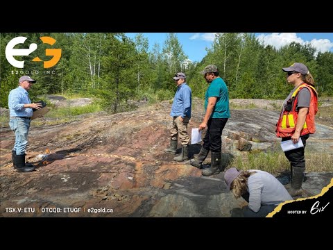
24:30 Great. Well, that's all the questions we have for today. Thank you so much Ellie and Eric for taking us through the presentation and the live Q&A. Thank you everyone for joining as well. If you do have any follow-up questions after this summit, feel free to reach out to the E2Gold team directly. You can also find more information on their website, e2gold.ca. And of course, this has been recorded and will be available to re-watch on 6.com. A copy of the presentation is also available for download in the handouts tab if you wanted to download that quickly now. But I'll pass it back to either Ellie or Eric for the final word in closing. Yeah, so good. Thank you, everybody, for showing up and listening to us. We appreciate your time and attention. We have a fairly robust planned exploration program planned for the summer, geologically and prospecting, and as well as geochem and trenching.
25:26 So these will all hopefully, and I'm sure they will lead us to some targets developing for the next drilling program further into the fall. And we hope you'll continue to pay attention to us because we have a robust, well, not only a robust program, but a very dedicated crew of people out there that are anxious to get out there and get working on in the field.