
Sulphide Mineralization, including Chalcopyrite, Discovered at Surface; Land Position Expanded
VANCOUVER, BC / ACCESS Newswire / July 8, 2026 / Storm Exploration Inc. (TSXV:STRM) ("Storm" or the "Company") today provides an update on exploration work currently underway at the Volcanogenic Massive Sulphide ("VMS") target on its 100%-owned Gold Standard Project located 60km north of Fort Frances in northwestern Ontario, Canada.
Highlights
The Very Low Frequency Electromagnetic (VLF-EM) data confirms that a strong conductor is present 100 m below surface that is coincident with the 5-kilometre-long VTEM anomaly.
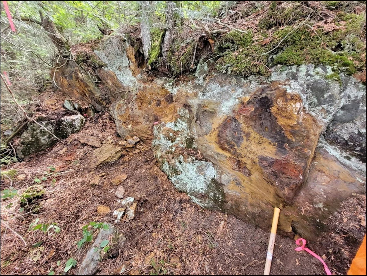
Sulphide mineralisation, including chalcopyrite, has been discovered in three separate locations at surface, coincident with the conductivity anomaly (see Figure 1).
The survey data indicates that the conductors strengthen and widen with depth.
Crews have arrived at Gold Standard to complete the VLF-EM survey over the VMS target and commence a systematic surface rock sampling program along the conductor.
An additional 1,672 ha of prospective geology has been staked at Gold Standard (Figure 2).
"The work underway at Gold Standard continues to indicate the potential for a large VMS system on the project," says Bruce Counts, President and CEO of Storm. "We are increasingly excited about the upcoming drill program and the opportunity for a significant discovery."
Mr. Counts continued, "Storm has developed an efficient method of evaluating the VMS target and identifying the most prospective drill locations. VLF-EM has proven to be a rapid, cost-effective method for mapping the conductor, while geochemical results from systematic sampling of sulphide-bearing surface rocks will help identify the most prospective areas along the target's 5-kilometre strike length."
VLF-EM Survey
The Phase 1 VLF-EM survey confirmed that it is an effective tool for mapping the 5-kilometre-long conductivity anomaly identified in airborne Versatile Time-Domain Electromagnetic ("VTEM") data. A total of 10 line-kilometres of data were collected at 4 separate locations along the anomaly. Lines were spaced 100m apart and readings taken every 20m.
Interpretation of the VLF-EM data defines multiple, variably dipping, conductive corridors that are coincident with the 5-kilometre-long VTEM anomaly. The survey data indicates that the conductors strengthen and widen at depth and coincide with geological contacts between mafic and felsic volcanic units. In addition, faults interpreted from the VLF-EM and VTEM data may indicate pathways for mineralised fluids as part of a VMS mineralising event.