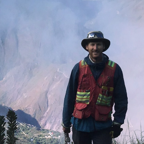
Douglas Murray
Project Geologist at Rackla Metals
Replay available
Watch Rackla Metals' presentation from the Deutsche Goldmesse Spring 2024 on May 3-4.

On 6ix: 6ix.com/event/rackla-metals-deutsche-goldmesse-spring-2024-presentation
Automated transcript · Written by software from the replay's audio. It can mishear names and figures; the replay is the record.
0:11 Good afternoon, everyone. Thanks for taking the time to learn about Rackla Metals and our projects that we have in the Yukon and Northwest Territories of Northern Canada. For those that are familiar with Rackla and Gold Group, you'll know that I'm not Simon Ridgeway. My name is Douglas Murray. I'm a project geologist for Rackla, and I've been with the group for 7 years now. In this image here, I'm standing on this pale grey rock. This is a tombstone gold belt granite, a tombstone belt granite. And these are the common host rocks of the type of deposits that we're looking for. The image on the left shows our nice camp. It's just on the Northwest Territory side of the border.
0:57 And it's right against this wide gravel airstrip connecting to that, this gravel road to the left, that goes into the Yukon to Ross River where it connects with some major highways. And we'll see some maps coming up that'll show why this type of infrastructure and access is hugely beneficial to us. I'll be making forward-looking statements throughout this talk. If you want to see this in more detail, it's on our website. So shown in yellow on this map, spanning across the Yukon Territory, is the Tombstone Gold Belt. It's a prolific belt of rocks. It's generated a lot of deposits and particularly a type of deposit, a type of gold occurrence known as a reduced intrusion-related gold system, or RIRGS, as it's commonly referred to in text.
1:53 There's an Alaskan part of the belt as well. Fort Knox is a gold mine there at over 12 million ounces. The Eagle gold mine, owned by Victoria Gold, that was recently commissioned, relatively recently, at over 8 million ounces are examples of some active mines for this type of gold occurrence. And There's a lot of recent discoveries as well, Banyan Golds, Ormac, Sitka RC, and most of the exploration and discoveries have taken place in the western part, clustered together around the town of Mayo. It was long thought that this belt produces deposits all the way throughout, but it's only gold-rich around Mayo, and it becomes gold-poor and tungsten-rich as you move east from there.
2:42 And there are several tungsten deposits in the eastern part. But probably the most notable discovery that you'll likely be familiar with is Snowline Gold's Valley discovery. It's in the middle of that belt in blue claims in the rogue plutonic complex or the rogue property And what Valley's been able to do is show that these deposits, these gold occurrences do exist in the eastern part of the belt. And there's no resource on Valley, but it's looking like it's going to be a giant, and the grades they're getting in drilling is higher than anything that the Western discoveries have been finding. So following Snowline's success at Valley, Simon and Rackla, the team, we became early movers, started looking at ground in the eastern part of the belt and acquired, staked and acquired the highest potential as we deemed it that was available.
3:48 And we now have 5 active projects from north to south on this map, Astro, Rack, Main, Joss, and then down around the past-producing tungsten mine, Cantung, Black, and flat. Last summer was our first exploration on the whole portfolio, and we focused mostly on ASTRO and what we call the ASTRO-Plutonic Complex. You can see it's very well situated. It's right beside Rogue that holds Valley, and that black line running along the edge of it is the North Cannell Road that we saw in that first image. So we have a road running to the edge of our claims, our camp, just south of the areas that we worked mostly.
4:38 Last summer, we started with geophysics. We ran an airborne magnetic survey, and that generated a reduced intrusion-related signature that we were hoping to see. This is basically, it's an airborne magnetic survey that shows magnetic lows that define the extent of these reduced intrusions and they're surrounded by a sharply contrasting magnetic high donut immediately surrounding, and these reflect the altered and contact metamorphose sediments that these bodies intrude. That's just depicted in gray on this map and the intrusions are in red. And then we followed up the geophysics with lots of surface sampling, stream sediment sampling and soil and talus sampling and then rock sampling, prospecting and mapping.
5:32 We try to walk all the creeks that no company's ever walked, and we're looking for sheeted veins in these intrusions. We followed up all that work with a drill program. We had our first drill program last year. We drilled 2 targets on the border Pluton and then moved up to the Cannell Trail stock where we tested a few targets there and drilled just under a thousand meters on the Cannell Trail stock. That included our hit discovery from last year. At hit, we drilled 2 holes from 1 pad drilled in opposite directions with the goal of testing a wide zone of dense sheeted veining. It was the most impressive veining we saw on the property. It might be a little small, but the small image on the left shows what it looks like in surface. We chip channeled along that, but that shows maybe 6 meters of a 250 meter plus exposure on this broad slope.
6:31 And so the holes were designed to test that. And hit 3 that was drilled to the northeast, we cut 130 meters from surface of 0.25 grams per ton gold and turned around and cut 46 meters of 0.5 grams per tonne gold, which we believe to be the start of the system. Both holes were in sheeted veins the whole way, so that vein system is open in all directions, and it's associated with a large gold bismuth arsenic, which are the typical elements we wanna see for these systems. And that wraps around the north and west part of the stock, showing there is growth potential. On hit 4, On the bottom right cross section, hit 4, you can see where our intercept was. We started cutting a secondary set of veins there that brought in slightly higher grades. We got a few hits over a gram or 2 grams, up to 8 grams in that.
7:33 And on the left, the larger section, this was put together by 3L Capital in coverage of Rackla. And it basically just shows the scale comparison. So the same scale, our 2 drill holes that hit overlain on an early section from Valley in their 2022 drilling where before they stepped to the southwest and started cutting the heart of their system, they were drilling similar grades and widths to what we got last year at HIT. So it just only shows the scale comparison, but tells us we need more drilling. And upper right is the plan view for scale of valley and then their high-grade zone compared to the Kennel Trail stock.
8:20 So we're looking forward to getting back there this summer. There's still some snow on the ground, but we should be drilling by mid-June. And our goal for this program is to prove the width and grade of this system that we discovered last year. We're going to step to the northwest, which is towards the contact of this intrusive body, and to the southwest into that soil anomaly. And we're also hoping to vector into higher grades that we started to cut at the bottom of HIT-4. And then another reason we really like the potential at HIT is the geochem in the sediments to the northwest of the intrusive. You can see in spheres or circles on this 3D image are talus vines, an entire talus line of strongly anomalous gold, and then all the streams draining from it are anomalous in gold as well. So we think it just shows the potential of this system to exist potentially in the sediments or just underlying the sediments to the northwest.
9:25 And then another part of the ASTRO property that we did work on last year and defined a compelling drill target is on the Kelvin stock. Just 11 kilometers south, it's got a lot of similarities to Kennel Trail stock, geophysical signature and the same geochemical assemblage, sheeted veins within the intrusion. The 2 targets that our work generated there last year were peak and circ. At peak, we define sediment-hosted sheeted veins for over a kilometer, and the grades we're getting there were tremendous. You can see them listed on this map. But 20% of all our samples in the whole area were greater than a gram per ton. No one's ever drilled this.
10:10 It's had no detailed trenching or anything. So we're excited to be the first company to do that this year. We're planning our maiden program this year. And then at CERC, we found sheeted quartz tourmaline veins within the intrusion, and they're associated with strong gold and arsenic in soils. We did very few rock sampling up there. We kind of got to it later in the summer. So while we're drilling at peak, we're going to be trying to define some compelling drill targets at circ. And then the same thing at our black property, which is just in the far southern part of the belt, just north of that Canton past-producing mine. We staked it last year based on regional geochem, but we didn't do any work on it.
10:58 And over the winter, though, through lots of data compilation and putting old assessment reports together, we've found some compelling targets, some really good gold numbers in quartz veins, hosted in sediments and associated with a strong lead and arsenic soil anomaly. So this year we'll put a camp in there and conduct an extensive mapping and sampling program and hopefully define some good drill targets there as well. Some financial figures of RACLA. We just announced financing on April 30th, so there's more details in our April 30th press release. Obviously, those figures will change with the financing. What you can expect from RackLA this upcoming field season in terms of updates and news.
11:48 Our follow-up drill program at HIT where we're looking to define the size and grade of that system that we discovered last year. Our maiden drill program at PEAK testing those high-grade veins. And then at CERC and BLACK defining drill targets through surface work. And as always, we're looking regionally, trying to make boots on the ground, prospecting discoveries, and acquire new ground as well that we think has high potential, especially in the eastern part of the Tombstone Gold Belt. Thank you. We've got a couple of minutes for questions, so let me kick off. What do you estimate the potential target size being at both hit and peak? I mean, they're both wide open. We have, I'll start with hit, I guess.
12:39 The width that we've mapped that vane system in is huge. We're just hoping at depth and stepping to the southwest, that has never been drilled, we'll start getting more of the higher grades. So that one is truly wide open, and then it could be cut off to the northwest, but we see it dipping shallowly under the sediments, and the geochem shows it could extend into the sediments as well. It's too early for that and probably too early for Peak to give a size estimate on it in terms of dimensions, but Peak, we've defined those veins for a kilometer in strike extent, but they're still open, and the depth, we're unsure. We think that as you go down vertically, we'll probably hit an intrusion underneath, an extension of the Kelvin stock that's been mapped in. I could probably go back to the figure for it.
13:34 So that would be the vertical zonation there where we'll go from sediment-hosted veins shown in that green, that's a soil anomaly down into the intrusion where we'll just be in more sheeted veins. So there's 2 early days for both of them, I think. Okay. Do we have any questions from the audience? You said you start drilling in June Because there is snow at the moment, how long is your time window to drill? How long can you drill? Yeah, good question. So our time window of exploration, we can be in there early June. We can be in there now. We actually just had a geologist in camp kind of keeping it up to standard and ready to go for the summer.
14:20 And we'll be in there, start prospecting in early June, and then I think we'll have a drill turning by mid-June. We still have the drill up there, so there's a ferry on the road that comes in and once that ferry's in we can start accessing it. So the snow is still around. You can start prospecting the south-facing slopes pretty quickly. But yeah, our typical window is mid-June to late September. Or if you stretch it, early June to October. Excellent. I think that's all we have time for. Doug, thank you very much. Thank you.
Follow Rackla Metals Inc. into a list and get an email when it puts out news.
Project Geologist at Rackla Metals