Powered by  Google Übersetzer
Google Übersetzer
Vancouver, British Columbia--(Newsfile Corp. - December 10, 2024) - Auric Minerals Corp. (CSE: AUMC) ("Auric" or the "Company") is pleased to announce the successful completion of its 2024 exploration fieldwork program (the "Program") on the Goodeye Property (the "Property"), located in British Columbia, Canada. The Program included ground prospecting, soil and stream sediment sampling, rock chip sampling, and ground geophysical surveys.
Program Highlights
Fieldwork and QA/QC Procedures
The sampling included 10% field duplicates. All samples are being prepared and will be delivered to ALS Metallurgy Laboratories in Kamloops, British Columbia, for analysis.
"The successful completion of our 2024 fieldwork at Goodeye Property marks an important milestone in advancing exploration at this promising property," said Mr. Dimitri Lakutin, CEO of Auric Minerals Corp. "Despite challenging winter conditions, our team demonstrated exceptional skill and adaptability, delivering high-quality results that will guide the next phases of exploration. We are optimistic about the property's potential and remain committed to creating long-term value for our shareholders."
Furthermore, at the request of CIRO, Auric Minerals Corp wishes to confirm that the Company's management is unaware of any material change in the Company's operations that would account for the recent market activity.
Qualified Person
Afzaal Pirzada, P.Geo., a "Qualified Person" as defined by National Instrument 43-101 - Standards of Disclosure for Mineral Projects, has reviewed and approved the technical content of this news release.
For further information, please contact:
Auric Minerals Corp.
106-482 South Service Road East
Suite 125
Oakville ON L6J 2X6
Tel: (647) 243-7402
Email: auricminerals@gmail.com
On Behalf of the Board of Directors
Dimitri Lakutin
CEO
About the Company
Auric is a mineral exploration company based in Oakville, Ontario and holds options over the Goodeye Property located in British Columbia, Canada.
For more information, investors should review the Company's filings that are available at www.sedar.com.
About the Property
The Property consists of three contiguous Mineral Claims covering approximately 1,906.95 hectares located in the Trail Creek Mining Division of British Columbia. The Property can be accessed by following a logging road from Rossland by travelling south towards the USA border. The claims cover an area of over 19 square kilometres at the headwaters of Goodeve Creek; 10 air kilometres southeast of the town of Rossland, B.C. and 16 road kilometres north of Northport, Washington, USA. Geologically, the Property area comprises stratified volcanic and sedimentary rocks of Late Paleozoic to Eocene age. Locally, the Property claims are underlain by rocks of Carboniferous age Mount Roberts Formation, Elise Formation, and Sheppard Intrusion. The Company carried out an exploration work program in 2021 which generated several exploration targets for a follow up work program.
Forward-Looking Statements
Except for the statements of historical fact, this news release contains "forward-looking information" within the meaning of the applicable Canadian securities legislation that is based on expectations, estimates and projections as at the date of this news release. "Forward-looking information" in this news release includes information about the Company's intentions, plans and future actions described herein and the terms thereon.
The forward-looking information in this news release reflects the current expectations, assumptions and/or beliefs of the Company based on information currently available to the Company. The Company has also assumed that no significant events occur outside of the Company's normal course of business. Although the Company believes that the assumptions inherent in the forward-looking information are reasonable, forward-looking information is not a guarantee of future performance and accordingly undue reliance should not be put on such information due to the inherent uncertainty therein.
Fieldwork Photos
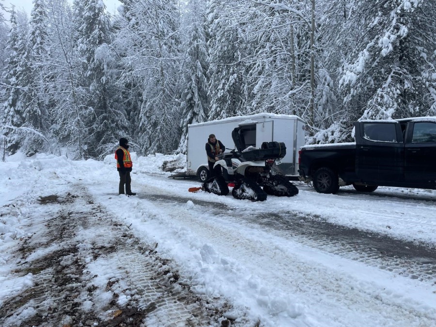
Access road to the Property
 Soil sample with field duplicate sample
 Ground Geophysical Survey in Progress
 Rock Sample