Iron Road Ltd · ASX:IRD
Iron Road — Corporate Update (February 2015)
24 slides from Iron Road's corporate update, Feb 24, 2015

Slide 1: Water
Water CEIP “Talking Topics” Session 1 24 February 2015

Slide 2: Introductions
Introductions Ben Jeuken Tim Scholz Principal Hydrogeologist, Principal Advisor Groundwater Science Stakeholder Engagement IRON ROAD 2 “Talking Topics” Water — Warramboo 24 February 2015
Slide 3: Today's Sessions
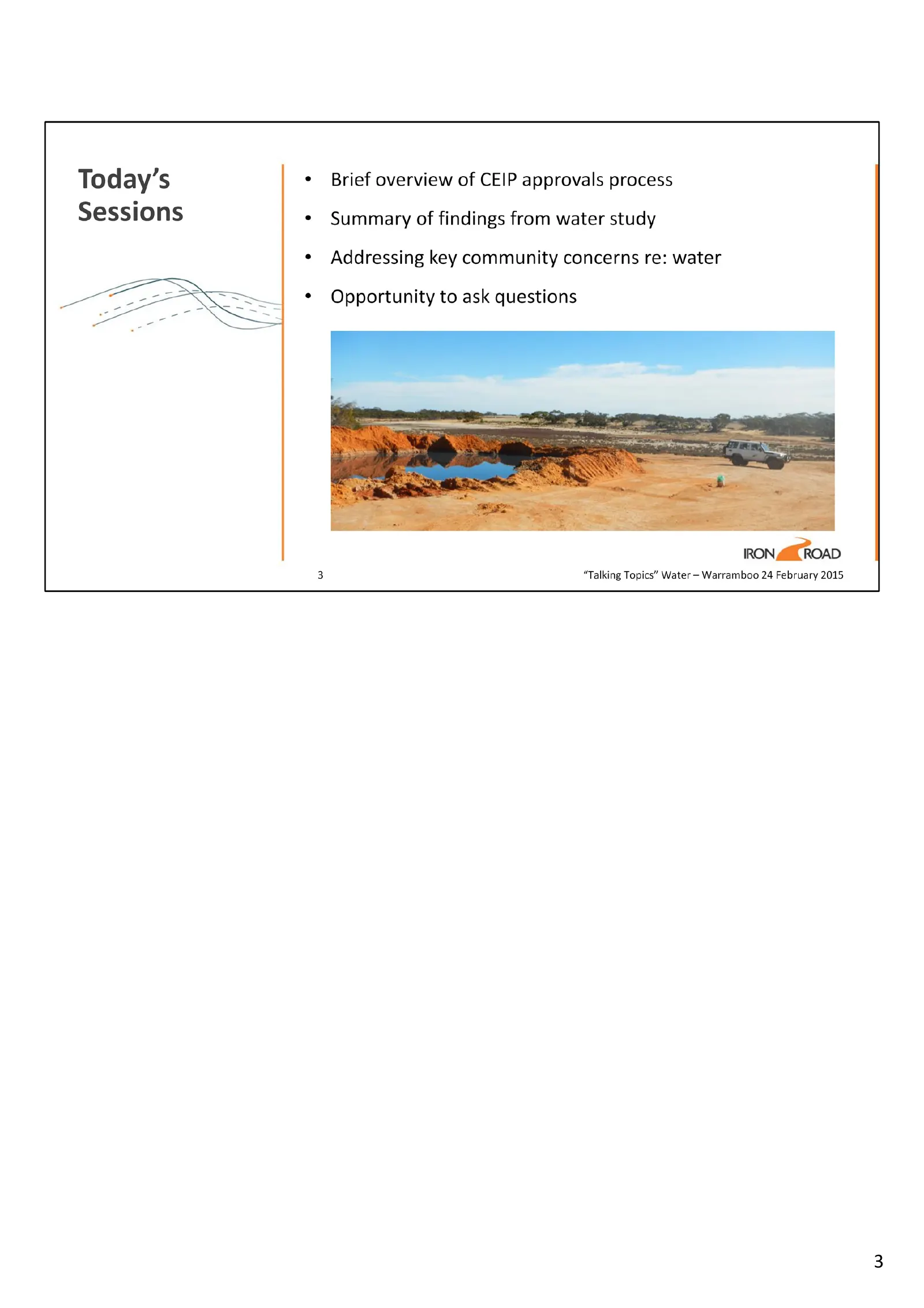
Brief overview of CEIP approvals process Today’s Sessions * Summary of findings from water study Addressing key community concerns re: water Opportunity to ask questions ance IRON ROAD 3 “Talking Topics” Water — Warramboo 24 February 2015
Slide 4: Community engagement on water
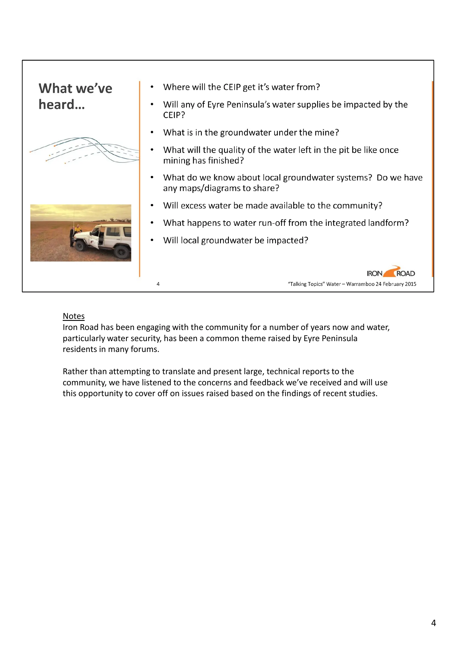
Notes Iron Road has been engaging with the community for a number of years now and water, particularly water security, has been a common theme raised by Eyre Peninsula residents in many forums. Rather than attempting to translate and present large, technical reports to the community, we have listene
Slide 5: CEIP approvals process under two Acts
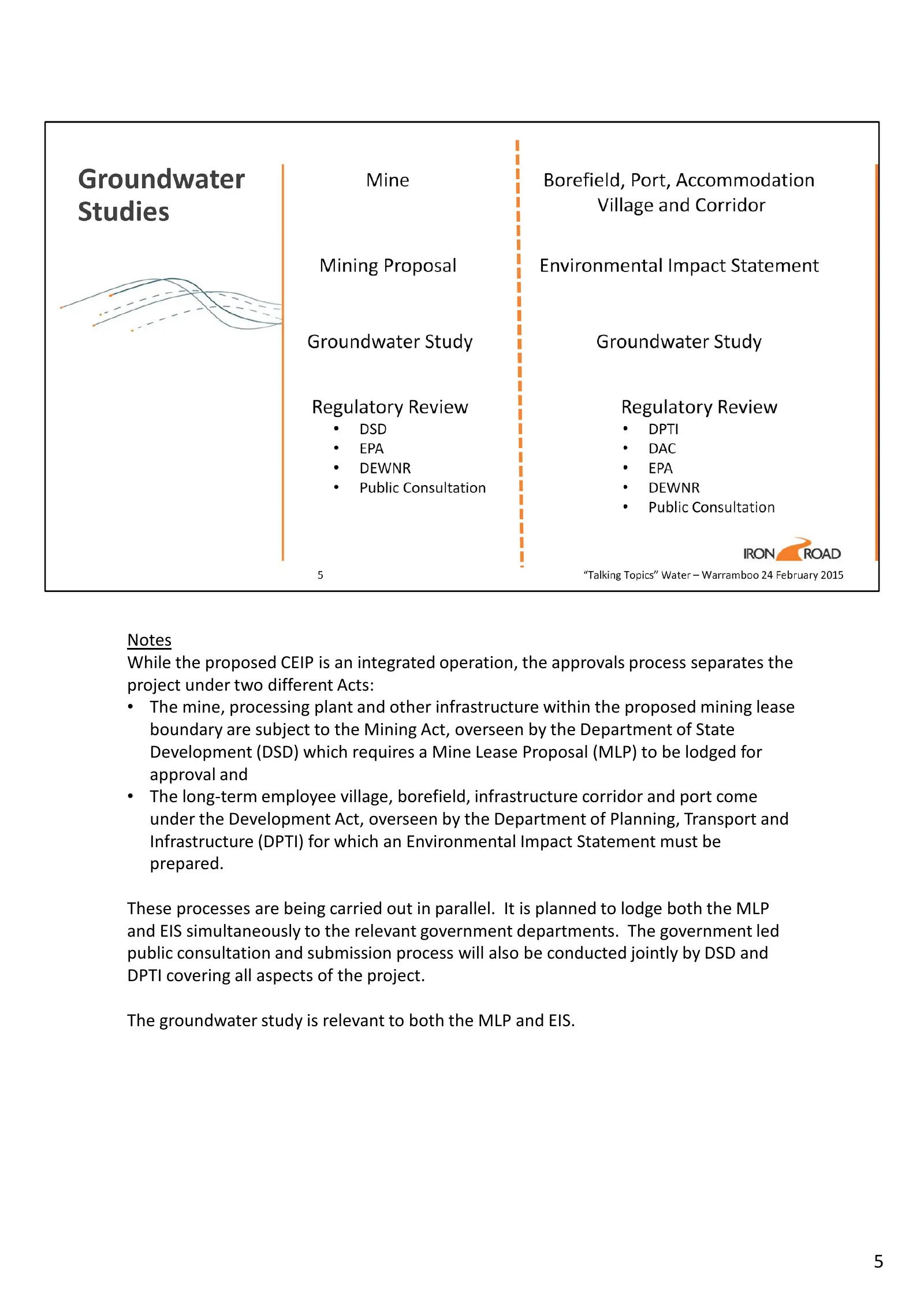
Notes While the proposed CEIP is an integrated operation, the approvals process separates the project under two different Acts: • The mine, processing plant and other infrastructure within the proposed mining lease boundary are subject to the Mining Act, overseen by the Department of State Developme
Slide 6: What is hydrogeology
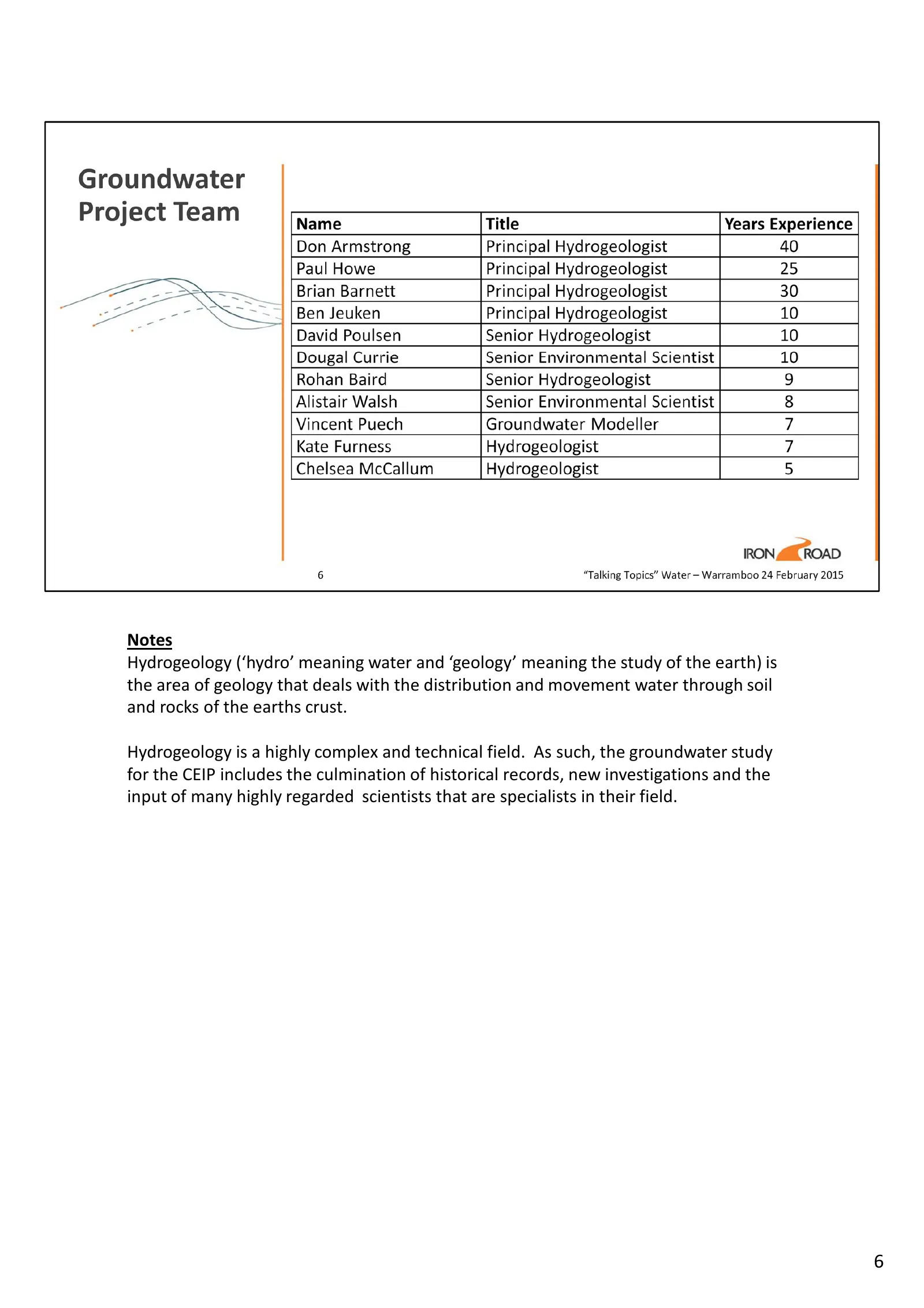
Notes Hydrogeology (‘hydro’ meaning water and ‘geology’ meaning the study of the earth) is the area of geology that deals with the distribution and movement water through soil and rocks of the earths crust. Hydrogeology is a highly complex and technical field. As such, the groundwater study for the
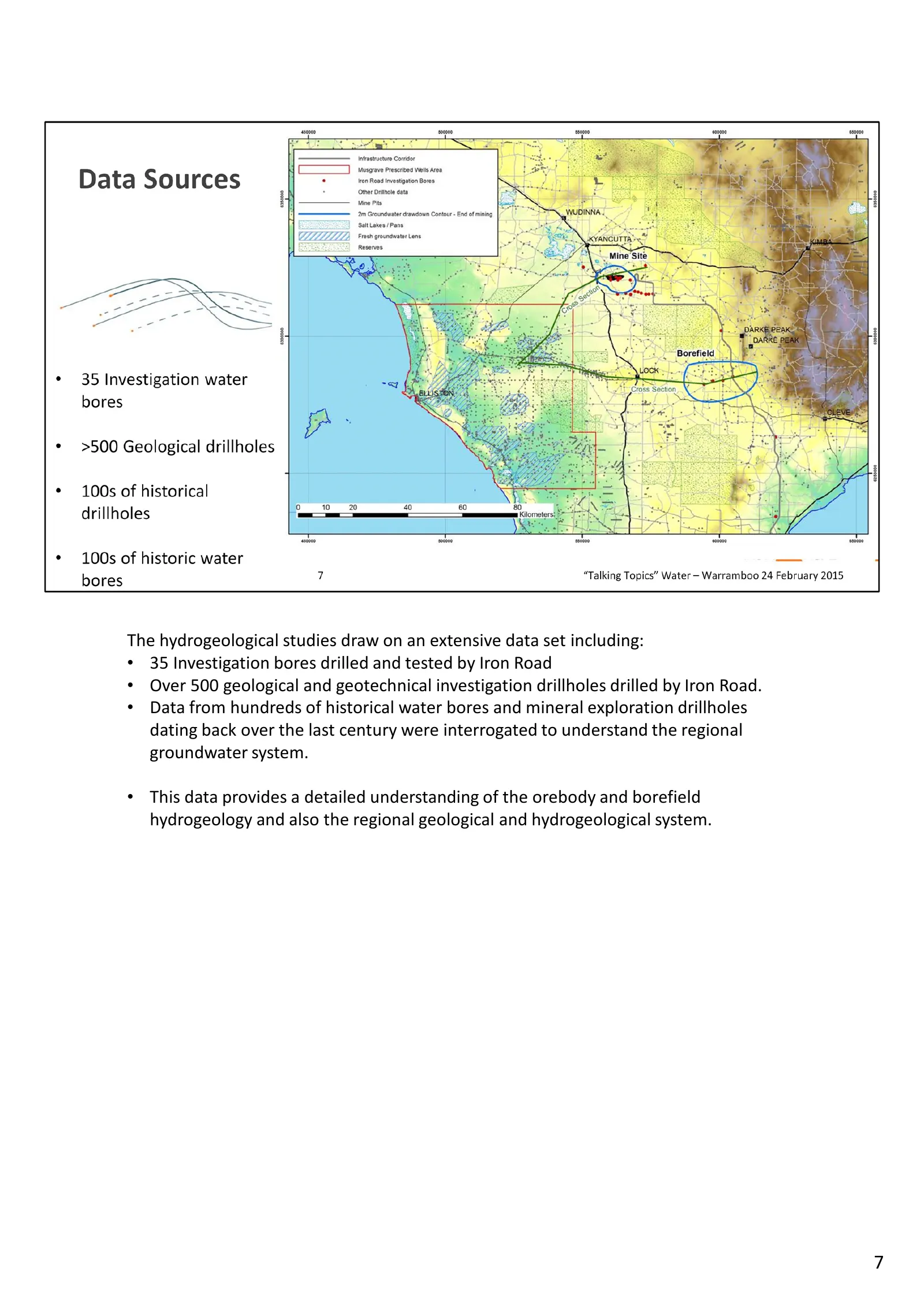
Slide 7: Extensive hydrogeological data set
The hydrogeological studies draw on an extensive data set including: • 35 Investigation bores drilled and tested by Iron Road • Over 500 geological and geotechnical investigation drillholes drilled by Iron Road. • Data from hundreds of historical water bores and mineral exploration drillholes dating
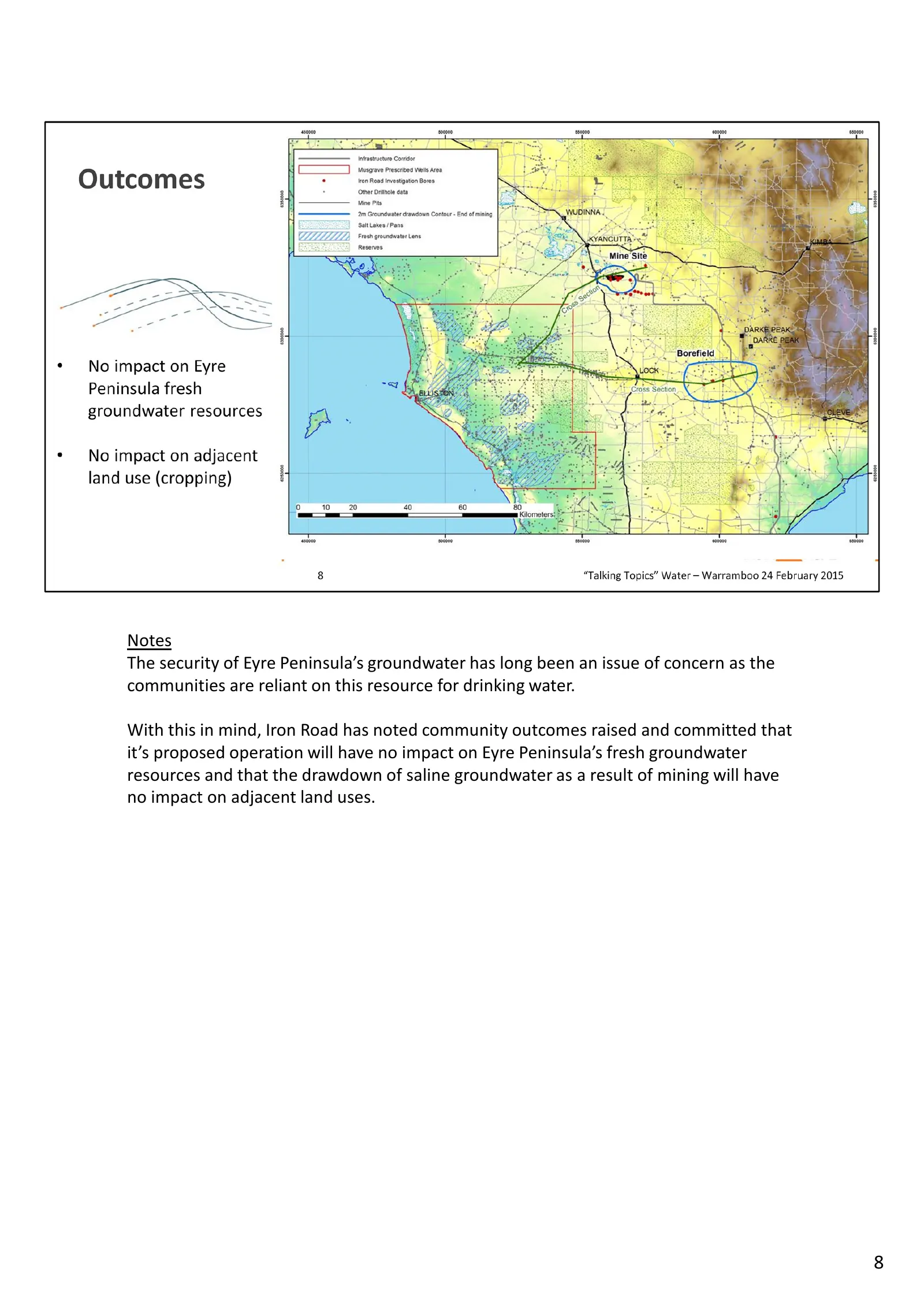
Slide 8: Security of Eyre Peninsula groundwater
Notes The security of Eyre Peninsula’s groundwater has long been an issue of concern as the communities are reliant on this resource for drinking water. With this in mind, Iron Road has noted community outcomes raised and committed that it’s proposed operation will have no impact on Eyre Peninsula’s
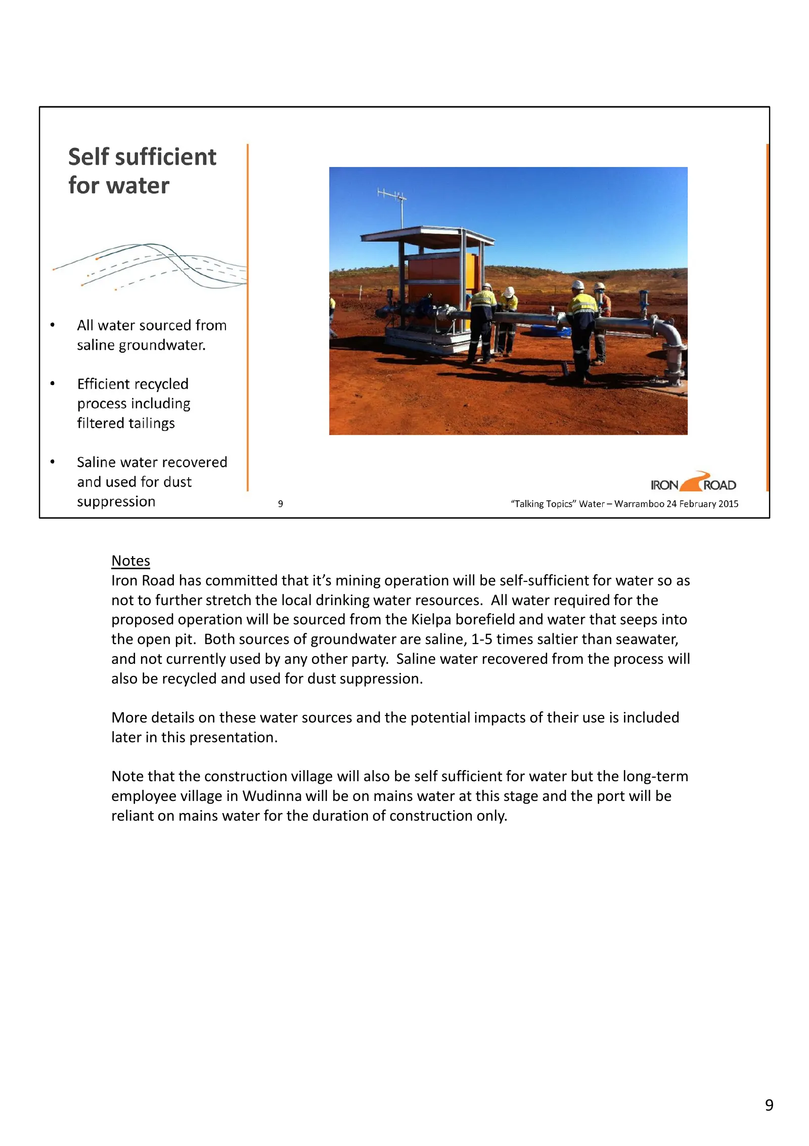
Slide 9: Self-sufficient mine water supply
Notes Iron Road has committed that it’s mining operation will be self-sufficient for water so as not to further stretch the local drinking water resources. All water required for the proposed operation will be sourced from the Kielpa borefield and water that seeps into the open pit. Both sources of
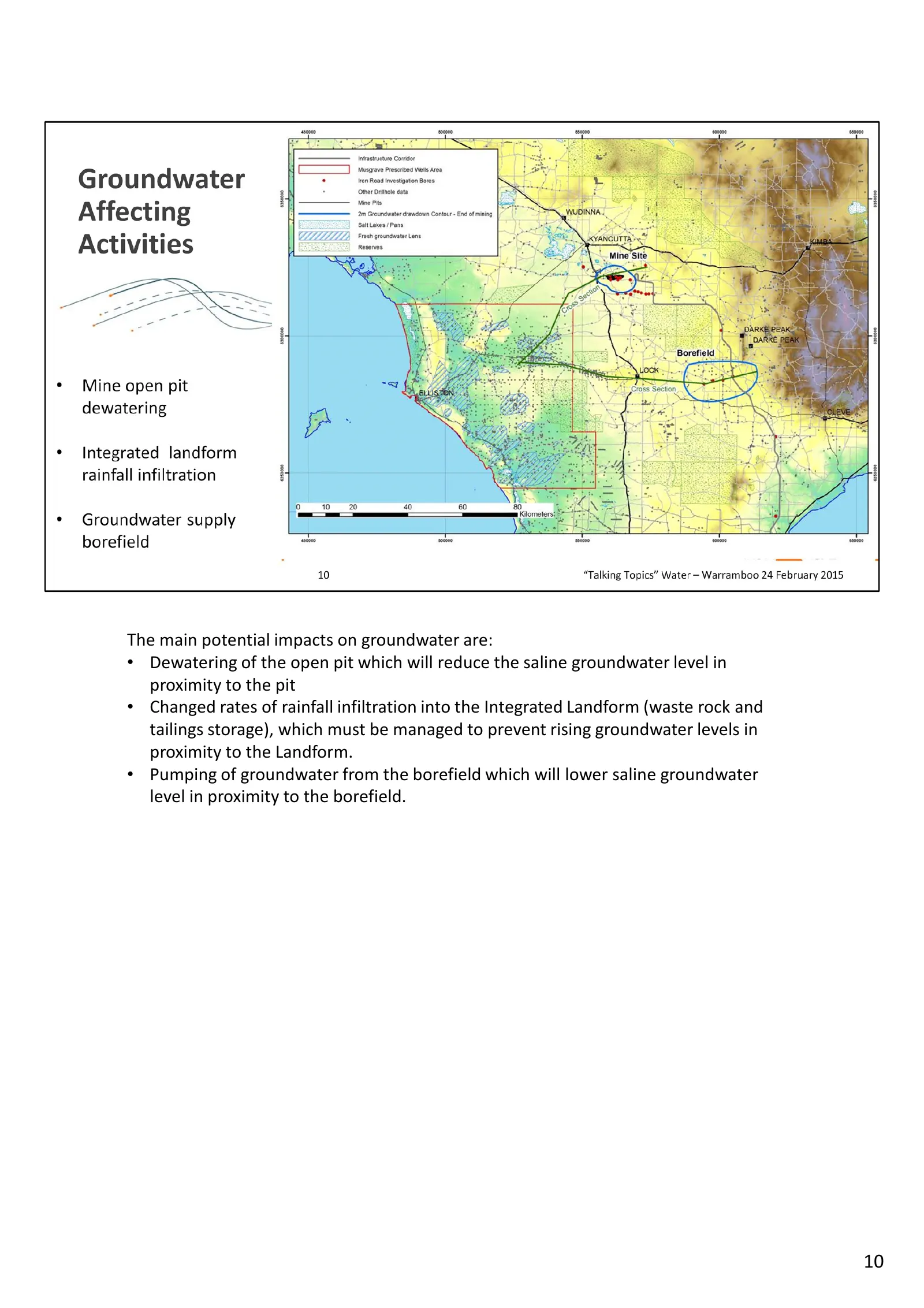
Slide 10: Main potential impacts on groundwater
The main potential impacts on groundwater are: • Dewatering of the open pit which will reduce the saline groundwater level in proximity to the pit • Changed rates of rainfall infiltration into the Integrated Landform (waste rock and tailings storage), which must be managed to prevent rising groundwa
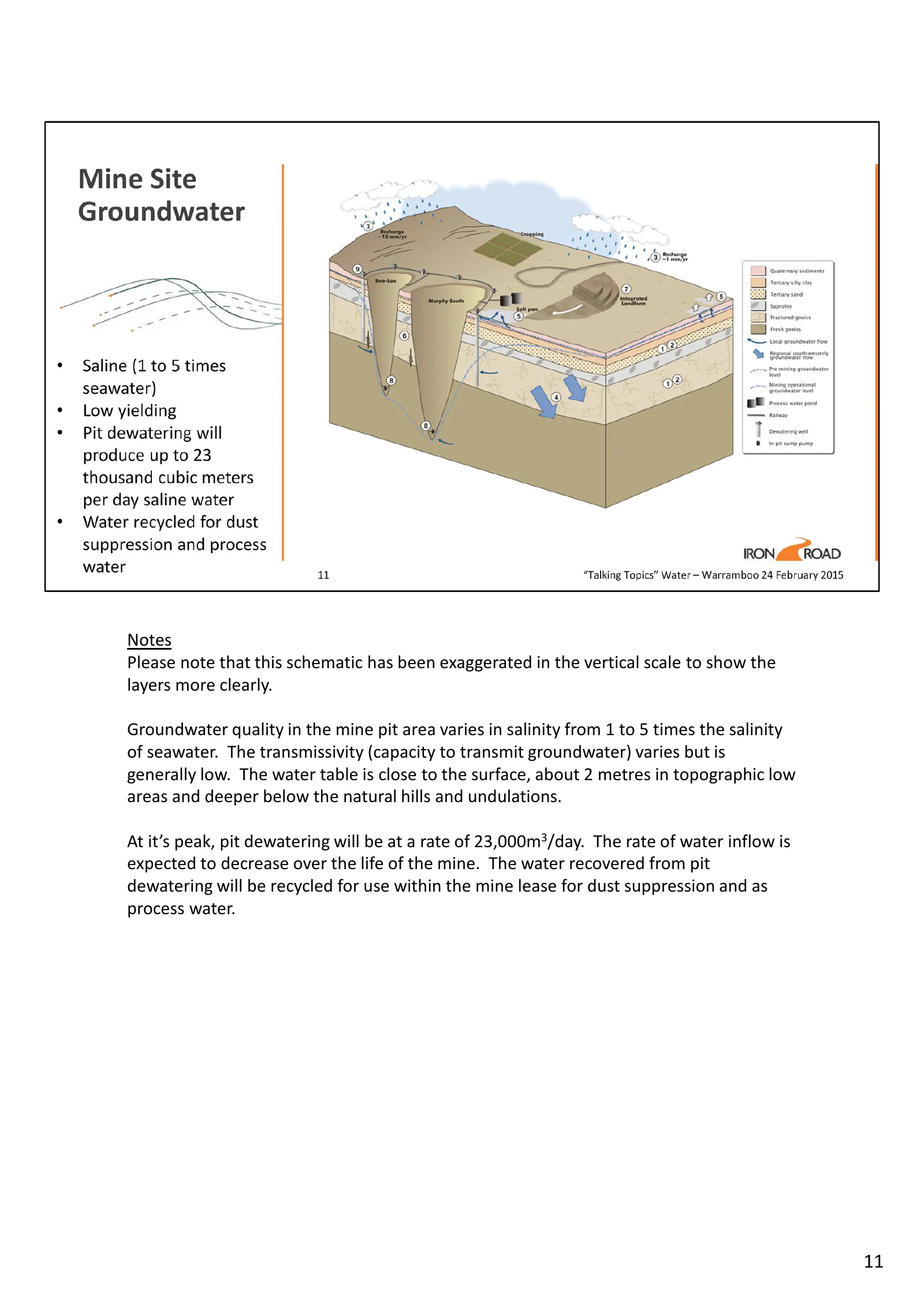
Slide 11: Pit dewatering schematic
Notes Please note that this schematic has been exaggerated in the vertical scale to show the layers more clearly. Groundwater quality in the mine pit area varies in salinity from 1 to 5 times the salinity of seawater. The transmissivity (capacity to transmit groundwater) varies but is generally low.
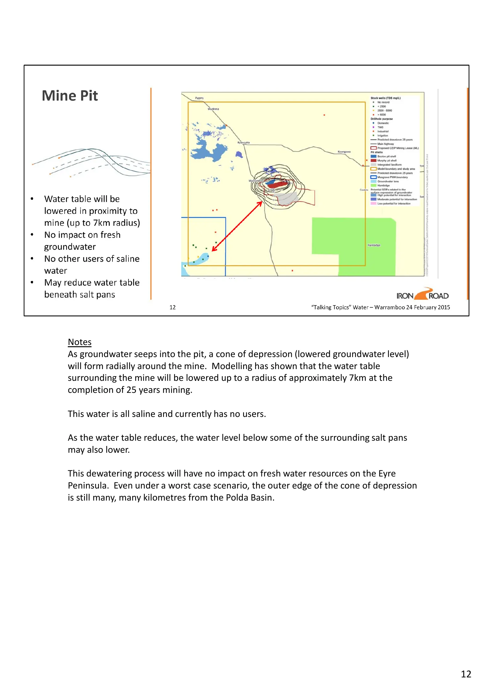
Slide 12: Cone of depression around the mine
Notes As groundwater seeps into the pit, a cone of depression (lowered groundwater level) will form radially around the mine. Modelling has shown that the water table surrounding the mine will be lowered up to a radius of approximately 7km at the completion of 25 years mining. This water is all sali
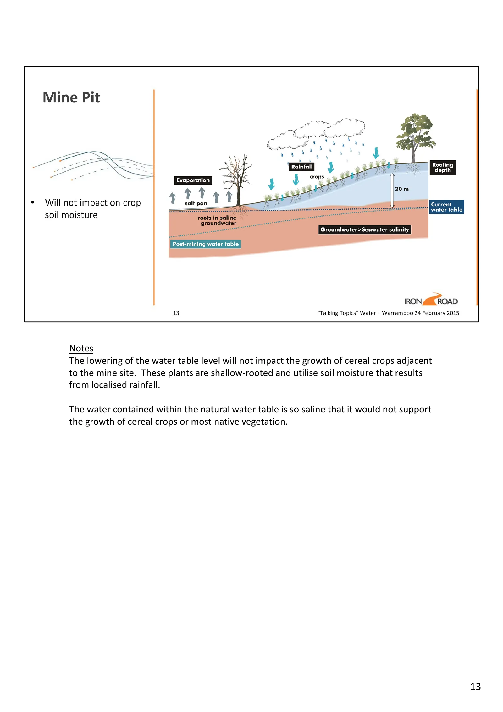
Slide 13: Impact on cereal crops
Notes The lowering of the water table level will not impact the growth of cereal crops adjacent to the mine site. These plants are shallow-rooted and utilise soil moisture that results from localised rainfall. The water contained within the natural water table is so saline that it would not support
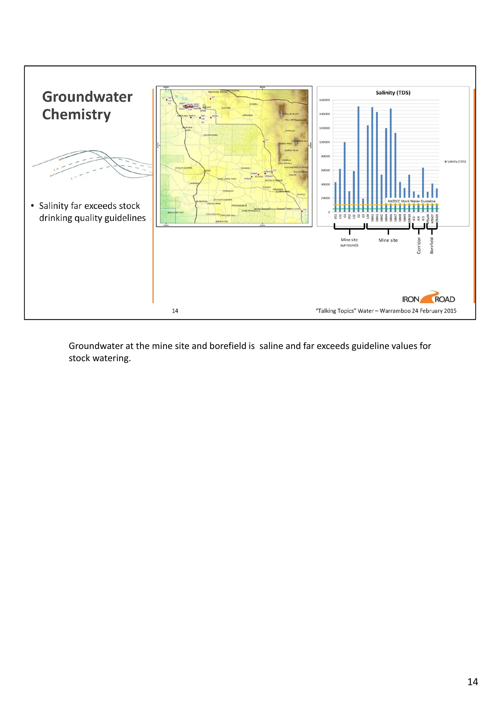
Slide 14: Groundwater salinity versus stock watering guidelines
Groundwater at the mine site and borefield is saline and far exceeds guideline values for stock watering. 14
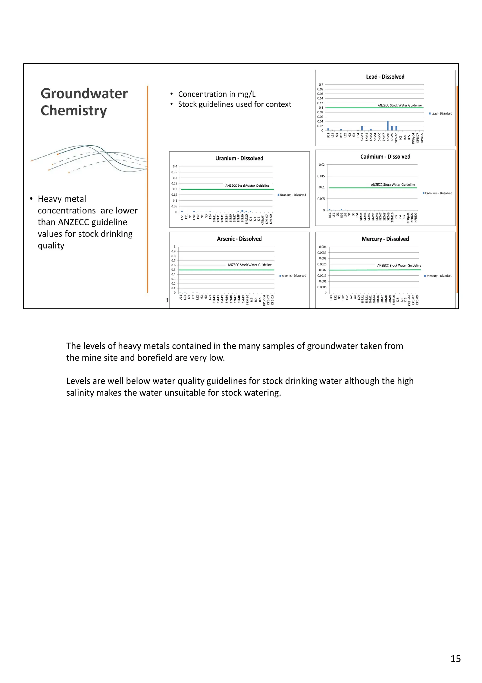
Slide 15: Heavy metals in groundwater samples
The levels of heavy metals contained in the many samples of groundwater taken from the mine site and borefield are very low. Levels are well below water quality guidelines for stock drinking water although the high salinity makes the water unsuitable for stock watering. 15
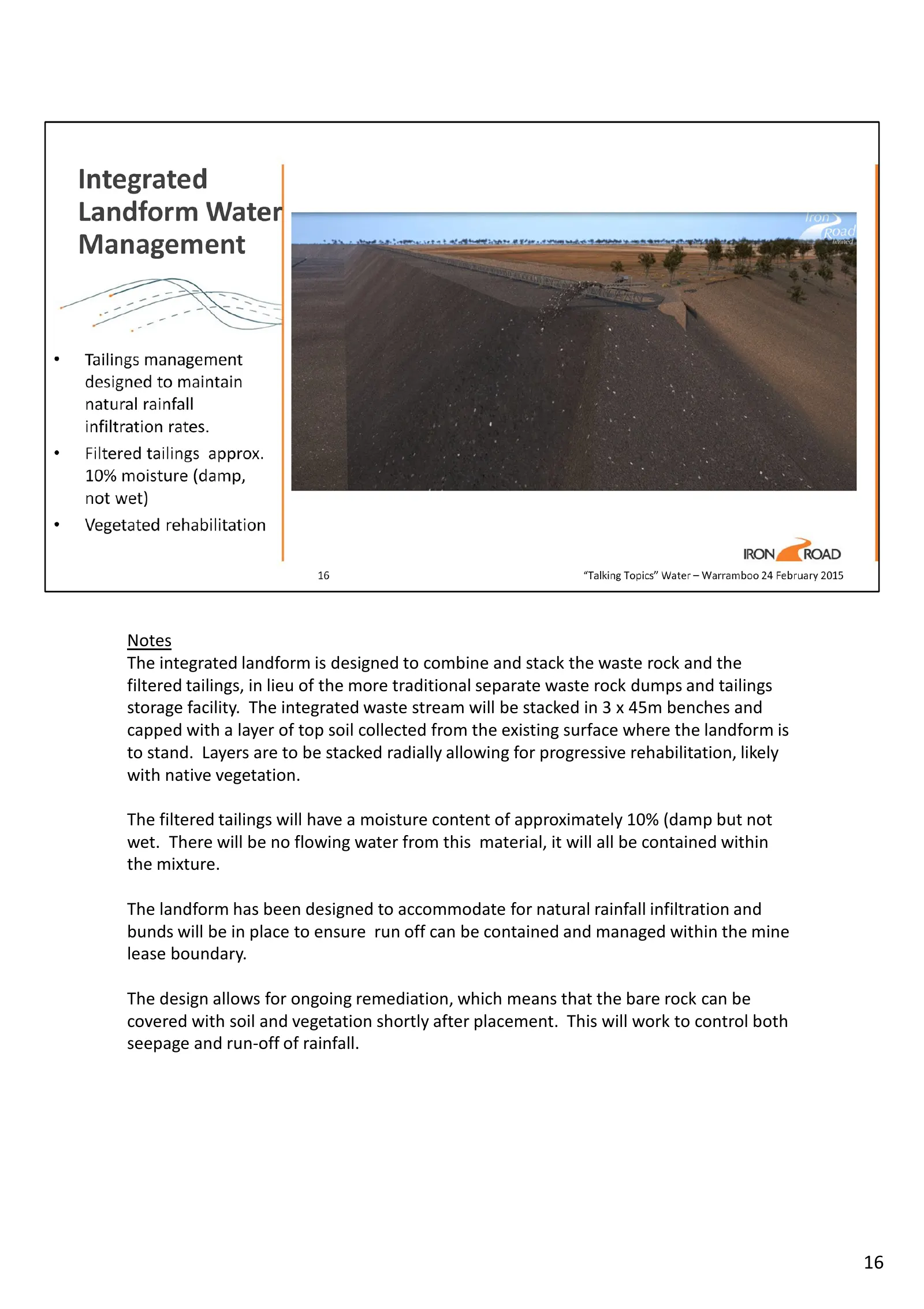
Slide 16: Integrated landform for waste rock and tailings
Notes The integrated landform is designed to combine and stack the waste rock and the filtered tailings, in lieu of the more traditional separate waste rock dumps and tailings storage facility. The integrated waste stream will be stacked in 3 x 45m benches and capped with a layer of top soil collect
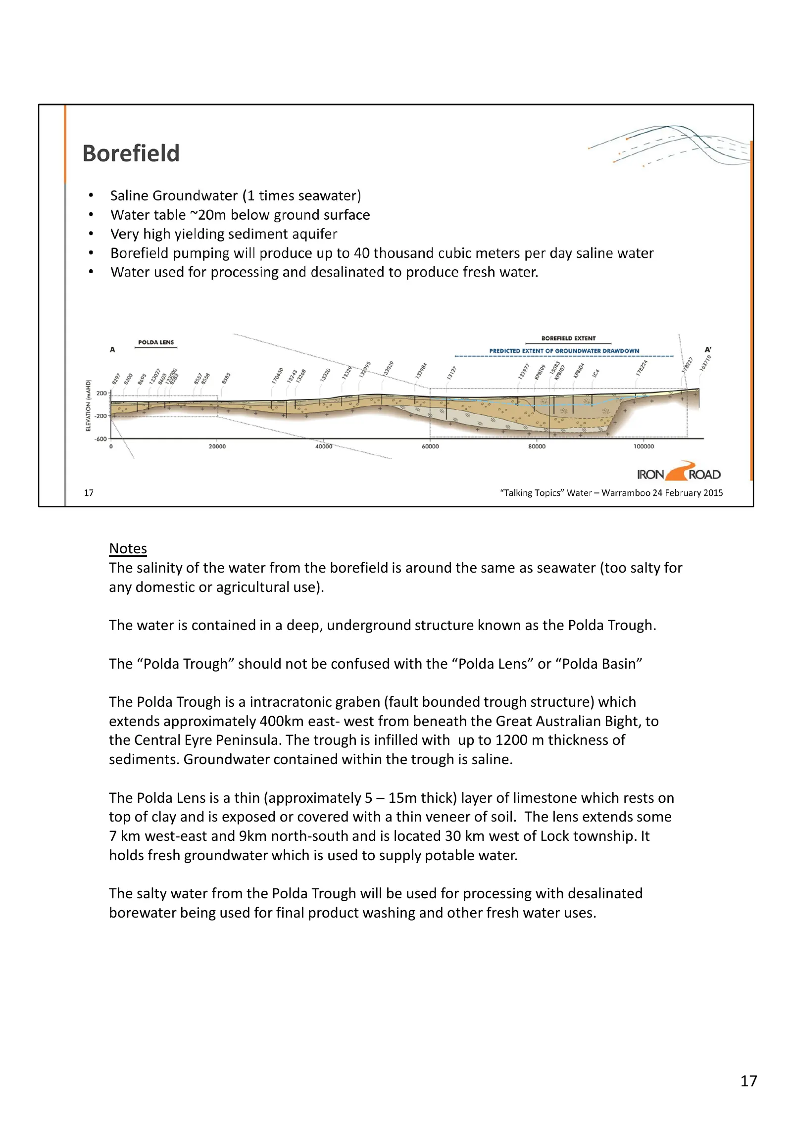
Slide 17: Borefield water and the Polda Trough
Notes The salinity of the water from the borefield is around the same as seawater (too salty for any domestic or agricultural use). The water is contained in a deep, underground structure known as the Polda Trough. The “Polda Trough” should not be confused with the “Polda Lens” or “Polda Basin” The
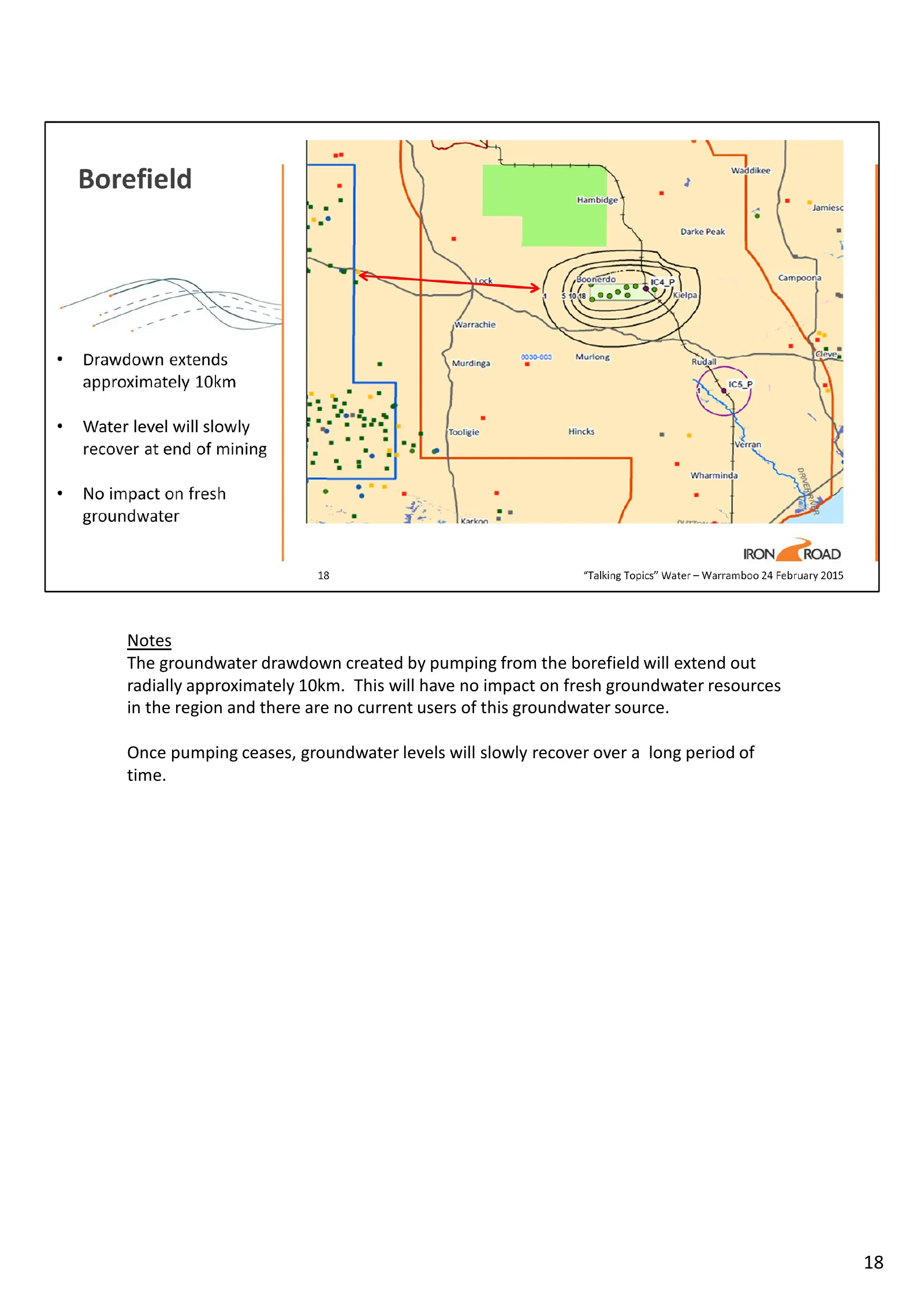
Slide 18: Borefield groundwater drawdown
Notes The groundwater drawdown created by pumping from the borefield will extend out radially approximately 10km. This will have no impact on fresh groundwater resources in the region and there are no current users of this groundwater source. Once pumping ceases, groundwater levels will slowly recov
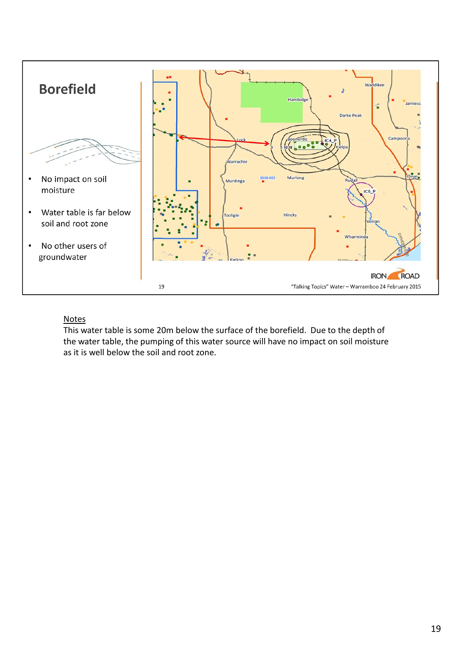
Slide 19: Borefield water table depth
Notes This water table is some 20m below the surface of the borefield. Due to the depth of the water table, the pumping of this water source will have no impact on soil moisture as it is well below the soil and root zone. 19
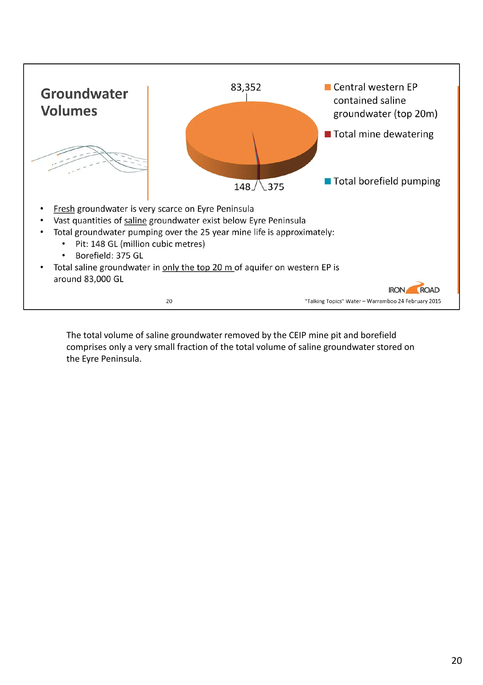
Slide 20: Volume of saline groundwater removed
The total volume of saline groundwater removed by the CEIP mine pit and borefield comprises only a very small fraction of the total volume of saline groundwater stored on the Eyre Peninsula. 20
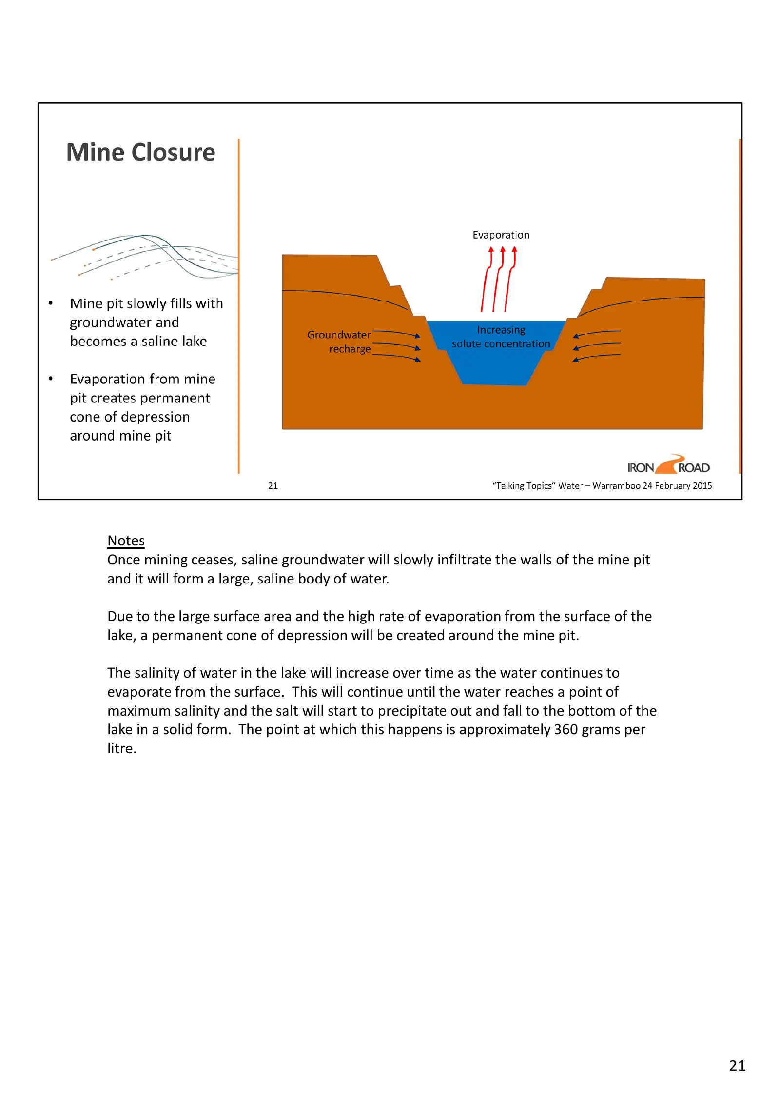
Slide 21: Post-mining pit lake formation
Notes Once mining ceases, saline groundwater will slowly infiltrate the walls of the mine pit and it will form a large, saline body of water. Due to the large surface area and the high rate of evaporation from the surface of the lake, a permanent cone of depression will be created around the mine pi
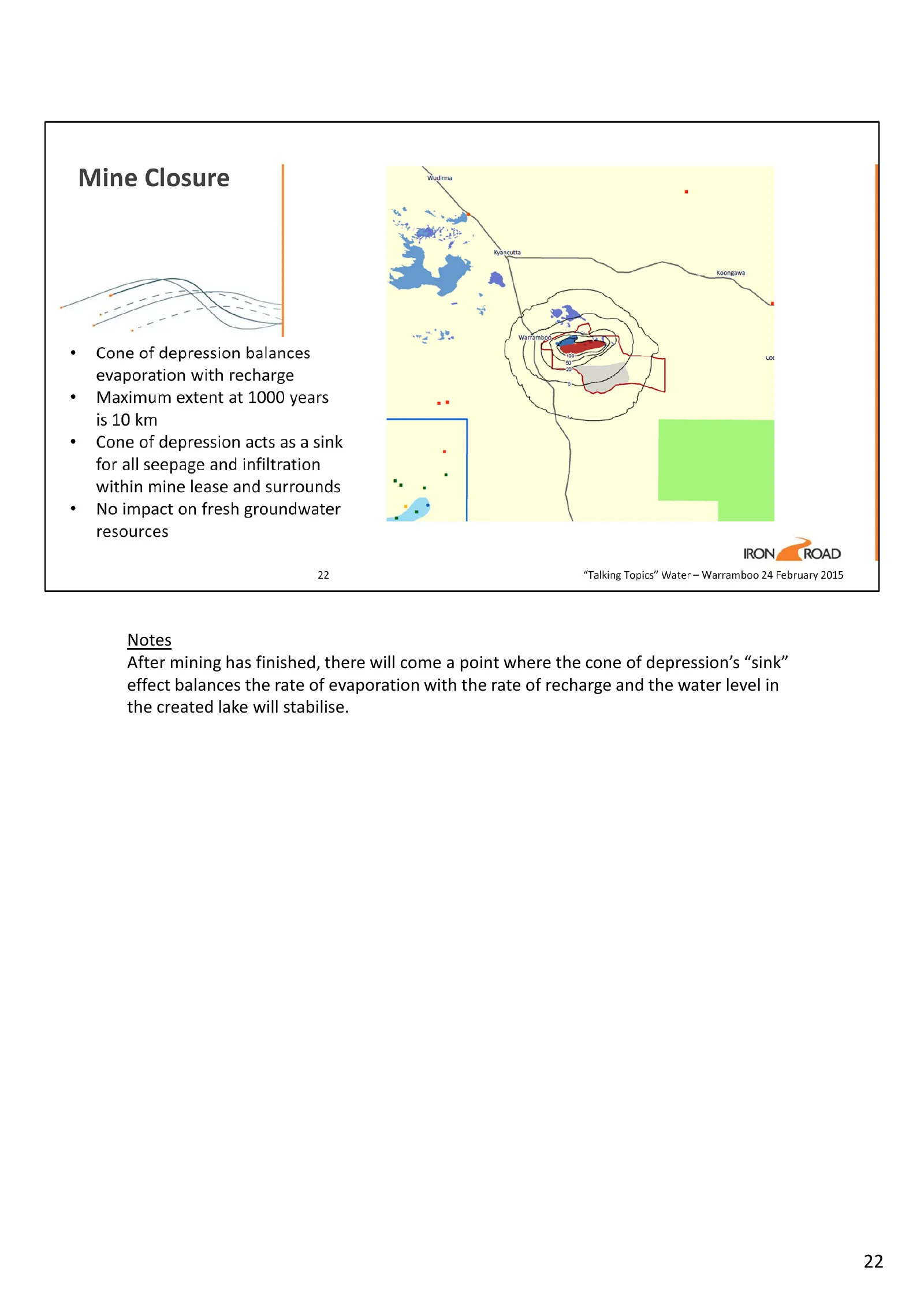
Slide 22: Pit lake stabilisation
Notes After mining has finished, there will come a point where the cone of depression’s “sink” effect balances the rate of evaporation with the rate of recharge and the water level in the created lake will stabilise. 22
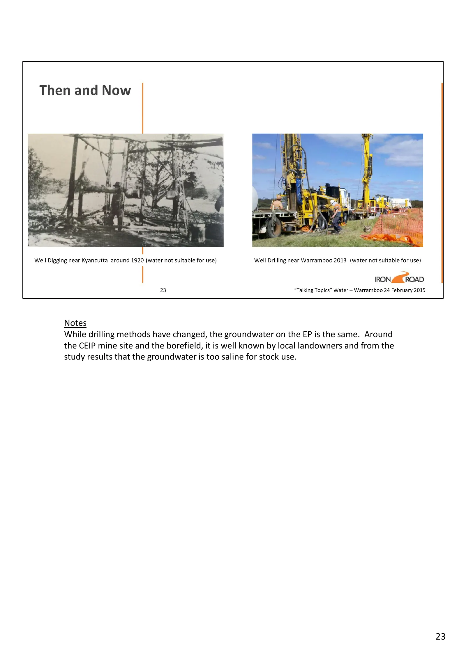
Slide 23: Groundwater too saline for stock use
Notes While drilling methods have changed, the groundwater on the EP is the same. Around the CEIP mine site and the borefield, it is well known by local landowners and from the study results that the groundwater is too saline for stock use. 23

Slide 24: Conversation
Conversation IRON ROAD “Talking Topics” Water — Warramboo 24 February 2015
Source: Internet Archive copy of ironroadlimited.com.au
More decks from Iron Road Ltd
 Shareholder Meeting (October 2026)17 slides · Oct 30, 2026
 Shareholder Meeting (November 2025)21 slides · Nov 26, 2025
 Shareholder Meeting (November 2024)19 slides · Nov 22, 2024
 20th Tactic Conference + Trade Expo (August 2024)14 slides · Aug 1, 2024
 Investor Presentation (September 2023)22 slides · Sep 7, 2023
 Investor Presentation (May 2022)65 slides · May 5, 2022