Spire Global, Inc. · NYSE:SPIR
Spire Global — Esri and Spire Maritime AIS Data Webinar (March 2019)
34 slides from Spire Global's conference presentation, Mar 26, 2019
Slide 1: Esri and Spire Maritime AIS Data Webinar
MARCH 26, 2019 SPIRE ESRI 40GEO ESRI AND SPIRE MARITIME AIS DATA WEBINAR SUPPORTED BY 40GEO
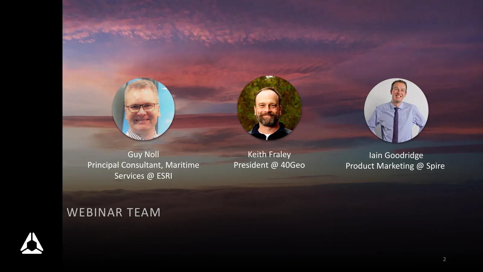
Slide 2: Webinar Team
Guy Noll Keith Fraley Iain Goodridge Principal Consultant, Maritime President @ 40Geo Product Marketing @ Spire Services @ ESRI WEBINAR TEAM 2
Slide 3: Agenda
AGENDA • Spire Maritime Introduction § AIS data level set § Visual demo of AIS data integrated in GeoEvent and ArcGIS Pro • ESRI Introduction § Maritime Analysis § AIS Discussion and Autonomous Shipping • 40GEO Introduction § What 40GEO offer § Leveraging Spire APIs in ArcGIS 3

Slide 4: Spire Maritime
SPIRE MARITIME Is is on a mission to become the global leader in capturing, mining, refining, and analyzing AIS-related data and information.
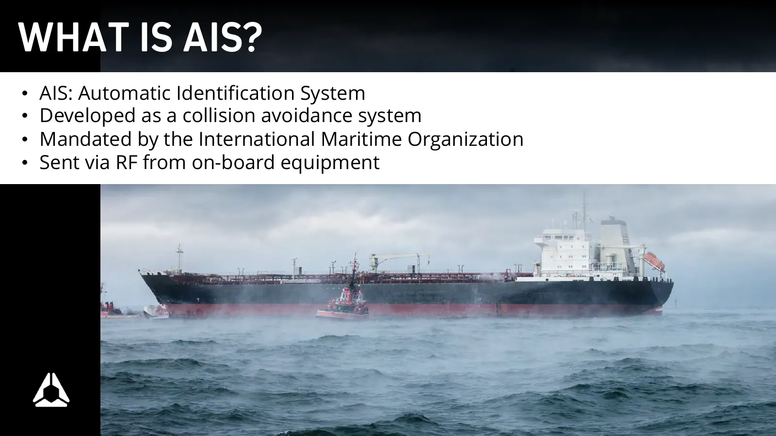
Slide 5: What is AIS?
WHAT IS AIS? • AIS: Automatic Identification System • Developed as a collision avoidance system • Mandated by the International Maritime Organization • Sent via RF from on-board equipment
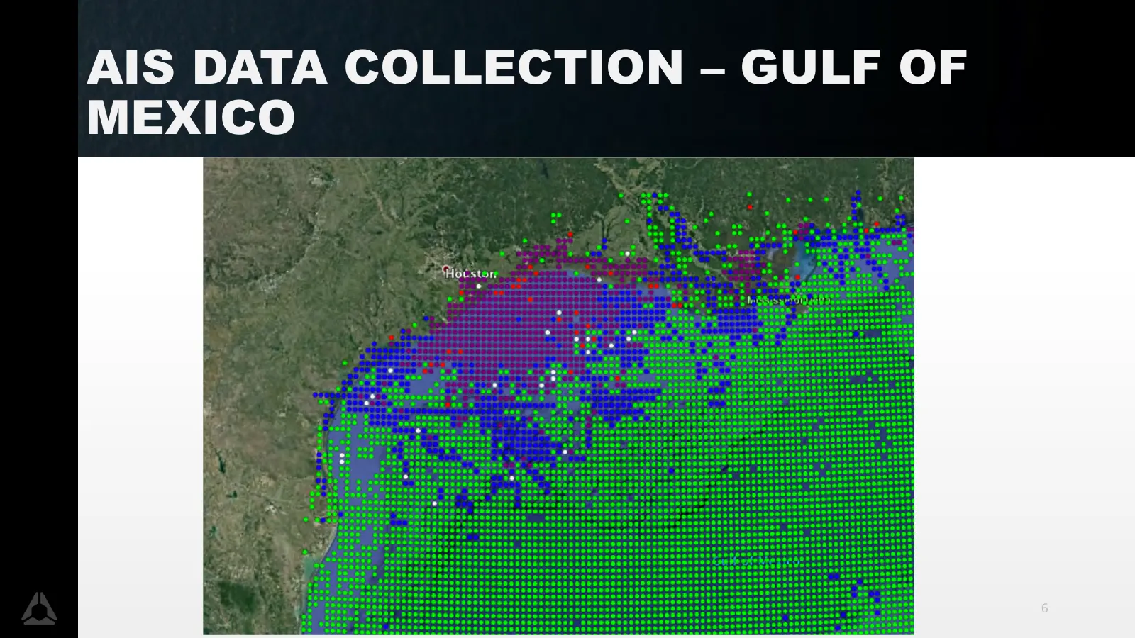
Slide 6: AIS Data Collection – Gulf of Mexico
AIS DATA COLLECTION – GULF OF MEXICO 6

Slide 7: Opening Poll
OPENING POLL 7

Slide 8: Results
RESULTS 8

Slide 9: Esri
A ESRI Guy Noll 0010101 0@ whe .
Slide 10: 40GEO
40GEO Keith Fraley 10

Slide 11: Closing Poll
CLOSING POLL 11

Slide 12: Q&A
Q&A 12
Slide 13: Spire and Esri Maritime: The Future of Marine Information
Spire and Esri Maritime: The Future of Marine Information Guy Noll Principal Consultant, Maritime Services
Slide 14: Find AIS on ArcGIS MarketPlace
Find AIS on ArcGIS MarketPlace https://marketplace.arcgis.com – search for “AIS”
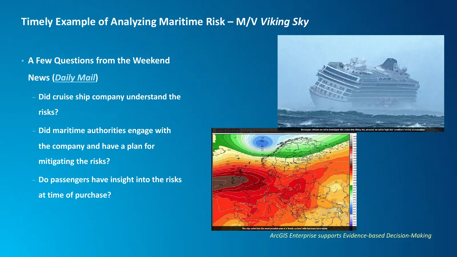
Slide 15: Timely Example of Analyzing Maritime Risk – M/V Viking Sky
Timely Example of Analyzing Maritime Risk – M/V Viking Sky • A Few Questions from the Weekend News (Daily Mail) - Did cruise ship company understand the risks? - Did maritime authorities engage with the company and have a plan for mitigating the risks? - Do passengers have insight into the risks at
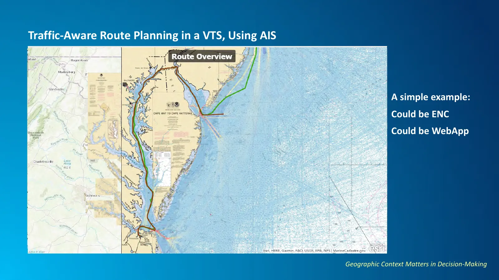
Slide 16: Traffic-Aware Route Planning in a VTS, Using AIS
Traffic-Aware Route Planning in a VTS, Using AIS A simple example: Could be ENC Could be WebApp Geographic Context Matters in Decision-Making
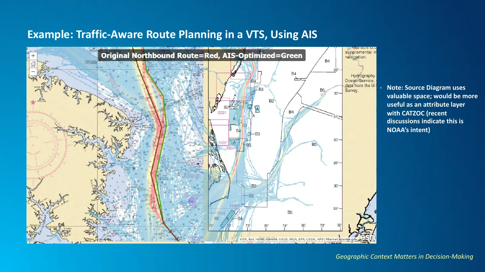
Slide 17: Example: Traffic-Aware Route Planning in a VTS, Using AIS
Example: Traffic-Aware Route Planning in a VTS, Using AIS • Note: Source Diagram uses valuable space; would be more useful as an attribute layer with CATZOC (recent discussions indicate this is NOAA’s intent) Geographic Context Matters in Decision-Making
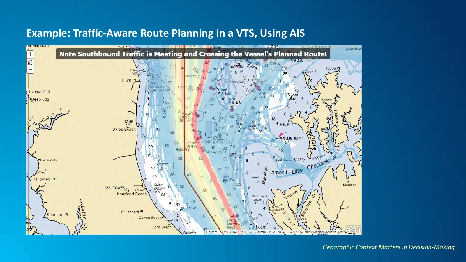
Slide 18: Example: Traffic-Aware Route Planning in a VTS, Using AIS
Example: Traffic-Aware Route Planning in a VTS, Using AIS Geographic Context Matters in Decision-Making
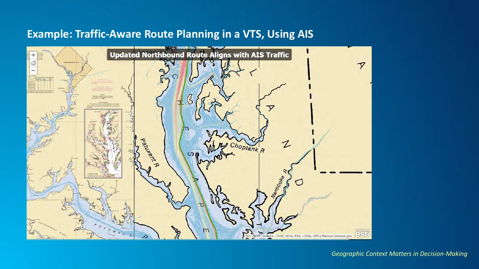
Slide 19: Example: Traffic-Aware Route Planning in a VTS, Using AIS
Example: Traffic-Aware Route Planning in a VTS, Using AIS Geographic Context Matters in Decision-Making
Slide 20: Maritime Analytics = More than a Vessel's Track
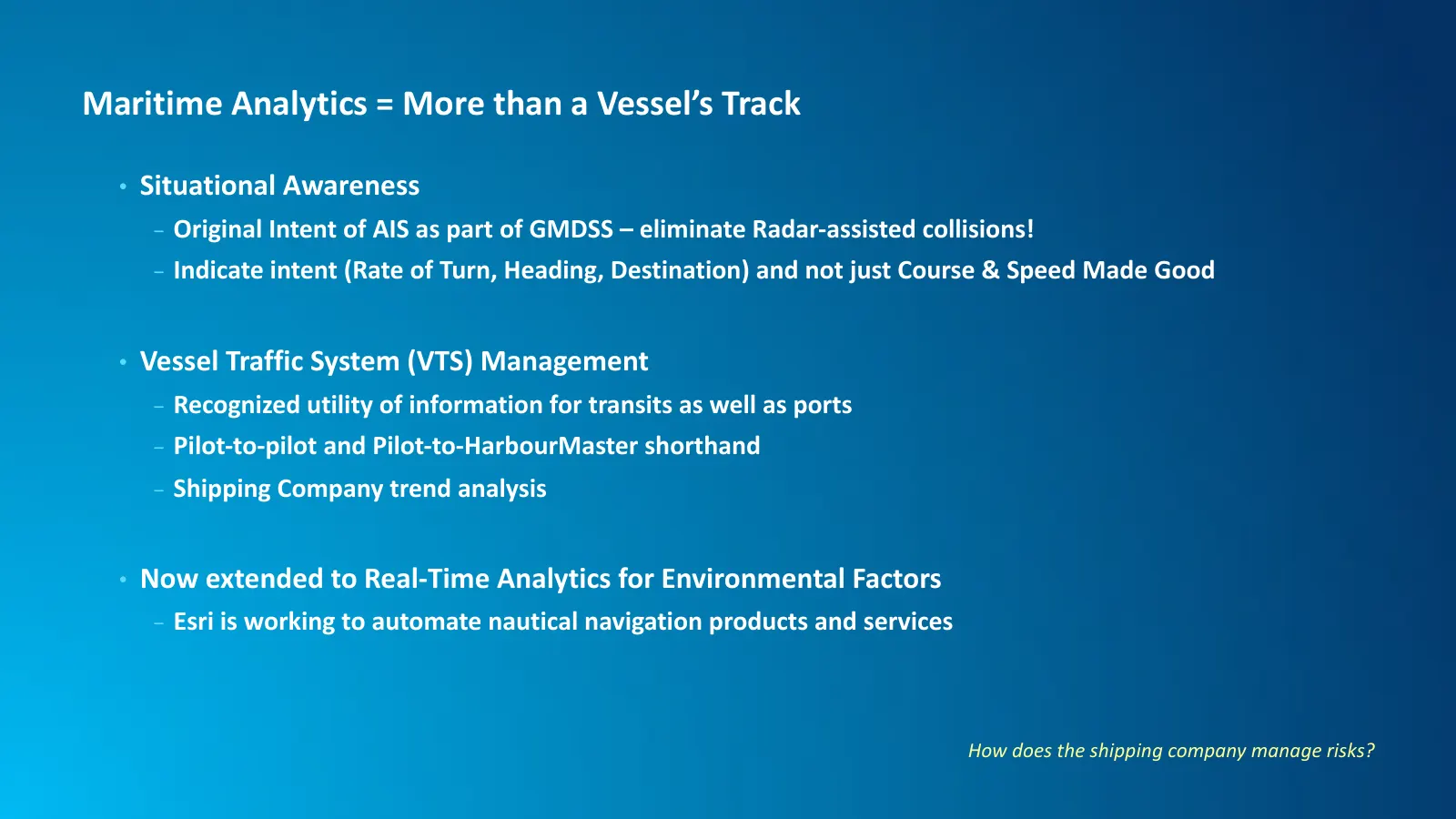
Maritime Analytics = More than a Vessel’s Track • Situational Awareness - Original Intent of AIS as part of GMDSS – eliminate Radar-assisted collisions! - Indicate intent (Rate of Turn, Heading, Destination) and not just Course & Speed Made Good • Vessel Traffic System (VTS) Management - Recognized
Slide 21: Generalized Geodatabases to New Products
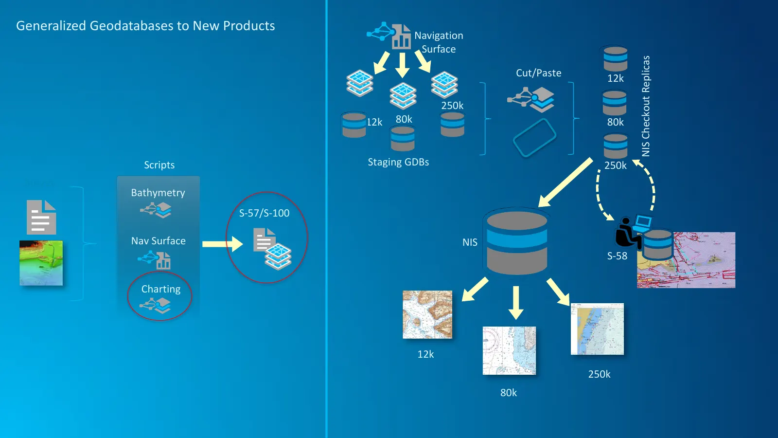
Generalized Geodatabases to New Products Navigation Surface NIS Checkout Replicas Cut/Paste 12k 250k 12k 80k 80k Scripts Staging GDBs 250k Survey Bathymetry S-57/S-100 Nav Surface NIS S-58 Charting 12k 250k 80k
Slide 22: Web-based Product Distribution: ArcGIS for Maritime
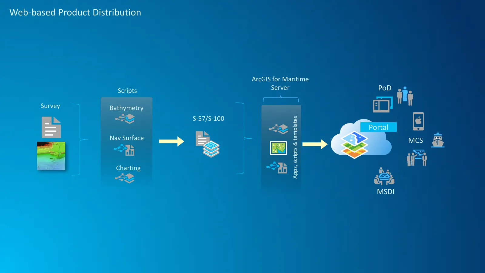
Web-based Product Distribution ArcGIS for Maritime Scripts Server PoD Survey Bathymetry S-57/S-100 Apps, scripts & templates Portal Nav Surface MCS Charting MSDI
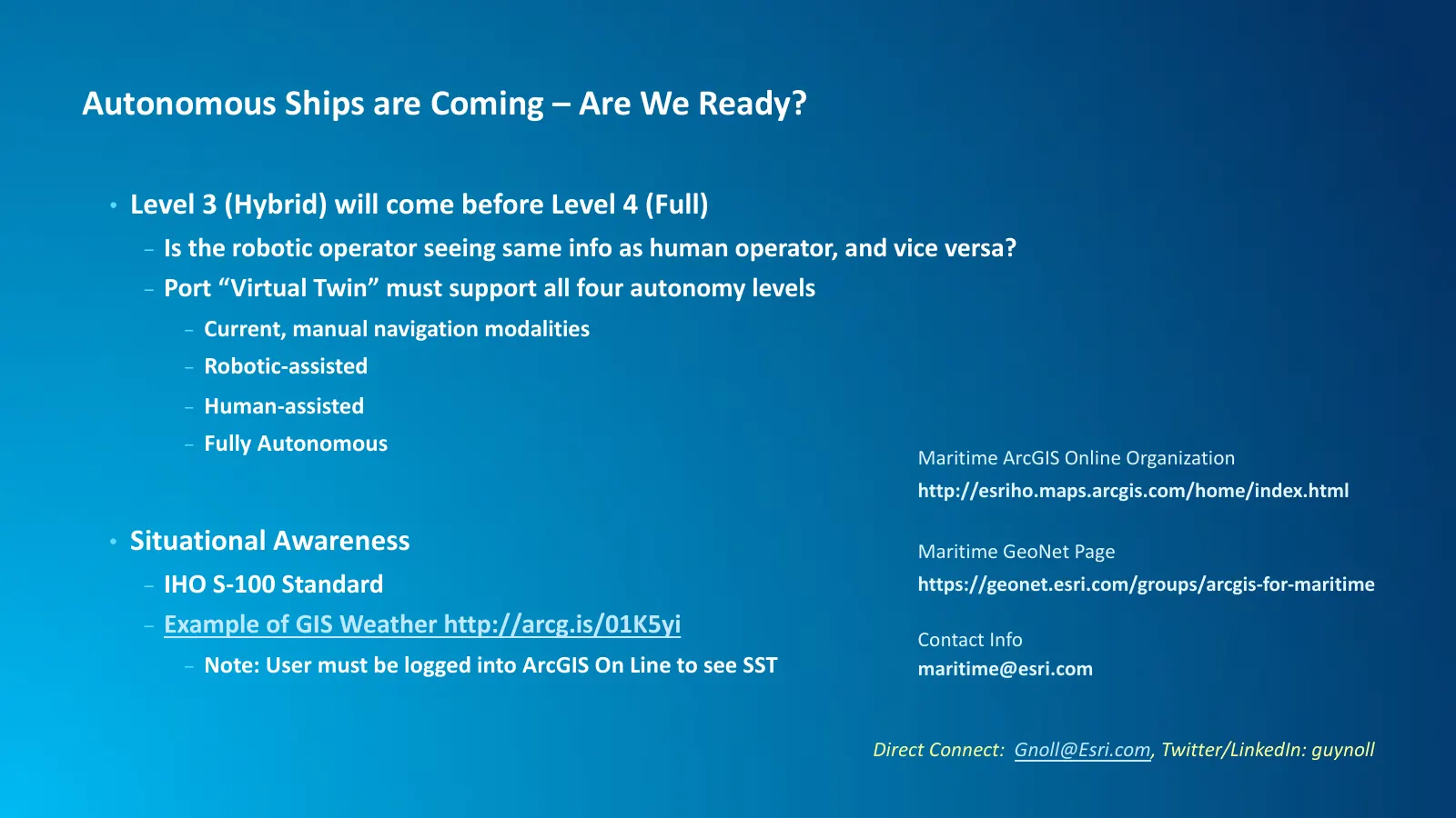
Slide 23: Autonomous Ships are Coming – Are We Ready?
Autonomous Ships are Coming – Are We Ready? • Level 3 (Hybrid) will come before Level 4 (Full) - Is the robotic operator seeing same info as human operator, and vice versa? - Port “Virtual Twin” must support all four autonomy levels - Current, manual navigation modalities - Robotic-assisted - Human-

Slide 24: The Science of Where
THE SCIENCE OF WHERE
Slide 25: 40Geo is a solutions company focused on geospatial integration
40Geo is a solutions company focused on the integration of geospatial technologies into enterprise wide systems. Our leadership has been designing, developing and delivering world class geospatial solutions for 20 years in a wide variety of industries. At 40Geo we turn APIs into location based intel

Slide 26: Why does AIS matter?
Why does AIS matter?

Slide 27: Common Operating Picture
Common Operating Picture

Slide 28: Supply Chain Optimization
Supply Chain Optimization

Slide 29: Remote Monitoring
__ Remote Monitoring . * 8 g ili @ i H i= f a V;
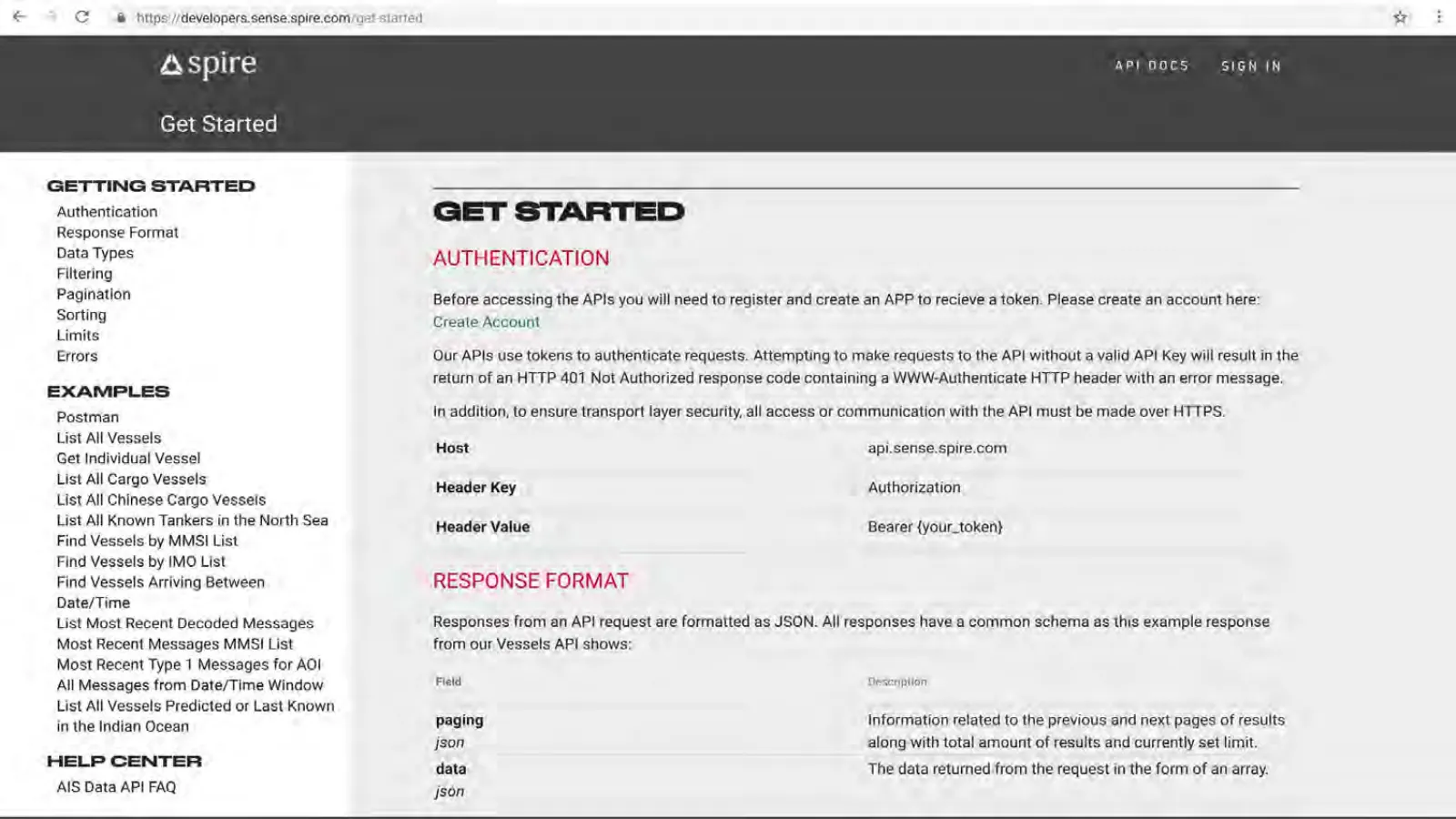
Slide 30: Spire API Documentation: Get Started
Aspire Get Started GETTING STARTED Authentication Response Format Data Types Filtering Pagination Sorting Limits Errors EXAMPLES Postman List All Vessels Get Individual Vessel List All Cargo Vessels List All Chinese Cargo Vessels List All Known Tankers in the North Sea Find Vessels by MMSI List Find
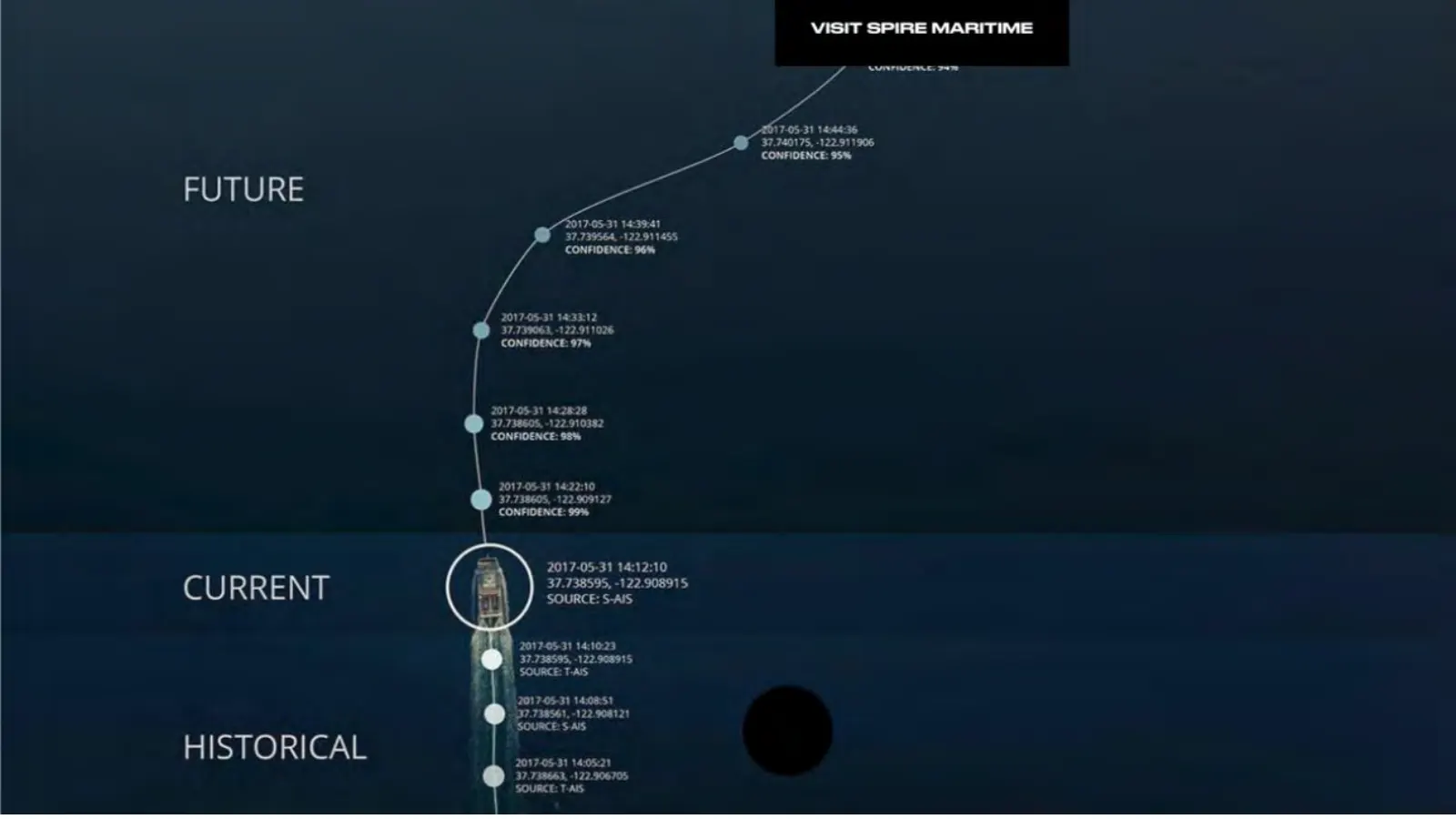
Slide 31: Future, Current, Historical Vessel Tracking
FUTURE CURRENT HISTORICAL VISIT SPIRE MARITIME 617-0531 14:04:36 32.740175, 122911906 CONFIDENCE: 95% O17-05-31 14:39:41 37.739964, -122.911455 CONFIDENCE 96% 2017-0531 14:35:12 37.73906, -122.911026 CONFIDENCE: 97% 2017.08.31 142828 37.738605, -122.910382 CONFIDENCE: 98% 2017-05-31 142210 37.738605

Slide 32: ArcGIS GeoEvent Server
@esri Products Industries Support & Services About Q ArcGIS GeoEvent Server Real-time mapping and analytics, Gain situational awareness of your real-time streaming data with ArcGIS GeoEvent S art of the Esri Geospatial Cloud. Whether you are tracking moving assets, monitoring stationary sensors, or

Slide 33

Slide 34: 40Geo
on. 40Geo Geospatial | Integration | Solutions
Source: Internet Archive copy of spire.com
More decks from Spire Global, Inc.
 Q3 2026 Earnings Presentation10 slides · November 2026
 Q2 2026 Earnings Presentation15 slides · Aug 12, 2026
 Q1 2026 Earnings Presentation13 slides · May 13, 2026
 Q4 2025 Earnings Presentation15 slides · Mar 18, 2026
 Q3 2025 Earnings Presentation10 slides · Dec 17, 2025
 FY2024 Earnings Presentation9 slides · Mar 3, 2025