
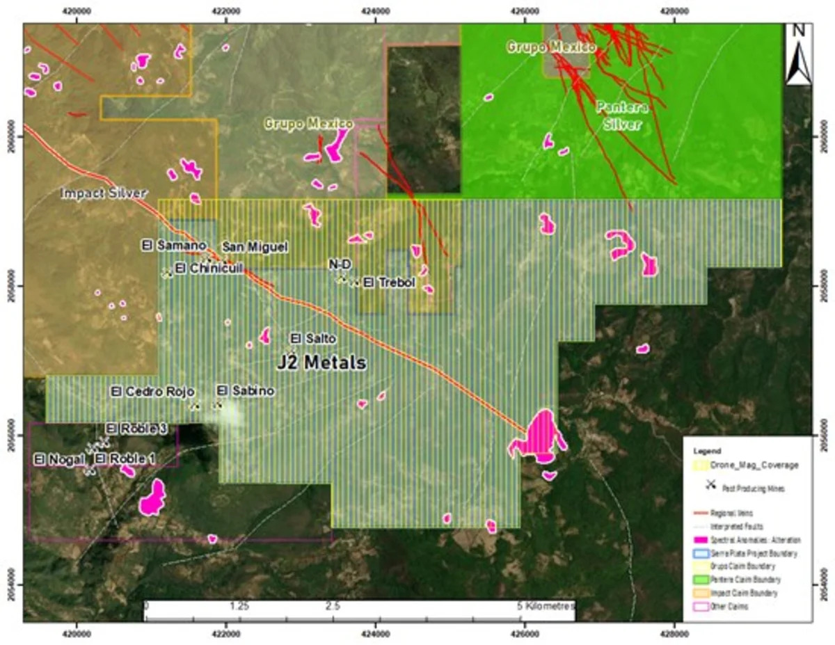
Vancouver, British Columbia--(Newsfile Corp. - July 8, 2026) - J2 Metals Inc. (TSXV: JTWO) (OTCQB: JTWOF) (FSE: OO10) ("J2" or the "Company") is pleased to announce that crews have been mobilized to complete a high-resolution unmanned aerial vehicle (UAV) drone magnetometer geophysical survey across its Sierra Plata silver-gold-antimony project in the Zacualpan-Taxco district of Guerrero State, Mexico. The airborne magnetic survey will be carried out by JM Geoconsultores of Querétaro, Mexico, and represents the Company's first geophysical program at Sierra Plata.
Survey Design and Scope
The high-resolution Total Magnetic Intensity (TMI) survey will cover approximately 1,885 hectares of the Sierra Plata Project area for a total of 562 line-kilometres, including tie lines. The program has been designed to international airborne magnetic survey standards, with the following key parameters:
Survey coverage: approximately 1,885 hectares
Total survey distance: 562 line-kilometres (including tie lines)
Line spacing: 50 metres
Tie-line spacing: 500 metres
Flight altitude: 50 metres above ground level
Data acquisition will be performed with a high-resolution UAV-mounted magnetometer flown on a DJI Matrice platform, with data processed and interpreted in Geosoft Oasis Montaj. Deliverables will include a TMI anomaly map together with a suite of filtered products - Reduction to the Pole (RTP), Analytic Signal, and First Vertical Derivative.
JM Geoconsultores will officially commence field activities July 8, 2026, beginning with an initial reconnaissance of the survey area to verify access, assess site conditions, and finalize the operational plan before data acquisition begins.
Building Toward Drill Targets
The magnetic survey results are intended to be the first step in creating a three-dimensional structural model of the Sierra Plata Project, tied in with the Company's ongoing ground geological and structural mapping. Integrating the airborne geophysical data together with surface mapping is expected to help generate epithermal structural targets to guide an eventual drill program on the property.
Once the survey deliverables are received, J2 plans to engage an independent geophysical consultant to complete a 3D inversion of the magnetic data and to construct a structural model of the project. The Company believes this integrated, modern geophysical and geological approach will substantially improve targeting across the structurally controlled vein corridors that characterize Sierra Plata.