
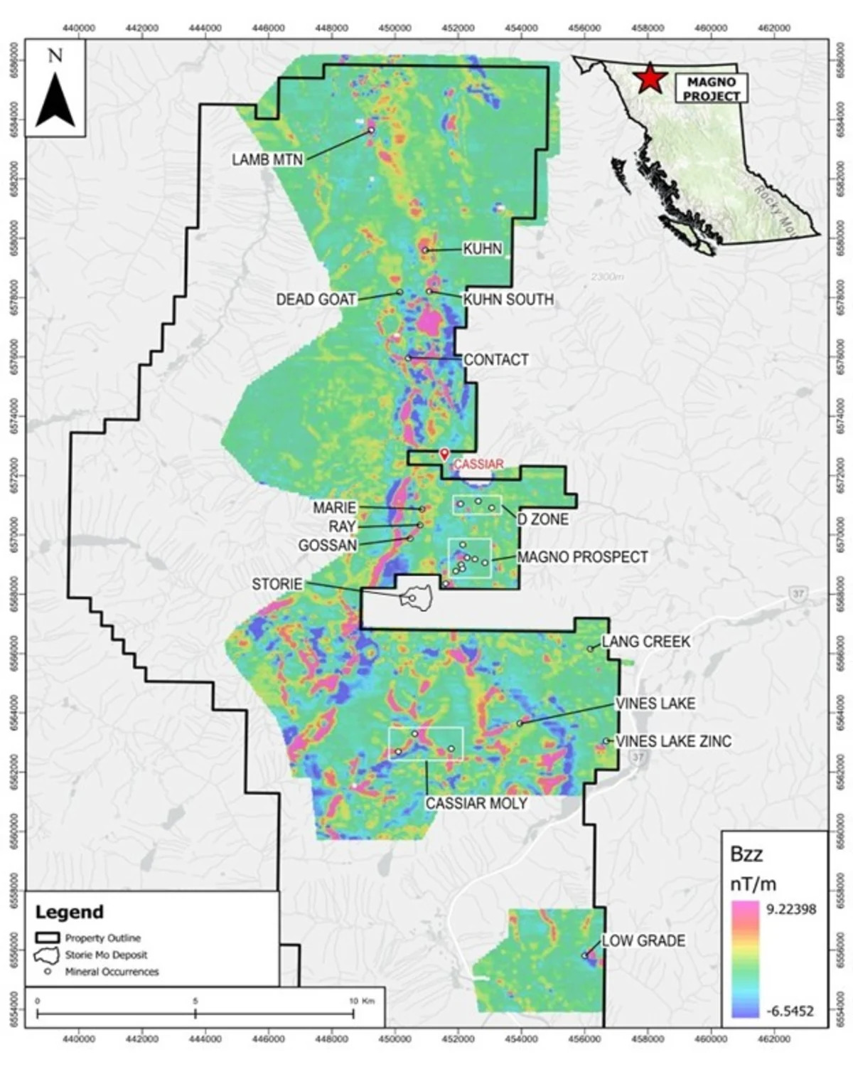
Survey reveals continuous north-south magnetic corridor linking known tungsten, silver, zinc, copper and indium occurrences within a single district-scale geological framework — drill program with Northtech advancing toward August mobilization
VANCOUVER, British Columbia, July 15, 2026 (GLOBE NEWSWIRE) -- GoldHaven Resources Corp. ("GoldHaven" or the "Company") (CSE: GOH) (OTCQB: GHVNF) (FSE: 4QS) is pleased to announce the successful completion and interpretation of its high-resolution airborne QMAGT magnetic survey over the Company's 100%-owned Magno Project in northern British Columbia.
Completed by Dias Geophysical, the survey comprised 2,320.7 line-kilometres flown at 100-metre line spacing, producing what GoldHaven believes is the most detailed modern airborne magnetic dataset collected across the Magno Project. Interpretation of the dataset has now been completed, defining a continuous district-scale structural corridor that links numerous known mineral occurrences while identifying multiple previously unrecognized exploration targets across the Company's 37,000+ hectare land package.
Why the Survey Matters
Completed 2,320.7 line-kilometres of high-resolution airborne magnetic surveying at 100-metre line spacing.
Largest modern airborne magnetic survey completed over the Magno Project.
Defines a continuous north-south magnetic and structural corridor linking numerous known mineral occurrences within a common geological framework.
Known occurrences within the corridor include surface values of up to 2,370 g/t Ag, 6,550 ppm W and 334 ppm In — one of the highest indium values ever recorded in the Cassiar District.
Identifies multiple previously unrecognized magnetic anomalies, structural intersections and intrusive-related features across the property.
Integrates airborne geophysics with geological mapping, historical drilling and surface geochemistry to substantially improve drill targeting.
Northtech Drilling engaged for the Company's inaugural 5,000–7,000 metre drill program, with mobilization targeted for approximately August 1, 2026, subject to permitting.
CEO Commentary
"This survey represents a major technical milestone for the Magno Project. For the first time, we can see how the historic Kuhn tungsten skarns, the Magno and D Zone CRD system and the recently acquired Cassiar Moly target fit within a single regional structural framework.
The survey demonstrates that Magno is not a collection of isolated historical showings—it is one connected mineral system with coherent structural architecture that we can now systematically map, model and drill.